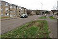
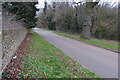
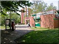
Area Overview for NN3 8JB
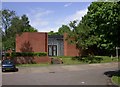
Photos of NN3 8JB

Area Information
NN3 8JB is a small, tightly knit residential postcode area in England, covering just 3,969 square metres. Despite its compact size, it is densely populated, with 1,916 residents packed at a density of 482,761 people per square kilometre. This makes daily life in NN3 8JB highly communal, with neighbours likely to be familiar faces. The area is characterised by its mix of housing stock and proximity to essential services. Residents benefit from nearby schools, retail outlets, and transport links, creating a self-contained environment. While the area lacks expansive green spaces or natural landmarks, its strategic location near Northampton’s infrastructure ensures practicality for commuters and families. The high broadband score of 100 and strong mobile coverage of 84 support modern lifestyles, though the area’s high crime risk score of 13 demands attention. For those seeking a compact, service-rich environment with a focus on connectivity, NN3 8JB offers a distinct blend of practicality and proximity.
- Area Type
- Postcode
- Area Size
- 3969 m²
- Population
- 1916
- Population Density
- 3417 people/km²
NN3 8JB’s property market is defined by its 37% home ownership rate, suggesting a rental-dominated landscape. The area’s accommodation is primarily houses, which, in such a small postcode, may be limited in number and potentially sought after by families. This scarcity of housing stock could mean competition among buyers, though the area’s size may restrict the availability of new developments. The low home ownership rate also indicates a transient population, which might affect property values and community stability. For buyers, the focus on houses rather than flats or apartments could appeal to those prioritising space, but the small area’s constraints may limit options. Proximity to schools and transport links adds value, but prospective buyers should consider the high crime risk score when evaluating long-term suitability.
House Prices in NN3 8JB
Showing 12 properties
| Address | Type | Beds | Baths | Last Sale Price | Last Sale Date | |
|---|---|---|---|---|---|---|
| 80 Rillwood Court, Northampton, NN3 8JB | house | - | - | £143,000 | Jun 2019 | |
| 82 Rillwood Court, Northampton, NN3 8JB | Terraced | 3 | - | £129,995 | Dec 2015 | |
| 81 Rillwood Court, Northampton, NN3 8JB | house | - | - | £95,000 | Feb 2014 | |
| 83 Rillwood Court, Northampton, NN3 8JB | house | - | - | £35,000 | Aug 2000 | |
| 84 Rillwood Court, Northampton, NN3 8JB | house | - | - | £38,000 | Aug 2000 | |
| 79 Rillwood Court, Northampton, NN3 8JB | Terraced | - | - | £29,995 | Apr 1999 | |
| 76 Rillwood Court, Northampton, NN3 8JB | house | - | - | £30,500 | Aug 1998 | |
| 74 Rillwood Court, Northampton, NN3 8JB | Terraced | - | - | £33,000 | Jul 1996 | |
| 78 Rillwood Court, Northampton, NN3 8JB | Terraced | 3 | 1 | - | - | |
| 75 Rillwood Court, Northampton, NN3 8JB | Terraced | - | - | - | - |
Energy Efficiency in NN3 8JB
Daily life in NN3 8JB is shaped by its proximity to essential amenities. Retail options include major chains like Tesco Northampton, Lidl Lings, and Co-op Bushland, offering convenience for shopping. The area’s bus interchanges connect residents to Northampton’s broader network, while the railway station provides regional links. Though the data does not mention parks or leisure facilities, the compact layout ensures that shops and transport are within practical reach. The presence of multiple schools and the absence of natural constraints like protected woodlands or AONBs suggest a focus on urban living. For residents, the lifestyle balances practicality with the need to travel for recreation, though the high population density may influence the character of local interactions. The area’s amenities cater to daily needs but require planning for broader leisure activities.
Amenities
Schools
Residents of NN3 8JB have access to a range of educational institutions, from primary schools to an outstanding academy. Lumbertubs Primary School, Lings Upper School, and Emmanuel CofE Voluntary Aided Middle School serve younger children, while Billing Brook Special School caters to specific needs. Northampton Academy, an academy with an Ofsted rating of outstanding, provides secondary education. This mix of school types ensures options for families at different stages of education. The presence of a special school and a high-performing academy suggests a commitment to diverse educational provision. However, the absence of data on school catchment areas or pupil performance means buyers should verify whether specific schools are accessible to their preferred properties. For families, the proximity of multiple schools within practical reach is a significant advantage.
| Rank | School | Type | Entry gender | Ages |
|---|
Explore more schools in this area
Go to Schools tabDemographics
The population of NN3 8JB is predominantly adults aged 30–64, with a median age of 47. This suggests a community of established professionals and families, rather than students or retirees. Home ownership is relatively low at 37%, indicating a rental market that may appeal to those seeking flexibility. The area’s accommodation is primarily houses, which, given its small size, may be limited in number. The predominant ethnic group is White, though specific data on diversity or deprivation is not provided. The high population density of 482,761 people per square kilometre implies a compact, possibly urbanised living environment. This density could mean shared amenities and close-knit social networks but may also contribute to pressure on local services. For buyers, understanding the age profile and housing stock is key to assessing whether NN3 8JB aligns with long-term lifestyle goals.
Household Size
Accommodation Type
Tenure
Ethnic Group
Religion
Household Composition
Age
Household Deprivation
NS-SEC
Explore more demographic insights in this area
Go to Demographics tabPlanning
Planning Constraints
- Flood RiskPremium
- Ramsar Wetland SitesPremium
- Area of Outstanding Natural BeautyPremium
- Protected Nature ReservePremium
- Protected WoodlandPremium