Area Overview for NN3 8HE
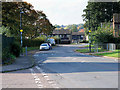
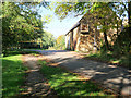
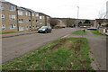
Photos of NN3 8HE


Area Information
Living in NN3 8HE means being part of a tightly knit residential cluster in England, where 1,801 people reside across 7,374 square metres. This small area is characterised by a high population density of 244,242 people per square kilometre, reflecting a compact, community-focused layout. The area is well-served by transport links, including Northampton Railway Station and nearby bus interchanges, which connect residents to broader networks. Daily life here is shaped by proximity to retail hubs like Tesco Northampton and Lidl Lings, offering convenience for shopping and dining. The median age of 47 suggests a mature population, with many residents in their 30s to 60s, creating a stable, established community. While the area is small, its strategic location near Northampton provides access to larger urban amenities without the density of a city centre. For those seeking a balance between suburban comfort and urban connectivity, NN3 8HE offers a focused, practical living environment.
- Area Type
- Postcode
- Area Size
- 7374 m²
- Population
- 1801
- Population Density
- 4161 people/km²
The property market in NN3 8HE is defined by a 34% home ownership rate, indicating that nearly two-thirds of properties are rented. The area is primarily composed of houses, which contrasts with regions dominated by flats or apartments. This suggests a more traditional, family-oriented housing stock, though the small size of the area may limit availability. Buyers should consider that the high population density and compact footprint mean competition for properties could be keen, particularly near key amenities like Northampton Railway Station. The mix of owner-occupied and rental properties may appeal to those seeking stability in a mature community. However, the limited size of NN3 8HE means that property choices are confined to a narrow geographic scope, requiring buyers to weigh proximity to transport and retail against the area’s constrained boundaries.
House Prices in NN3 8HE
Showing 25 properties
| Address | Type | Beds | Baths | Last Sale Price | Last Sale Date | |
|---|---|---|---|---|---|---|
| 25 Brownlow Court, Northampton, NN3 8HE | Terraced | 3 | - | £147,000 | Sep 2020 | |
| 15 Brownlow Court, Northampton, NN3 8HE | Terraced | 3 | 1 | £175,000 | Sep 2020 | |
| 4 Brownlow Court, Northampton, NN3 8HE | Terraced | 3 | 1 | £155,000 | Jul 2020 | |
| 22 Brownlow Court, Northampton, NN3 8HE | Terraced | 3 | - | £173,000 | Nov 2019 | |
| 7 Brownlow Court, Northampton, NN3 8HE | Terraced | 3 | - | £175,000 | Oct 2019 | |
| 11 Brownlow Court, Northampton, NN3 8HE | house | - | - | £143,500 | Sep 2019 | |
| 9 Brownlow Court, Northampton, NN3 8HE | Terraced | 4 | - | £138,000 | Jun 2018 | |
| 5 Brownlow Court, Northampton, NN3 8HE | Terraced | 3 | 1 | £155,000 | May 2018 | |
| 17 Brownlow Court, Northampton, NN3 8HE | Terraced | 3 | 1 | £149,995 | Apr 2017 | |
| 2 Brownlow Court, Northampton, NN3 8HE | house | - | - | £117,500 | Jun 2015 |
Energy Efficiency in NN3 8HE
Residents of NN3 8HE have access to a range of nearby amenities, including retail options like Tesco Northampton, Lidl Lings, and Co-op Bushland, which provide everyday shopping and dining convenience. The area is served by two major bus interchanges—the University Bus Interchange and Northampton Bus Interchange—offering frequent services to local destinations and beyond. Northampton Railway Station is within practical reach, connecting residents to broader regional networks. While the area itself is small, its proximity to Northampton’s urban core means residents can access larger leisure, cultural, and commercial facilities without long commutes. The presence of multiple retail outlets and transport hubs contributes to a practical, efficient lifestyle, ideal for those prioritising accessibility and convenience.
Amenities
Schools
| Rank | School | Type | Entry gender | Ages |
|---|
Explore more schools in this area
Go to Schools tabDemographics
The community in NN3 8HE is predominantly composed of adults aged 30–64, with a median age of 47. This indicates a mature population, likely with established careers and families. Home ownership stands at 34%, suggesting a mix of owner-occupied properties and rental units. The area is largely composed of houses, reflecting a traditional housing stock rather than flats or apartments. The predominant ethnic group is White, which aligns with broader regional demographics. While specific data on deprivation is not provided, the high population density and proximity to retail and transport suggest a functional, though potentially limited, range of services. The age profile implies a community with a focus on stability, though the lower home ownership rate may indicate a reliance on rental markets or shared living arrangements.
Household Size
Accommodation Type
Tenure
Ethnic Group
Religion
Household Composition
Age
Household Deprivation
NS-SEC
Explore more demographic insights in this area
Go to Demographics tabPlanning
Planning Constraints
- Flood RiskPremium
- Ramsar Wetland SitesPremium
- Area of Outstanding Natural BeautyPremium
- Protected Nature ReservePremium
- Protected WoodlandPremium