Area Overview for NN3 8HB
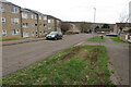
Photos of NN3 8HB

Area Information
NN3 8HB is a compact residential postcode area in England, covering just 1.0 hectare with a population of 1801 people. This makes it one of the most densely populated areas in the country, with 174,285 people per square kilometre. Despite its small size, it is a well-defined cluster of homes, primarily occupied by adults aged 30–64. The area’s proximity to Northampton’s transport hubs and retail centres makes it convenient for daily life, though its high density means community interactions are frequent. Residents benefit from excellent digital connectivity and access to nearby amenities, but the compact nature of the area means space is limited. Living here offers a mix of practicality and proximity to essential services, though the high population density may influence the pace of life. For those seeking a small, tightly knit community with easy access to urban infrastructure, NN3 8HB provides a distinct balance of residential comfort and connectivity.
- Area Type
- Postcode
- Area Size
- 1.0 hectares
- Population
- 1801
- Population Density
- 4161 people/km²
The property market in NN3 8HB is dominated by rental properties, with only 34% of homes owned by residents. This suggests a strong presence of private landlords or housing associations, rather than owner-occupied homes. The area is composed largely of houses, which is unusual for a high-density postcode, indicating a mix of older, larger properties. The small size of the area—just 1.0 hectare—means the housing stock is limited, potentially increasing competition among buyers or renters. For those considering purchasing, the low home ownership rate may reflect a lack of long-term investment in the area, though the proximity to Northampton’s amenities could offset this. Buyers should be aware that the market is likely to be competitive, with limited availability of properties. The focus on houses rather than flats may appeal to those seeking more space, though the area’s density may limit outdoor living options.
House Prices in NN3 8HB
Showing 27 properties
| Address | Type | Beds | Baths | Last Sale Price | Last Sale Date | |
|---|---|---|---|---|---|---|
| 14 Arbour Court, Northampton, NN3 8HB | Terraced | 3 | 1 | £193,000 | Feb 2024 | |
| 15 Arbour Court, Northampton, NN3 8HB | house | 3 | - | £174,000 | Nov 2021 | |
| 9 Arbour Court, Northampton, NN3 8HB | house | 3 | - | £157,000 | Jul 2018 | |
| 11 Arbour Court, Northampton, NN3 8HB | house | - | - | £168,000 | Jun 2018 | |
| 13 Arbour Court, Northampton, NN3 8HB | house | - | - | £115,000 | Feb 2016 | |
| 21 Arbour Court, Northampton, NN3 8HB | house | - | - | £114,995 | Nov 2015 | |
| 10 Arbour Court, Northampton, NN3 8HB | Terraced | 3 | - | £94,995 | Oct 2013 | |
| 4 Arbour Court, Northampton, NN3 8HB | house | - | - | £89,000 | Apr 2013 | |
| 5 Arbour Court, Northampton, NN3 8HB | house | - | - | £107,000 | Nov 2005 | |
| 24 Arbour Court, Northampton, NN3 8HB | Terraced | - | - | £108,000 | Aug 2005 |
Energy Efficiency in NN3 8HB
Living in NN3 8HB offers access to a range of nearby amenities within practical reach. Retail options include major supermarkets such as Tesco Northampton, Co-op Bushland, and Lidl Lings, ensuring residents have convenient access to groceries and daily essentials. The area’s proximity to the University Bus Interchange and Northampton Bus Interchange provides easy access to public transport, facilitating travel to workplaces, leisure activities, or further education. While the data does not specify parks or leisure facilities, the presence of multiple retail and transport hubs suggests a focus on practicality over green spaces. For those prioritising convenience and connectivity, NN3 8HB’s amenities support a lifestyle centred on accessibility and efficiency, though outdoor recreational options may require travel beyond the immediate area.
Amenities
Schools
| Rank | School | Type | Entry gender | Ages |
|---|
Explore more schools in this area
Go to Schools tabDemographics
The community in NN3 8HB is predominantly composed of adults aged 30–64, with a median age of 47. This suggests a mature population, likely with established careers and families. Home ownership is relatively low at 34%, indicating that a majority of residents rent their homes. The area is characterised by houses rather than flats or apartments, reflecting a traditional housing stock. The predominant ethnic group is White, with no specific data provided on other demographics. The high population density of 174,285 people per square kilometre implies a tightly packed residential environment, which may influence local services and infrastructure. While the data does not specify deprivation levels, the high density and low home ownership suggest a reliance on shared community resources. This profile positions NN3 8HB as a practical, compact living space for those prioritising accessibility over space.
Household Size
Accommodation Type
Tenure
Ethnic Group
Religion
Household Composition
Age
Household Deprivation
NS-SEC
Explore more demographic insights in this area
Go to Demographics tabPlanning
Planning Constraints
- Flood RiskPremium
- Ramsar Wetland SitesPremium
- Area of Outstanding Natural BeautyPremium
- Protected Nature ReservePremium
- Protected WoodlandPremium