Area Overview for NN3 7RP
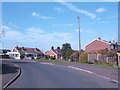
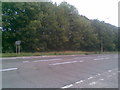
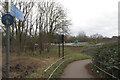
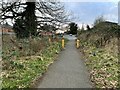
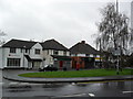
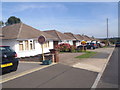
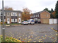
Photos of NN3 7RP


Area Information
Living in NN3 7RP means inhabiting a tightly knit residential cluster in England, where 1,877 people reside across 7,261 square metres. The area’s high population density — 258,520 people per square kilometre — reflects its compact nature, ideal for those seeking a close-knit community. Daily life here is shaped by proximity to essential services, with nearby shops, transport hubs, and schools within practical reach. The area’s small footprint means residents are likely to know their neighbours, fostering a sense of familiarity. While it lacks sprawling parks or major landmarks, its strategic location near Northampton’s transport networks and retail centres offers convenience. For buyers, this is a place where practicality meets accessibility, with homes predominantly occupied by owners rather than renters. The median age of 47 suggests a stable population, with many residents in their prime working years, balancing family life with professional commitments.
- Area Type
- Postcode
- Area Size
- 7261 m²
- Population
- 1877
- Population Density
- 2064 people/km²
The property market in NN3 7RP is dominated by owner-occupied homes, with 77% of properties owned by residents rather than rented. This suggests a stable, long-term community with limited turnover. The accommodation type is primarily houses, which contrasts with areas where flats or apartments dominate. For buyers, this means a focus on family homes and standalone properties, though the small area size may limit availability. The compact nature of NN3 7RP means that property choices are likely limited to a few key locations, requiring buyers to prioritise proximity to amenities like schools and transport. Given the high home ownership rate, rental options may be scarce, making this area more suitable for those seeking a permanent residence rather than short-term tenancy.
House Prices in NN3 7RP
Showing 11 properties
| Address | Type | Beds | Baths | Last Sale Price | Last Sale Date | |
|---|---|---|---|---|---|---|
| 1B Moulton Way South, Northampton, NN3 7RP | Detached | 5 | - | £379,995 | Apr 2019 | |
| 4 Moulton Way South, Northampton, NN3 7RP | Detached | 5 | 4 | £354,000 | Jan 2018 | |
| 5 Moulton Way South, Northampton, NN3 7RP | Bungalow | 2 | - | £262,000 | Feb 2017 | |
| 1 Moulton Way South, Northampton, NN3 7RP | Bungalow | 3 | 1 | £314,500 | Oct 2014 | |
| 6 Moulton Way South, Northampton, NN3 7RP | Detached | - | - | £97,000 | Feb 1999 | |
| 2 Moulton Way South, Northampton, NN3 7RP | Bungalow | 2 | 1 | - | - | |
| 3 Moulton Way South, Northampton, NN3 7RP | Semi-detached | 4 | 2 | - | - | |
| Hawthornes, 1C Moulton Way South, Northampton, NN3 7RP | house | - | - | - | - | |
| 8 Moulton Way South, Northampton, NN3 7RP | house | - | - | - | - | |
| 1A Moulton Way South, Northampton, NN3 7RP | Detached | - | - | - | - |
Energy Efficiency in NN3 7RP
The lifestyle in NN3 7RP is shaped by its proximity to essential amenities. Retail options include Tesco Spinny, Co-op Bushland, and Co-op Moulton, offering everyday shopping within walking distance. Transport links are robust, with two bus interchanges and a railway station providing access to Northampton and beyond. While the area lacks large parks or leisure facilities, its compact size ensures that residents can reach services quickly. The presence of a special school and nearby transport hubs suggests a focus on practicality over leisure. For those prioritising convenience over expansive amenities, NN3 7RP offers a functional, accessible lifestyle with minimal need for long commutes.
Amenities
Schools
The nearest school to NN3 7RP is On Track Education, a special school with a good Ofsted rating. This indicates that the area is served by educational facilities catering to specific needs, though no mainstream primary or secondary schools are listed in the data. For families requiring traditional schooling, residents may need to look beyond the immediate area. The presence of a special school suggests a focus on inclusive education, but the lack of other school types means potential gaps in options for children with different learning requirements. Parents should consider the availability of nearby schools outside NN3 7RP when evaluating the area’s suitability for their family.
| Rank | School | Type | Entry gender | Ages |
|---|
Explore more schools in this area
Go to Schools tabDemographics
The community in NN3 7RP is predominantly composed of adults aged 30–64, with a median age of 47. This age range indicates a population skewed towards established professionals and families, rather than younger students or retirees. Home ownership is high, at 77%, suggesting long-term residency and financial stability. The area is characterised by houses rather than flats, reflecting a preference for standalone properties. The predominant ethnic group is White, with no specific data on other demographics provided. The population density — over 258,000 people per square kilometre — implies a tightly packed living environment, which may influence local amenities and social dynamics. While no deprivation data is available, the high home ownership rate and presence of retail and transport options suggest a quality of life that balances density with practicality.
Household Size
Accommodation Type
Tenure
Ethnic Group
Religion
Household Composition
Age
Household Deprivation
NS-SEC
Explore more demographic insights in this area
Go to Demographics tabPlanning
Planning Constraints
- Flood RiskPremium
- Ramsar Wetland SitesPremium
- Area of Outstanding Natural BeautyPremium
- Protected Nature ReservePremium
- Protected WoodlandPremium