Area Overview for NN3 7BG
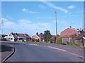
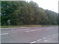
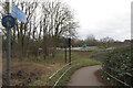
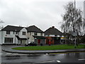
Photos of NN3 7BG


Area Information
NN3 7BG is a small, densely populated residential cluster in England, covering just 1.3 hectares and home to 1,877 residents. Its compact size means it is a tightly knit community, with a high population density of 143,247 people per square kilometre. This area is characterised by its focus on owner-occupied homes, with 77% of residents living in houses rather than flats. The demographic profile skews towards adults aged 30–64, reflecting a mature, stable population. Proximity to Northampton’s transport hubs, including Northampton Railway Station and multiple bus interchanges, ensures easy access to the city’s amenities. While the area itself is small, its strategic location near retail outlets like Tesco Spinny and Co-op Moulton adds to its practicality. Living here offers a blend of suburban comfort and urban connectivity, though the limited space means the community is tightly defined. For buyers, this is a niche market—properties are likely to be in high demand, given the area’s safety profile and strong broadband connectivity.
- Area Type
- Postcode
- Area Size
- 1.3 hectares
- Population
- 1877
- Population Density
- 2064 people/km²
The property market in NN3 7BG is dominated by owner-occupied homes, with 77% of residents living in houses. This contrasts with areas where rental properties or flats predominate, indicating a community focused on long-term stability rather than transient tenancy. Given the area’s small size—just 1.3 hectares—there is limited housing stock, which may mean buyers need to consider nearby zones for more options. The prevalence of houses suggests a preference for traditional, family-friendly homes, though the compact nature of the area could mean properties are smaller or more tightly spaced. For buyers, this is a niche market with potential for strong demand, particularly from those seeking a secure, established neighbourhood. However, the lack of new developments or larger properties may limit choice, requiring careful consideration of the immediate surroundings.
House Prices in NN3 7BG
Showing 13 properties
| Address | Type | Beds | Baths | Last Sale Price | Last Sale Date | |
|---|---|---|---|---|---|---|
| 8 Cubleigh Close, Northampton, NN3 7BG | Detached | 4 | 2 | £474,105 | Dec 2021 | |
| 3 Cubleigh Close, Northampton, NN3 7BG | house | 4 | - | £417,500 | Jul 2017 | |
| 5 Cubleigh Close, Northampton, NN3 7BG | Detached | 4 | 3 | £315,000 | Jul 2015 | |
| 2 Cubleigh Close, Northampton, NN3 7BG | Detached | 4 | - | £320,000 | Jul 2014 | |
| 9 Cubleigh Close, Northampton, NN3 7BG | house | 4 | - | £330,000 | Apr 2012 | |
| 12 Cubleigh Close, Northampton, NN3 7BG | Detached | - | - | £349,995 | Jul 2007 | |
| 11 Cubleigh Close, Northampton, NN3 7BG | Detached | - | - | £325,000 | Nov 2004 | |
| 7 Cubleigh Close, Northampton, NN3 7BG | Detached | - | - | £115,000 | Feb 1996 | |
| 4 Cubleigh Close, Northampton, NN3 7BG | Detached | - | - | - | - | |
| 14 Cubleigh Close, Northampton, NN3 7BG | Detached | - | - | - | - |
Energy Efficiency in NN3 7BG
The lifestyle in NN3 7BG is shaped by its proximity to retail and transport hubs. Nearby shops include Tesco Spinny, Co-op Moulton, and Co-op Bushland, offering everyday essentials within walking or short driving distance. The area’s bus interchanges and Northampton Railway Station provide seamless links to the city’s cultural and commercial centres, as well as regional destinations. While the data does not mention parks or leisure facilities, the presence of multiple retail outlets and transport options suggests a practical, convenience-driven lifestyle. Residents can access shopping, dining, and transport without needing to travel far, though the area’s small size means community activities may be limited to nearby town amenities.
Amenities
Schools
The nearest school to NN3 7BG is On Track Education, a special school with a Good Ofsted rating. This institution caters to students with specific educational needs, but the data does not list any other schools in the immediate vicinity. Families requiring mainstream education for younger children may need to look beyond the area for primary or secondary schools. The absence of multiple school types—such as state or private institutions—means parents should investigate nearby options in Northampton or surrounding towns. While On Track Education provides a high standard of care for its pupils, the lack of a broader range of schools could be a consideration for families prioritising a variety of educational choices.
| Rank | School | Type | Entry gender | Ages |
|---|
Explore more schools in this area
Go to Schools tabDemographics
The population of NN3 7BG is predominantly adults aged 30–64, with a median age of 47. This suggests a community of established professionals and families, rather than a younger or retired demographic. Home ownership is high at 77%, with the majority of residents living in houses rather than flats. The predominant ethnic group is White, though no specific data on diversity or deprivation is provided. The age profile indicates a stable, long-term resident base, which can influence local services and amenities. With no mention of deprivation or socio-economic challenges in the data, it is reasonable to infer that the area supports a middle-to-upper-income lifestyle. However, the high population density—over 140,000 people per square kilometre—suggests that living space is limited, which may affect property availability and community dynamics.
Household Size
Accommodation Type
Tenure
Ethnic Group
Religion
Household Composition
Age
Household Deprivation
NS-SEC
Explore more demographic insights in this area
Go to Demographics tabPlanning
Planning Constraints
- Flood RiskPremium
- Ramsar Wetland SitesPremium
- Area of Outstanding Natural BeautyPremium
- Protected Nature ReservePremium
- Protected WoodlandPremium