Area Overview for NN3 7QE
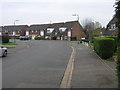
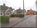
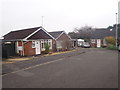
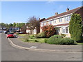
Photos of NN3 7QE

Area Information
Living in NN3 7QE means being part of a small, tightly knit residential cluster in England, where 2141 people reside across 3.4 hectares. The area’s compact size fosters a sense of community, with a population density of 306 people per square kilometre. This is a place where daily life is shaped by proximity to local amenities and a balanced mix of housing. The area’s character is defined by its modest scale and practical layout, offering residents a blend of convenience and quiet living. While it lacks the sprawling infrastructure of larger towns, its accessibility to nearby services and transport links ensures it remains functional for families and professionals alike. The absence of major planning constraints or environmental designations means development is unlikely to disrupt the existing residential fabric. For those seeking a manageable, low-maintenance environment with a focus on local connectivity, NN3 7QE provides a straightforward, unpretentious alternative to more densely populated regions.
- Area Type
- Postcode
- Area Size
- 3.4 hectares
- Population
- 2141
- Population Density
- 306 people/km²
NN3 7QE is predominantly an owner-occupied area, with 65% of properties owned by residents rather than rented. The housing stock consists mainly of houses, which is unusual for a small postcode area but aligns with the low population density and larger individual plots. This suggests a focus on family homes rather than high-density housing. The small size of the area means the property market is limited in scope, with few options available for buyers. However, the high home ownership rate indicates a steady demand for existing properties, potentially leading to competitive pricing for available homes. For buyers, this small cluster may offer a sense of exclusivity, though the lack of nearby commercial or industrial zones could limit future property value growth. The primary accommodation type also implies that new developments are unlikely to introduce rental properties or apartments, maintaining the area’s character as a residential hub for established households.
House Prices in NN3 7QE
Showing 19 properties
| Address | Type | Beds | Baths | Last Sale Price | Last Sale Date | |
|---|---|---|---|---|---|---|
| 6 Whiting Court, Moulton, NN3 7QE | Flat | 1 | 1 | £109,000 | Feb 2025 | |
| 3 Whiting Court, Moulton, NN3 7QE | Flat | 2 | 1 | £70,000 | Mar 2023 | |
| 16 Whiting Court, Moulton, NN3 7QE | Maisonette | 1 | - | £75,000 | Oct 2019 | |
| 17 Whiting Court, Moulton, NN3 7QE | Maisonette | 1 | - | £74,000 | Aug 2019 | |
| 8 Whiting Court, Moulton, NN3 7QE | Maisonette | - | - | £85,001 | Aug 2018 | |
| 4 Whiting Court, Moulton, NN3 7QE | Maisonette | 1 | 1 | £71,000 | Apr 2010 | |
| 14 Whiting Court, Moulton, NN3 7QE | Maisonette | 2 | 1 | £82,500 | Jan 2007 | |
| 11 Whiting Court, Moulton, NN3 7QE | Flat | - | - | £83,000 | Nov 2006 | |
| 1 Whiting Court, Moulton, NN3 7QE | Maisonette | - | - | £79,995 | Oct 2005 | |
| 2 Whiting Court, Moulton, NN3 7QE | Flat | - | - | £52,500 | Sep 2002 |
Energy Efficiency in NN3 7QE
Residents of NN3 7QE have access to a range of local amenities within practical reach. Retail options include Co-op Moulton, Aldi Overstone, and Tesco Spinny, offering everyday shopping needs. The area’s transport links, such as the University Bus Interchange and Northampton Railway Station, provide connections to nearby educational institutions and cities. While there is no explicit mention of parks or leisure facilities in the data, the absence of environmental designations like AONB or protected woodlands suggests open spaces may be limited. However, the presence of multiple schools and retail outlets indicates a focus on practicality over large-scale recreation. The lifestyle here is defined by convenience, with daily essentials and transport options readily available, though those seeking expansive green spaces may need to look beyond the immediate area.
Amenities
Schools
Residents of NN3 7QE have access to several educational institutions, including Moulton Primary School, which holds a good Ofsted rating, and Moulton School and Science College, an academy with a similar rating. These schools cater to primary and secondary education, with Moulton College offering sixth-form provision. The presence of multiple schools within close proximity ensures families have options for both early and advanced education. The good Ofsted ratings suggest a standard of teaching and facilities that meet or exceed national benchmarks. The mix of school types—primary, secondary, and sixth-form—provides a continuum of education, reducing the need for long commutes. For families prioritising educational quality, the availability of rated schools is a significant advantage, though the limited number of institutions may mean competition for places in popular schools.
| Rank | School | Type | Entry gender | Ages |
|---|
Explore more schools in this area
Go to Schools tabDemographics
The population of NN3 7QE is predominantly adults aged 30–64, with a median age of 47. This suggests a mature, stable community with a strong presence of established households. Home ownership is high, at 65%, indicating a preference for long-term residency over rental properties. The accommodation type is primarily houses, which aligns with the area’s low population density and smaller footprint. The predominant ethnic group is White, reflecting a homogenous demographic profile. While no specific deprivation data is provided, the high home ownership rate and age distribution imply a relatively stable economic environment. This stability may contribute to a low crime risk, as noted in the area’s assessments. The absence of significant diversity metrics means the community’s social dynamics are likely shaped by shared cultural and economic factors, though this does not necessarily indicate a lack of inclusivity.
Household Size
Accommodation Type
Tenure
Ethnic Group
Religion
Household Composition
Age
Household Deprivation
NS-SEC
Explore more demographic insights in this area
Go to Demographics tabPlanning
Planning Constraints
- Flood RiskPremium
- Ramsar Wetland SitesPremium
- Area of Outstanding Natural BeautyPremium
- Protected Nature ReservePremium
- Protected WoodlandPremium