Area Overview for NN3 7RB
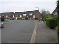
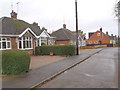
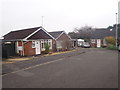
Photos of NN3 7RB
Area Information
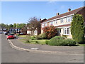
Living in NN3 7RB means being part of a compact, residential cluster in England that balances quietude with practicality. The area covers 9.7 hectares, housing 2,141 residents at a density of 306 people per square kilometre. This small postcode area is ideal for those seeking a manageable, community-focused environment. Proximity to amenities like Moulton Primary School, Northampton Railway Station, and nearby retail hubs ensures daily needs are met without long commutes. The area’s appeal lies in its blend of modest living space and accessible infrastructure, making it suitable for families and individuals alike. With a median age of 47 and a population skewed towards adults aged 30–64, NN3 7RB reflects a stable, established community. Its low crime risk and absence of environmental constraints further enhance its liveability. For buyers, the area offers a snapshot of suburban England—cohesive, functional, and grounded in local essentials.
- Area Type
- Postcode
- Area Size
- 9.7 hectares
- Population
- 2141
- Population Density
- 306 people/km²
The property market in NN3 7RB is defined by a 65% home ownership rate, indicating a strong presence of owner-occupied homes. The accommodation type is predominantly houses, which aligns with the area’s character as a residential cluster rather than a high-density development. This suggests a market skewed towards family homes or semi-detached properties, appealing to those prioritising space and stability. Given the small area size of 9.7 hectares, the housing stock is likely limited, making the market competitive for buyers. The focus on owner-occupation also implies a lower rental demand compared to areas with higher transient populations. For prospective buyers, this means fewer options but potentially more established properties. The absence of flats or high-rise buildings further reinforces a community-oriented, low-rise environment.
House Prices in NN3 7RB
Showing 15 properties
| Address | Type | Beds | Baths | Last Sale Price | Last Sale Date | |
|---|---|---|---|---|---|---|
| 13 Harvey Lane, Moulton, NN3 7RB | Semi-detached | 3 | 1 | £389,995 | Apr 2024 | |
| 3 Harvey Lane, Moulton, NN3 7RB | Bungalow | 3 | 1 | £410,000 | Aug 2022 | |
| 6 Harvey Lane, Moulton, NN3 7RB | Semi-detached | 2 | - | £235,000 | May 2021 | |
| 11 Harvey Lane, Moulton, NN3 7RB | Detached | 3 | - | £299,995 | Jun 2018 | |
| Vine Cottage, 7 Harvey Lane, Moulton, NN3 7RB | Bungalow | 3 | - | £240,000 | Dec 2014 | |
| 5 Harvey Lane, Moulton, NN3 7RB | Bungalow | 2 | - | £232,000 | Nov 2014 | |
| 2 Harvey Lane, Moulton, NN3 7RB | Bungalow | - | - | £135,000 | Oct 2011 | |
| 10 Harvey Lane, Moulton, NN3 7RB | Semi-detached | - | - | £48,500 | Nov 1996 | |
| 4 Harvey Lane, Moulton, NN3 7RB | Bungalow | 1 | 1 | - | - | |
| 8 Harvey Lane, Moulton, NN3 7RB | Detached | 2 | 1 | - | - |
Energy Efficiency in NN3 7RB
Daily life in NN3 7RB is shaped by its proximity to essential amenities. Retail options include Co-op Moulton, Aldi Overstone, and Tesco Spinny, offering groceries and household goods within easy reach. The area’s bus network, with stops at the University Bus Interchange and Northampton Bus Interchange, connects residents to nearby towns and services. Northampton Railway Station provides direct links to further afield, enhancing accessibility. While the area lacks large leisure facilities, its compact size ensures that essentials are never far. The presence of schools, shops, and transport hubs creates a self-contained environment where residents can meet most needs without venturing far. This convenience, paired with the area’s safety profile, contributes to a lifestyle that prioritises practicality and community cohesion.
Amenities
Schools
Residents of NN3 7RB have access to a range of educational institutions, including Moulton Primary School, which holds an Ofsted rating of ‘good’. This school, alongside Moulton School and Science College—listed as both a primary and academy—provides early years and secondary education options. The presence of Moulton College, a sixth-form institution, ensures continuity for older students. This mix of school types supports families throughout a child’s education, from primary to post-16 learning. The ‘good’ rating at Moulton Primary School signals a reliable foundation for younger pupils, while the sixth-form college caters to those preparing for higher education or vocational training. The proximity of these schools within practical reach of the area reinforces NN3 7RB’s appeal for families prioritising educational infrastructure.
| Rank | School | Type | Entry gender | Ages |
|---|
Explore more schools in this area
Go to Schools tabDemographics
The community in NN3 7RB is predominantly composed of adults aged 30–64, with a median age of 47. This suggests a mature, settled population, likely with strong ties to local institutions. Home ownership rates stand at 65%, indicating a mix of long-term residents and those seeking stable property investments. The area is characterised by houses rather than flats, reflecting a preference for family-friendly or semi-detached living. The predominant ethnic group is White, though specific data on diversity is not provided. With 2,141 residents spread across 9.7 hectares, the population density of 306 people per square kilometre creates a tightly knit community. This density, combined with the age profile, suggests a low turnover of residents and a focus on continuity. The absence of detailed deprivation data means quality of life is inferred from factors like safety and access to services, which appear favourable.
Household Size
Accommodation Type
Tenure
Ethnic Group
Religion
Household Composition
Age
Household Deprivation
NS-SEC
Explore more demographic insights in this area
Go to Demographics tabPlanning
Planning Constraints
- Flood RiskPremium
- Ramsar Wetland SitesPremium
- Area of Outstanding Natural BeautyPremium
- Protected Nature ReservePremium
- Protected WoodlandPremium