Area Overview for NN3 6RQ
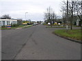
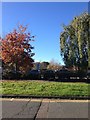
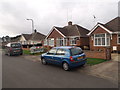
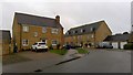
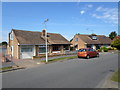
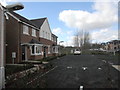
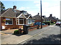
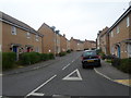
Photos of NN3 6RQ
Area Information
Living in NN3 6RQ offers a compact, tightly knit residential experience. The area covers just 1.6 hectares, housing 1,877 residents in a densely populated cluster. This makes it a small but efficient community, where proximity to amenities and services is key. The area’s demographics suggest a mature population, with a median age of 47 and the majority of residents aged between 30 and 64. This reflects a stable, established community, with 77% of homes owned outright, indicating a strong preference for long-term residency. Daily life here is shaped by the mix of local shops, transport links, and the presence of a special school. While the area is small, its strategic location near Northampton’s transport hubs and retail centres ensures residents have access to broader opportunities without needing to travel far. The high population density means the area feels lively, with a focus on practical living rather than sprawling development. For those seeking a balance between urban convenience and residential comfort, NN3 6RQ provides a focused, well-served environment.
- Area Type
- Postcode
- Area Size
- 1.6 hectares
- Population
- 1877
- Population Density
- 2064 people/km²
The property market in NN3 6RQ is characterised by high home ownership, with 77% of properties owned outright. This contrasts with areas where rental demand drives the market, suggesting NN3 6RQ is more of a buyer-occupied community. The accommodation type is exclusively houses, which is notable given the area’s small size. This implies a focus on single-family homes, potentially catering to professionals or families seeking space in a compact setting. The limited land area means the housing stock is unlikely to expand significantly, making properties here potentially more valuable in the long term. For buyers, this means a market where properties are likely to be held for extended periods, with fewer opportunities for short-term investment. The presence of houses rather than flats also aligns with the area’s demographic profile of older, established residents.
House Prices in NN3 6RQ
Showing 34 properties
| Address | Type | Beds | Baths | Last Sale Price | Last Sale Date | |
|---|---|---|---|---|---|---|
| 10 Brad Street, Northampton, NN3 6RQ | Detached | 4 | 3 | £435,000 | Oct 2022 | |
| 12 Brad Street, Northampton, NN3 6RQ | house | - | - | £420,000 | Jan 2022 | |
| 19 Brad Street, Northampton, NN3 6RQ | Semi-detached | 3 | 1 | £220,000 | Jul 2017 | |
| 15 Brad Street, Northampton, NN3 6RQ | Terraced | 3 | 1 | £184,000 | Sep 2015 | |
| 37 Brad Street, Northampton, NN3 6RQ | house | - | - | £230,000 | Jun 2015 | |
| 33 Brad Street, Northampton, NN3 6RQ | Detached | 4 | - | £245,000 | Jan 2015 | |
| 1 Brad Street, Northampton, NN3 6RQ | Detached | 4 | - | £286,000 | Aug 2014 | |
| 3 Brad Street, Northampton, NN3 6RQ | house | 3 | - | £232,950 | May 2007 | |
| 7 Brad Street, Northampton, NN3 6RQ | Semi-detached | - | - | £240,000 | Mar 2007 | |
| 17 Brad Street, Northampton, NN3 6RQ | Terraced | - | - | £220,000 | Mar 2007 |
Energy Efficiency in NN3 6RQ
The lifestyle in NN3 6RQ is shaped by its proximity to essential amenities. Within practical reach are retail outlets such as Tesco Spinny, Co-op Bushland, and Morrisons Kingsley, offering a range of shopping options. These stores cater to daily needs, from groceries to household goods, reducing the need for long trips. The area’s transport links, including the University and Northampton Bus Interchanges, provide access to broader leisure and employment opportunities. While the data does not list parks or leisure facilities, the presence of multiple retail and transport hubs suggests a focus on convenience and accessibility. For residents, this means a practical, service-oriented lifestyle where essentials are within walking or short-vehicle distance, supporting a balance between local living and regional connectivity.
Amenities
Schools
The nearest school to NN3 6RQ is On Track Education, a special school with a good Ofsted rating. This institution serves students with specific educational needs, offering tailored support and resources. While the data does not list other schools, the presence of a special school suggests the area may cater to families with children requiring specialist provision. However, parents seeking mainstream education for their children may need to look beyond NN3 6RQ, as no primary or secondary schools are noted in the data. The good Ofsted rating indicates a reliable standard of care and teaching, which is a positive for families prioritising special educational needs. For those considering the area, proximity to this school could be a key factor, though additional research into nearby schools would be necessary for a full picture of educational options.
| Rank | School | Type | Entry gender | Ages |
|---|
Explore more schools in this area
Go to Schools tabDemographics
The community in NN3 6RQ is predominantly composed of adults aged 30 to 64, with a median age of 47. This suggests a population that is largely settled, with fewer young families or elderly residents compared to other areas. Home ownership is high, at 77%, indicating a strong preference for property investment and long-term stability. The accommodation type is exclusively houses, which is unusual for areas with high population density, pointing to a mix of larger properties and possibly family homes. The predominant ethnic group is White, though no specific data on diversity or deprivation levels is provided. The age profile and ownership figures suggest a community focused on established living, with limited turnover of properties. This stability may contribute to a cohesive local environment, though the lack of younger demographics could influence the area’s future growth dynamics.
Household Size
Accommodation Type
Tenure
Ethnic Group
Religion
Household Composition
Age
Household Deprivation
NS-SEC
Explore more demographic insights in this area
Go to Demographics tabPlanning
Planning Constraints
- Flood RiskPremium
- Ramsar Wetland SitesPremium
- Area of Outstanding Natural BeautyPremium
- Protected Nature ReservePremium
- Protected WoodlandPremium