Area Overview for NN3 6RL
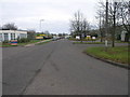
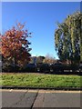
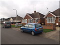
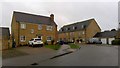
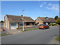
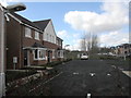
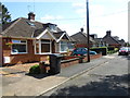
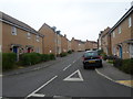
Photos of NN3 6RL
Area Information
NN3 6RL is a compact residential cluster in England, covering just 3.2 hectares yet housing 1,877 people. This translates to an exceptionally high population density of 59,000 people per square kilometre, reflecting a tightly knit community. The area is characterised by its focus on house ownership, with 77% of residents living in their own homes. Daily life here is shaped by proximity to amenities, including five retail outlets such as Tesco Spinny and Co-op Bushland, and transport hubs like Northampton Bus Interchange. The median age of 47 suggests a mature demographic, with most residents aged 30–64. The area’s safety profile is strong, with low crime risk and no flood or environmental constraints. Living in NN3 6RL offers a blend of practicality and security, though its small size means every aspect of life is closely interwoven with nearby services and transport links.
- Area Type
- Postcode
- Area Size
- 3.2 hectares
- Population
- 1877
- Population Density
- 2064 people/km²
The property market in NN3 6RL is heavily skewed towards owner-occupation, with 77% of homes owned by residents. This contrasts with rental markets, where private landlords dominate. The accommodation type is predominantly houses, which is unusual for areas with high population density. This suggests a mix of smaller, family-friendly homes and possibly terraced properties, given the compact nature of the area. Buyers considering NN3 6RL should note that the small size of the postcode—just 3.2 hectares—means property options are limited. The high home ownership rate may indicate a stable market, but the lack of specific data on property prices or availability means potential buyers must look to nearby areas for broader choices. The focus on houses also implies a preference for private, semi-detached living rather than apartments or flats.
House Prices in NN3 6RL
Showing 56 properties
| Address | Type | Beds | Baths | Last Sale Price | Last Sale Date | |
|---|---|---|---|---|---|---|
| 111 Howards Way, Northampton, NN3 6RL | Semi-detached | 3 | 2 | £292,000 | Aug 2024 | |
| 55 Howards Way, Northampton, NN3 6RL | Detached | 4 | 2 | £390,000 | Jul 2024 | |
| 43 Howards Way, Northampton, NN3 6RL | Semi-detached | 3 | 2 | £290,000 | Mar 2024 | |
| 97 Howards Way, Northampton, NN3 6RL | Terraced | 3 | 1 | £250,000 | Jun 2023 | |
| 5 Howards Way, Northampton, NN3 6RL | house | 3 | 2 | £295,000 | Nov 2022 | |
| 21 Howards Way, Northampton, NN3 6RL | house | 3 | - | £250,000 | Aug 2021 | |
| 33 Howards Way, Northampton, NN3 6RL | Detached | 3 | 2 | £282,000 | Mar 2021 | |
| 47 Howards Way, Northampton, NN3 6RL | Detached | 4 | - | £355,000 | Oct 2020 | |
| 99 Howards Way, Northampton, NN3 6RL | Terraced | 3 | 1 | £88,000 | Sep 2018 | |
| 35 Howards Way, Northampton, NN3 6RL | Semi-detached | 3 | 2 | £265,000 | Dec 2017 |
Energy Efficiency in NN3 6RL
Living in NN3 6RL offers practical access to nearby amenities, including five retail outlets such as Tesco Spinny and Co-op Bushland, which cater to daily shopping needs. The area’s proximity to Northampton Bus Interchange and Northampton Railway Station enhances connectivity, allowing residents to travel to larger urban centres. While there is no mention of parks or leisure facilities in the data, the density of retail and transport options suggests a focus on convenience over expansive recreational spaces. The small size of the area means amenities are within walking or short driving distance, fostering a compact, efficient lifestyle. For those prioritising accessibility and practicality, NN3 6RL provides a functional base with immediate access to essential services.
Amenities
Schools
The nearest school to NN3 6RL is On Track Education, a special school rated ‘good’ by Ofsted. This institution serves students with specific educational needs, making it a critical resource for families in the area. The absence of other schools in the data highlights a reliance on this single facility, which may be both a strength and a limitation. For families with children requiring specialist support, On Track Education offers a high standard of care. However, the lack of mainstream schools or nurseries in the immediate vicinity could be a concern for those seeking a broader range of educational options. Parents should consider the school’s proximity to their homes and the potential need for additional travel if other schools are required.
| Rank | School | Type | Entry gender | Ages |
|---|
Explore more schools in this area
Go to Schools tabDemographics
The community in NN3 6RL is predominantly composed of adults aged 30–64, with a median age of 47. This suggests a stable population, likely with established careers and families. Home ownership is high at 77%, indicating a strong preference for long-term residency. The accommodation type is primarily houses, which aligns with the area’s residential character. The predominant ethnic group is White, though no specific data on diversity or deprivation is provided. The population density of 59,000 people per square kilometre implies a closely packed community, which may foster a sense of familiarity but could also mean limited space for expansion. The absence of specific deprivation data means the quality of life cannot be assessed in terms of economic hardship, but the low crime risk and safety assessments suggest a generally secure environment.
Household Size
Accommodation Type
Tenure
Ethnic Group
Religion
Household Composition
Age
Household Deprivation
NS-SEC
Explore more demographic insights in this area
Go to Demographics tabPlanning
Planning Constraints
- Flood RiskPremium
- Ramsar Wetland SitesPremium
- Area of Outstanding Natural BeautyPremium
- Protected Nature ReservePremium
- Protected WoodlandPremium