Area Overview for NN3 6PZ
Photos of NN3 6PZ
Area Information
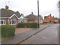
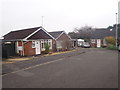
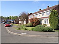
Living in NN3 6PZ offers a compact, residential experience within a small cluster of 6.3 hectares, home to 1,517 residents. The area’s population density of 898 people per square kilometre reflects a tightly knit community, with a median age of 47 and a strong presence of adults aged 30–64. This suggests a mature, stable demographic, likely centred around families and long-term residents. The area’s small size means it is likely integrated into nearby towns, with proximity to transport hubs and amenities. Daily life here is shaped by a balance of local services and the broader regional infrastructure, making it suitable for those seeking a quieter, community-focused environment without sacrificing connectivity. The high home ownership rate—90% of properties are owner-occupied—indicates a preference for settled living, with most homes being traditional houses rather than flats. This characterises NN3 6PZ as a place where stability and familiarity are key, with residents likely prioritising long-term residency over transient living.
- Area Type
- Postcode
- Area Size
- 6.3 hectares
- Population
- 1517
- Population Density
- 898 people/km²
The property market in NN3 6PZ is characterised by a high rate of home ownership—90% of properties are owner-occupied—suggesting a community of long-term residents rather than a rental market. The accommodation type is predominantly houses, which is unusual for a small postcode area and may indicate a mix of older, traditional homes and newer builds. Given the area’s compact size of 6.3 hectares, the housing stock is likely limited in scale, with little scope for expansion. Buyers should consider that this is not a high-density area, and properties are likely to be family-sized homes rather than apartments. The high home ownership rate also implies that the market is less influenced by short-term rental trends, making it a stable but potentially less dynamic area for property investment. For those seeking a home, the focus would be on securing a house in a small, established community, though the limited space may restrict options for larger families or those requiring more land.
House Prices in NN3 6PZ
Showing 10 properties
| Address | Type | Beds | Baths | Last Sale Price | Last Sale Date | |
|---|---|---|---|---|---|---|
| 14-18 Tenter Road, Northampton, NN3 6PZ | Industrial | - | - | - | - | |
| 19 Tenter Road, Northampton, NN3 6PZ | office_workshop | - | - | - | - | |
| Unit B1, 19A Tenter Road, Northampton, NN3 6PZ | Industrial | - | - | - | - | |
| Unit B3, 19C Tenter Road, Northampton, NN3 6PZ | office_workshop | - | - | - | - | |
| Unit B2, 19B Tenter Road, Northampton, NN3 6PZ | office_workshop | - | - | - | - | |
| Plant Tree Biotech Ltd, 6 Tenter Road, Northampton, NN3 6PZ | office_workshop | - | - | - | - | |
| The Automated Technology Group, Site J, Tenter Road, Northampton, NN3 6PZ | warehouse | - | - | - | - | |
| 20 Tenter Road, Northampton, NN3 6PZ | general_industrial | - | - | - | - | |
| 19-A-19-C Tenter Road, Northampton, NN3 6PZ | office_workshop | - | - | - | - | |
| 2-4, Tenter Road, Northampton, NN3 6PZ | warehouse | - | - | - | - |
Energy Efficiency in NN3 6PZ
The lifestyle in NN3 6PZ is shaped by its proximity to essential amenities within practical reach. Retail options include Tesco Spinny, Co-op Moulton, and M&S Harborough BP, providing access to everyday shopping needs. The two bus stops, including the University Bus Interchange, connect residents to broader transport networks, while Northampton Railway Station offers rail links for longer commutes. Though the area itself is small, the presence of these amenities suggests a focus on convenience for daily living. The absence of named parks or leisure facilities in the data means that recreational opportunities may be found in nearby towns. However, the compact layout of the area, combined with nearby transport, implies that residents can access larger amenities without significant travel. This balance of local services and connectivity makes NN3 6PZ suitable for those prioritising practicality over expansive leisure options.
Amenities
Schools
The schools near NN3 6PZ include Parklands Primary School and Parklands Middle School, both of which are primary institutions. Northampton School for Girls is listed twice: once as a primary school and again as an academy with a ‘good’ Ofsted rating. This suggests a range of educational options for families, from early years through to secondary education. The presence of a special school, Include Northampton, adds to the diversity of educational provision, catering to students with specific needs. The mix of primary, academy, and special schools indicates that the area can accommodate a range of family requirements, though the absence of secondary schools explicitly named in the data means parents may need to look beyond the immediate postcode for comprehensive schooling. The ‘good’ rating at Northampton School for Girls as an academy is a positive indicator for families seeking quality secondary education, though the overall school landscape remains focused on primary and specialist provision.
| Rank | School | Type | Entry gender | Ages |
|---|
Explore more schools in this area
Go to Schools tabDemographics
The community in NN3 6PZ is predominantly composed of adults aged 30–64, with a median age of 47. This suggests a population skewed towards middle-aged individuals, many of whom may be in their peak working years or raising families. The high home ownership rate of 90% indicates a strong presence of long-term residents, with most properties being houses rather than flats. The area’s demographic is largely homogeneous, with the White ethnic group forming the majority. The population density of 898 people per square kilometre, while relatively high for a small area, does not suggest overcrowding but rather a tightly packed residential cluster. This density likely fosters a sense of community, though it may also mean limited space for new developments. The absence of specific data on deprivation or income levels means the area’s quality of life cannot be fully assessed, but the demographic profile points to a stable, established population with established social networks.
Household Size
Accommodation Type
Tenure
Ethnic Group
Religion
Household Composition
Age
Household Deprivation
NS-SEC
Explore more demographic insights in this area
Go to Demographics tabPlanning
Planning Constraints
- Flood RiskPremium
- Ramsar Wetland SitesPremium
- Area of Outstanding Natural BeautyPremium
- Protected Nature ReservePremium
- Protected WoodlandPremium