Area Overview for NN3 6NN
Photos of NN3 6NN


Area Information
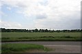
Living in NN3 6NN means being part of a tightly knit residential cluster in England, where 1,517 people reside across 1.3 hectares. The area’s compact size fosters a sense of community, with homes predominantly occupied by owners, reflecting a stable, long-term demographic. The population density of 898 people per square kilometre suggests a mix of family homes and established households. Daily life here is shaped by proximity to essential services, including schools, retail outlets, and transport hubs. While the area lacks natural conservation designations, its practicality is evident in the accessibility of Northampton Railway Station and nearby bus interchanges. Residents benefit from excellent broadband connectivity, rated at 100, ensuring seamless digital experiences. However, the area’s small footprint means that amenities are concentrated, requiring careful planning for those prioritising space. NN3 6NN is ideal for those seeking a balance between urban convenience and a manageable, owner-occupied environment.
- Area Type
- Postcode
- Area Size
- 1.3 hectares
- Population
- 1517
- Population Density
- 898 people/km²
NN3 6NN is a predominantly owner-occupied area, with 90% of homes owned by residents rather than rented. The housing stock consists almost entirely of houses, which is unusual for a postcode of this size. This suggests a focus on family homes and long-term residency, with limited rental availability. The compact nature of the area means that property choices are constrained, and buyers must consider proximity to amenities like schools and transport. The high home ownership rate indicates a stable market, where properties are likely to hold value over time. However, the small size of the area means that buyers should prioritise locations near essential services, as expansion is not feasible. For those seeking a house in NN3 6NN, the emphasis on owner-occupation and traditional housing types may appeal to those prioritising security and community ties.
House Prices in NN3 6NN
No properties found in this postcode.
Energy Efficiency in NN3 6NN
Daily life in NN3 6NN is shaped by its proximity to retail and transport hubs. The area includes notable retail outlets such as Tesco Spinny, Co-op Moulton, and M&S Harborough BP, offering a range of shopping options. These stores cater to everyday needs, from groceries to general retail, reducing the necessity for long trips. The presence of two bus interchanges and a railway station enhances mobility, connecting residents to broader networks for work, leisure, or travel. While the area does not list parks or leisure facilities explicitly, the nearby schools and transport links suggest a focus on practicality over expansive recreational spaces. The character of NN3 6NN is defined by its convenience, with amenities clustered closely to serve a compact population. However, those prioritising green spaces or cultural venues may need to look beyond the immediate area. The lifestyle here is efficient but limited in scope, ideal for those valuing accessibility over diversity of options.
Amenities
Schools
Residents of NN3 6NN have access to a range of educational institutions, including Parklands Primary School and Parklands Middle School, both of which cater to younger children. Northampton School for Girls is listed twice in the data: once as a primary school and once as an academy with a ‘good’ Ofsted rating. This dual listing may indicate a transition in the school’s status or a mix of educational phases. Include Northampton is a special school, offering tailored support for students with specific needs. The presence of both mainstream and specialist schools provides families with diverse options, though the exact catchment areas and admission policies are not specified. The ‘good’ rating for Northampton School for Girls as an academy suggests a reliable standard of education, which is a key consideration for parents. The concentration of schools within proximity supports a family-friendly environment, though the small area may limit the number of choices available.
| Rank | School | Type | Entry gender | Ages |
|---|
Explore more schools in this area
Go to Schools tabDemographics
The community in NN3 6NN is predominantly composed of adults aged 30–64, with a median age of 47. This suggests a mature, settled population, likely with established careers and family structures. Home ownership is exceptionally high at 90%, indicating a preference for long-term residency over rental properties. The area is characterised by houses rather than flats, aligning with the demographic profile of older, family-oriented residents. The predominant ethnic group is White, reflecting a homogenous community. With a population density of 898 people per square kilometre, the area is neither overcrowded nor sparse, offering a moderate living environment. This density supports a range of local services but may limit opportunities for those seeking more expansive housing options. The age profile and ownership rates suggest a stable, low-turnover community focused on continuity and familiarity.
Household Size
Accommodation Type
Tenure
Ethnic Group
Religion
Household Composition
Age
Household Deprivation
NS-SEC
Explore more demographic insights in this area
Go to Demographics tabPlanning
Planning Constraints
- Flood RiskPremium
- Ramsar Wetland SitesPremium
- Area of Outstanding Natural BeautyPremium
- Protected Nature ReservePremium
- Protected WoodlandPremium