Area Overview for NN3 6EW
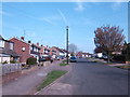
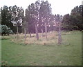
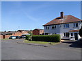
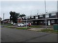
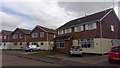
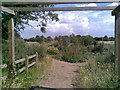
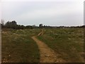
Photos of NN3 6EW
Area Information
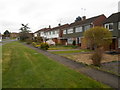
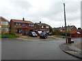
NN3 6EW is a small, tightly knit residential area in England, covering just 1.4 hectares and home to 1,517 people. Its compact size means it is a quiet, community-focused postcode, with a population density of 898 people per square kilometre. The area is dominated by houses, reflecting a strong preference for owner-occupied properties. With a median age of 47, the community is largely composed of adults aged 30–64, suggesting a stable, established population. Daily life here is likely shaped by proximity to local amenities, schools, and transport links. The area’s small footprint means residents are close to essential services, though its limited size also means it is not a sprawling suburb. For those seeking a balance between urban convenience and residential tranquillity, NN3 6EW offers a compact, well-defined living environment. Its position near Northampton’s transport hubs and schools makes it appealing for families, while the high home ownership rate indicates a long-term commitment from residents.
- Area Type
- Postcode
- Area Size
- 1.4 hectares
- Population
- 1517
- Population Density
- 898 people/km²
The property market in NN3 6EW is characterised by high home ownership (90%) and a focus on houses rather than flats or other formats. This suggests a market dominated by owner-occupiers, with limited rental activity. The compact size of the area means the housing stock is finite, which could drive competition among buyers. The prevalence of houses indicates a preference for standalone properties, possibly with gardens or private outdoor space, which may appeal to families or those seeking a traditional living environment. Given the area’s proximity to schools, transport, and retail, properties here are likely to be in demand, particularly for those prioritising convenience. However, the small size of NN3 6EW means buyers should consider the immediate surrounding areas for more options. The market is likely stable, with limited new developments, making it a niche but potentially secure investment for those seeking a residential cluster with established infrastructure.
House Prices in NN3 6EW
Showing 38 properties
| Address | Type | Beds | Baths | Last Sale Price | Last Sale Date | |
|---|---|---|---|---|---|---|
| 45A Oulton Rise, Northampton, NN3 6EW | Maisonette | 2 | 1 | £62,500 | Mar 2022 | |
| 22 Oulton Rise, Northampton, NN3 6EW | Bungalow | - | - | £225,000 | Nov 2021 | |
| 12 Oulton Rise, Northampton, NN3 6EW | Detached | 4 | - | £275,000 | Aug 2020 | |
| 7 Oulton Rise, Northampton, NN3 6EW | Semi-detached | 3 | 1 | £208,000 | Jul 2020 | |
| 34 Oulton Rise, Northampton, NN3 6EW | Detached | 4 | - | £300,000 | Jun 2020 | |
| 32 Oulton Rise, Northampton, NN3 6EW | house | - | - | £312,000 | Dec 2019 | |
| 20 Oulton Rise, Northampton, NN3 6EW | Bungalow | 2 | - | £190,000 | Aug 2017 | |
| 14 Oulton Rise, Northampton, NN3 6EW | Bungalow | 3 | - | £237,000 | Apr 2015 | |
| 39A Oulton Rise, Northampton, NN3 6EW | Flat | 2 | - | £95,000 | Oct 2013 | |
| 12A Oulton Rise, Northampton, NN3 6EW | Retail | - | - | £185,000 | Jun 2013 |
Energy Efficiency in NN3 6EW
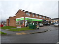
Living in NN3 6EW provides access to a range of amenities within easy reach. Retail options include Tesco Spinny, Morrisons Kingsley, and Tesco Kingsley, offering everyday shopping needs. The area’s bus and rail links connect residents to Northampton’s broader network, enabling access to larger retail centres, dining venues, and cultural attractions. While specific parks or leisure facilities are not listed in the data, the presence of schools and transport hubs suggests a focus on community and practicality over expansive green spaces. The compact size of the area means amenities are closely clustered, reducing travel time for errands or social activities. For those valuing convenience and proximity to services, NN3 6EW’s lifestyle balances local accessibility with connections to regional opportunities, making it suitable for those who prefer a streamlined, efficient daily routine.
Amenities
Schools
Residents of NN3 6EW have access to a range of schools within practical reach. Parklands Primary School and Parklands Middle School cater to younger children, while Northampton School for Girls offers both primary and academy-level education with a good Ofsted rating. This mix of school types provides families with options for different stages of education, from early years through to secondary schooling. Include Northampton, a special school, ensures support for students with specific needs. The presence of multiple schools within the area suggests a strong focus on education, which is likely a key factor for families considering the area. The good Ofsted rating for Northampton School for Girls adds value, indicating quality teaching and facilities. With these options available, NN3 6EW is well-positioned to meet the educational needs of its residents, from primary to specialist provision.
| Rank | School | Type | Entry gender | Ages |
|---|
Explore more schools in this area
Go to Schools tabDemographics
The population of NN3 6EW is predominantly adults aged 30–64, with a median age of 47. This suggests a mature, settled community with a strong presence of families and professionals. Home ownership is exceptionally high at 90%, indicating a preference for long-term residency over rental properties. The area is composed almost entirely of houses, with no mention of flats or other accommodation types. The predominant ethnic group is White, though specific data on diversity or deprivation is not provided. The population density of 898 people per square kilometre means the area is neither sparse nor overcrowded, allowing for a mix of private and shared spaces. This density, combined with the high home ownership rate, implies a cohesive, stable community where residents are likely to know their neighbours. The age profile suggests a low proportion of young children or retirees, which may influence local services and amenities.
Household Size
Accommodation Type
Tenure
Ethnic Group
Religion
Household Composition
Age
Household Deprivation
NS-SEC
Explore more demographic insights in this area
Go to Demographics tabPlanning
Planning Constraints
- Flood RiskPremium
- Ramsar Wetland SitesPremium
- Area of Outstanding Natural BeautyPremium
- Protected Nature ReservePremium
- Protected WoodlandPremium