Area Overview for NN3 6DP
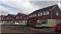
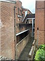
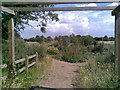
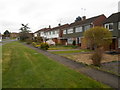
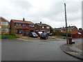
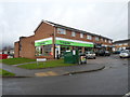
Photos of NN3 6DP

Area Information
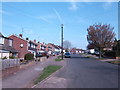
Living in NN3 6DP means being part of a tightly knit residential cluster in England, where 1,517 people reside across 8,528 square metres. The area’s compact size fosters a sense of familiarity, with homes predominantly occupied by owners rather than renters. Daily life here balances suburban tranquillity with practical access to nearby amenities. The population density of 898 people per square kilometre reflects a mix of established families and long-term residents, many of whom are in their mid-40s. While the area lacks sprawling green spaces or major landmarks, its proximity to Northampton’s infrastructure—such as the railway station and bus interchanges—ensures connectivity to the wider region. For those prioritising convenience over vast open spaces, NN3 6DP offers a self-contained lifestyle with essential services within reach. The absence of environmental constraints like protected woodlands or Areas of Outstanding Natural Beauty means development is unencumbered, though this also means the area’s character is shaped more by its human-scale density than by natural features.
- Area Type
- Postcode
- Area Size
- 8528 m²
- Population
- 1517
- Population Density
- 898 people/km²
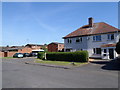
The property market in NN3 6DP is characterised by high home ownership, with 90% of properties occupied by owners rather than renters. This suggests a stable, long-term resident base rather than a transient rental market. The accommodation type is exclusively houses, which is unusual for areas with higher population densities, where flats or terraced homes are more common. This mix of high ownership and single-family homes implies a community that prioritises privacy and space, potentially attracting families or professionals seeking a quieter alternative to urban centres. However, the small area size—just 8,528 square metres—means the housing stock is limited, which could create competition among buyers. For those considering the area, the dominance of owner-occupied properties may indicate a strong sense of community and investment in local assets, though the lack of newer developments could mean limited options for modern housing.
House Prices in NN3 6DP
Showing 25 properties
| Address | Type | Beds | Baths | Last Sale Price | Last Sale Date | |
|---|---|---|---|---|---|---|
| 180 Spinney Hill Road, Northampton, NN3 6DP | Semi-detached | 2 | 2 | £250,000 | Nov 2024 | |
| 194 Spinney Hill Road, Northampton, NN3 6DP | Semi-detached | 3 | 1 | £267,500 | Jan 2024 | |
| 184 Spinney Hill Road, Northampton, NN3 6DP | Retail | 2 | 1 | £255,000 | Aug 2022 | |
| 202 Spinney Hill Road, Northampton, NN3 6DP | Semi-detached | 4 | - | £265,000 | Nov 2019 | |
| 192 Spinney Hill Road, Northampton, NN3 6DP | Semi-detached | 4 | - | £267,000 | Oct 2018 | |
| 186 Spinney Hill Road, Northampton, NN3 6DP | Semi-detached | 2 | 2 | £200,000 | Jun 2018 | |
| 220 Spinney Hill Road, Northampton, NN3 6DP | Semi-detached | 2 | - | £138,500 | Mar 2014 | |
| 182 Spinney Hill Road, Northampton, NN3 6DP | Semi-detached | 3 | 1 | £144,000 | Apr 2010 | |
| 188 Spinney Hill Road, Northampton, NN3 6DP | house | - | - | £158,000 | Nov 2007 | |
| 178 Spinney Hill Road, Northampton, NN3 6DP | Semi-detached | 4 | 2 | £170,000 | Mar 2004 |
Energy Efficiency in NN3 6DP
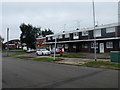
The lifestyle in NN3 6DP is shaped by its proximity to retail and transport hubs. Within practical reach are major supermarkets like Tesco Spinny, Morrisons Kingsley, and Tesco Kingsley, ensuring daily shopping needs are met without long journeys. The area’s bus interchanges and Northampton Railway Station provide easy access to the city and beyond, making it convenient for commuters or those requiring regular travel. While the data does not mention parks or leisure facilities, the presence of multiple retail outlets and transport links suggests a focus on practicality over recreation. For those prioritising convenience, the area’s compact size and nearby amenities offer a self-contained experience, though it may lack the green spaces or cultural venues found in larger towns. The blend of retail and transport options supports a lifestyle that balances suburban comfort with urban accessibility.
Amenities
Schools
Residents of NN3 6DP have access to a range of educational institutions, including Parklands Primary School and Parklands Middle School, both of which cater to younger children. Northampton School for Girls operates as both a primary and academy, with an Ofsted rating of ‘good’, indicating a reliable standard of education. For students with special educational needs, Include Northampton provides tailored support. The presence of both mainstream and special schools suggests the area is well-suited for families with diverse educational requirements. However, the absence of secondary schools within the immediate vicinity means parents may need to consider commuting to nearby towns for older children. The mix of school types ensures coverage for different age groups and needs, though the lack of higher education institutions nearby could be a consideration for those planning for long-term family growth.
| Rank | School | Type | Entry gender | Ages |
|---|
Explore more schools in this area
Go to Schools tabDemographics
The community in NN3 6DP is defined by its median age of 47, with the majority of residents falling into the 30-64 age bracket. This suggests a population skewed towards working-age adults, many of whom are likely to be homeowners, as 90% of properties are owner-occupied. The accommodation type is predominantly houses, reflecting a demographic that values private space over flats or shared housing. The predominant ethnic group is White, which aligns with broader regional trends but underscores the area’s homogeneity. With 898 people per square kilometre, the density is high enough to support local amenities but low enough to avoid the congestion of larger urban centres. This balance may appeal to those seeking a quieter, more stable environment without sacrificing proximity to transport links. The data does not indicate significant deprivation, but the lack of diversity in age and ethnicity might limit the range of social or cultural experiences available to residents.
Household Size
Accommodation Type
Tenure
Ethnic Group
Religion
Household Composition
Age
Household Deprivation
NS-SEC
Explore more demographic insights in this area
Go to Demographics tabPlanning
Planning Constraints
- Flood RiskPremium
- Ramsar Wetland SitesPremium
- Area of Outstanding Natural BeautyPremium
- Protected Nature ReservePremium
- Protected WoodlandPremium