Area Overview for NN3 5EY
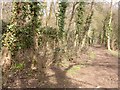
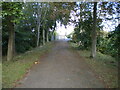
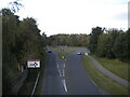
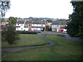
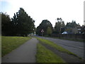
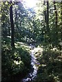
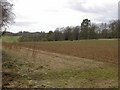
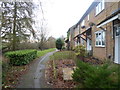
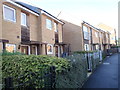
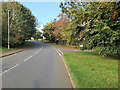
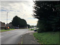
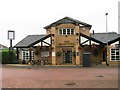
Photos of NN3 5EY
Area Information
NN3 5EY is a small, tightly packed residential postcode area in England, spanning just 1.4 hectares and home to 2,149 residents. Its high population density of 152,273 people per square kilometre reflects a compact, closely knit community. The area is characterised by a mix of housing stock, with a focus on family-oriented living. Residents benefit from proximity to essential services, including two railway stations and multiple bus routes, which connect them to nearby towns like Northampton and Wellingborough. The area’s compact size means amenities are within easy reach, though its small footprint also means it is a highly specific postcode cluster. With a median age of 47 and a majority of residents aged 30–64, the community is mature and stable, with a strong emphasis on family life. For those considering living here, the blend of convenience, connectivity, and a well-established local environment offers a practical base for daily living.
- Area Type
- Postcode
- Area Size
- 1.4 hectares
- Population
- 2149
- Population Density
- 6914 people/km²
NN3 5EY’s property market is defined by a 49% home ownership rate, indicating that nearly half of the housing stock is rented out. This suggests a mix of owner-occupied and rental properties, though the data does not specify the proportion of each. The accommodation type is predominantly houses, which is unusual for a small postcode area but may reflect a focus on family homes. Given the area’s compact size and high density, the housing stock is likely limited to a few key developments. Buyers should consider that the small footprint of NN3 5EY means property availability is constrained, and proximity to amenities like schools and transport is a key selling point. The presence of houses rather than flats may appeal to those seeking more space, though the area’s size means potential buyers should prioritise locations within the immediate vicinity for greater choice.
House Prices in NN3 5EY
Showing 46 properties
| Address | Type | Beds | Baths | Last Sale Price | Last Sale Date | |
|---|---|---|---|---|---|---|
| 83 Crowthorp Road, Northampton, NN3 5EY | Terraced | 3 | - | £146,000 | Feb 2025 | |
| 54 Crowthorp Road, Northampton, NN3 5EY | Terraced | 3 | 1 | £205,000 | Feb 2025 | |
| 79 Crowthorp Road, Northampton, NN3 5EY | Terraced | 3 | 1 | £195,000 | Nov 2023 | |
| 67 Crowthorp Road, Northampton, NN3 5EY | Terraced | 3 | 1 | £190,000 | Sep 2023 | |
| 84 Crowthorp Road, Northampton, NN3 5EY | house | - | - | £184,995 | Oct 2021 | |
| 75 Crowthorp Road, Northampton, NN3 5EY | Terraced | 3 | 1 | £149,000 | Nov 2017 | |
| 69 Crowthorp Road, Northampton, NN3 5EY | house | - | - | £140,000 | Jan 2017 | |
| 53 Crowthorp Road, Northampton, NN3 5EY | Terraced | 3 | 2 | £127,000 | Jul 2016 | |
| 57 Crowthorp Road, Northampton, NN3 5EY | Terraced | 4 | 1 | £156,995 | Jan 2015 | |
| 65 Crowthorp Road, Northampton, NN3 5EY | house | 3 | - | £82,500 | Jan 2012 |
Energy Efficiency in NN3 5EY
Living in NN3 5EY offers access to a range of retail and transport hubs within close proximity. The area is served by five retail outlets, including Co-op Northampton and Asda Nene Valley, providing everyday shopping needs. These stores cater to both routine purchases and larger grocery requirements, ensuring convenience for residents. The presence of two bus interchanges and two railway stations further enhances mobility, linking the area to Northampton, Wellingborough, and beyond. While the data does not specify parks or leisure facilities, the compact nature of NN3 5EY suggests that nearby towns likely host recreational spaces. The combination of retail, transport, and connectivity makes daily life efficient, with minimal need to travel far for essentials. This accessibility supports a practical lifestyle, ideal for those prioritising convenience and ease of movement.
Amenities
Schools
The nearest school to NN3 5EY is Rectory Farm Primary School, which serves the local community with a primary education offering. The school holds an Ofsted rating of ‘good’, indicating a satisfactory standard of teaching and facilities. As the only named school in the data, it highlights the area’s reliance on a single primary institution for children’s early education. Families in NN3 5EY would need to look beyond the immediate postcode for secondary school options, as no secondary schools are listed. The presence of a well-rated primary school is a significant advantage for parents, though the lack of nearby secondary education may influence decisions about long-term residency. The school’s ‘good’ rating suggests it meets acceptable standards, but further research into its curriculum and extracurricular offerings would be advisable for prospective residents.
| Rank | School | Type | Entry gender | Ages |
|---|
Explore more schools in this area
Go to Schools tabDemographics
The population of NN3 5EY skews towards adults aged 30–64, with a median age of 47. This suggests a community rooted in middle-aged households, likely with established careers and families. Home ownership stands at 49%, indicating a balance between owner-occupied properties and rental homes. The predominant accommodation type is houses, which aligns with the area’s residential character. The population density of 152,273 people per square kilometre is exceptionally high, reflecting a tightly packed urban environment. The predominant ethnic group is White, which shapes the cultural and social dynamics of the area. While the data does not specify deprivation levels, the high density and age profile suggest a community that prioritises stability and proximity to services. This demographic profile makes NN3 5EY appealing to those seeking a settled, family-friendly environment with minimal commute times to nearby urban hubs.
Household Size
Accommodation Type
Tenure
Ethnic Group
Religion
Household Composition
Age
Household Deprivation
NS-SEC
Explore more demographic insights in this area
Go to Demographics tabPlanning
Planning Constraints
- Flood RiskPremium
- Ramsar Wetland SitesPremium
- Area of Outstanding Natural BeautyPremium
- Protected Nature ReservePremium
- Protected WoodlandPremium