Area Overview for NN3 5HX
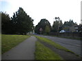
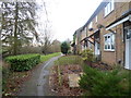
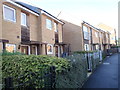
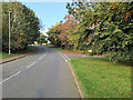
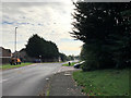
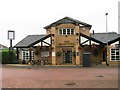
Photos of NN3 5HX
Area Information
NN3 5HX is a compact residential postcode area in England, covering just 8,236 square metres and home to 2,149 residents. Its high population density—260,916 people per square kilometre—reflects a tightly packed community, typical of small urban clusters. The area is defined by its proximity to essential services and transport links, making it a practical choice for those prioritising convenience. With a median age of 47, the population skews towards adults aged 30–64, suggesting a mix of established families and older professionals. Daily life here is shaped by the immediate access to retail, transport hubs, and schools, though the area’s size means it is best suited for those who value proximity to amenities over expansive open spaces. The low flood risk and absence of protected natural sites indicate a relatively straightforward planning environment, though the moderate crime risk underscores the need for standard security measures. For buyers seeking a small, well-connected area with a focus on accessibility, NN3 5HX offers a blend of practicality and community density.
- Area Type
- Postcode
- Area Size
- 8236 m²
- Population
- 2149
- Population Density
- 6914 people/km²
The property market in NN3 5HX is characterised by a 49% home ownership rate, indicating that just over half of the area’s properties are owner-occupied. The accommodation type is predominantly houses, which may suggest a focus on family homes or single-dwelling properties. Given the area’s small size and high population density, the housing stock is likely limited, with little scope for expansion. This makes the market potentially competitive for buyers, particularly those seeking larger properties. The relatively low home ownership rate could imply a stronger rental market, though the data does not specify the proportion of rental properties. For buyers, the area’s compact nature means that proximity to amenities and transport is a key advantage, though the limited size of the postcode may restrict options for those prioritising space or privacy.
House Prices in NN3 5HX
Showing 20 properties
| Address | Type | Beds | Baths | Last Sale Price | Last Sale Date | |
|---|---|---|---|---|---|---|
| 3 Fellmead Road, Northampton, NN3 5HX | Terraced | - | - | £145,000 | Nov 2017 | |
| 1 Fellmead Road, Northampton, NN3 5HX | house | - | - | £112,000 | Dec 2013 | |
| 17 Fellmead Road, Northampton, NN3 5HX | house | - | - | - | - | |
| 2 Fellmead Road, Northampton, NN3 5HX | house | - | - | - | - | |
| 20 Fellmead Road, Northampton, NN3 5HX | house | - | - | - | - | |
| 8 Fellmead Road, Northampton, NN3 5HX | Semi-detached | - | - | - | - | |
| 18 Fellmead Road, Northampton, NN3 5HX | house | - | - | - | - | |
| 9 Fellmead Road, Northampton, NN3 5HX | house | - | - | - | - | |
| 12 Fellmead Road, Northampton, NN3 5HX | Semi-detached | - | - | - | - | |
| 10 Fellmead Road, Northampton, NN3 5HX | Semi-detached | - | - | - | - |
Energy Efficiency in NN3 5HX
The lifestyle in NN3 5HX is shaped by its proximity to retail, transport, and community hubs. Nearby shops include Co-op Northampton and Asda Nene Valley, offering essential goods and services. The area’s transport links, such as the University Bus Interchange and Northampton Railway Station, provide easy access to nearby towns and cities, supporting both commuting and leisure travel. While the data does not mention parks or recreational spaces, the presence of retail and transport amenities suggests a practical, convenience-focused lifestyle. The compact nature of the area means residents can access daily necessities without long journeys, though the lack of detailed information on leisure facilities implies a focus on functional living over expansive leisure options. For those prioritising accessibility and proximity to services, NN3 5HX offers a straightforward, well-connected environment.
Amenities
Schools
The nearest school to NN3 5HX is Rectory Farm Primary School, which serves the local community with a primary education offering. The school holds an Ofsted rating of ‘good’, indicating a satisfactory standard of teaching and facilities. As the only listed school in the area, it is the primary educational option for young families. The absence of secondary schools within the data suggests that students may need to travel to nearby towns for further education. For parents, the presence of a well-rated primary school is a significant draw, though the lack of secondary options could be a consideration for long-term family planning. The school’s rating reflects a baseline of quality, but additional research into its curriculum and extracurricular offerings would be necessary for a full assessment.
| Rank | School | Type | Entry gender | Ages |
|---|
Explore more schools in this area
Go to Schools tabDemographics
The community in NN3 5HX is predominantly composed of adults aged 30–64, with a median age of 47. This suggests a population of middle-aged individuals, likely including families and professionals. Home ownership stands at 49%, meaning just under half of properties are owner-occupied, with the remaining likely rented. The accommodation type is primarily houses, which may indicate a preference for single-family homes over flats or apartments. The predominant ethnic group is White, though the data does not specify further diversity metrics. The area’s high population density—260,916 people per square kilometre—means living spaces are closely packed, which can influence the character of the neighbourhood. While the data does not provide deprivation statistics, the combination of a mature population and moderate home ownership suggests a stable but potentially aging demographic. This profile may appeal to those seeking a settled, community-oriented environment with established infrastructure.
Household Size
Accommodation Type
Tenure
Ethnic Group
Religion
Household Composition
Age
Household Deprivation
NS-SEC
Explore more demographic insights in this area
Go to Demographics tabPlanning
Planning Constraints
- Flood RiskPremium
- Ramsar Wetland SitesPremium
- Area of Outstanding Natural BeautyPremium
- Protected Nature ReservePremium
- Protected WoodlandPremium