Area Overview for NN3 5AX
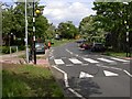
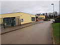
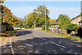
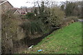
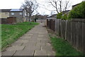
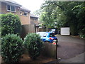
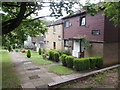
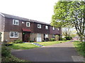
Photos of NN3 5AX


Area Information
Living in NN3 5AX means inhabiting a compact, densely populated residential cluster in England. With a population of 1,738 spread across just 5,633 square metres, this area is characterised by its tight-knit community and proximity to essential services. The high population density, at 308,556 people per square kilometre, reflects a focus on residential living rather than sprawling development. Residents benefit from being near Northampton’s transport hubs, including the University Bus Interchange and Northampton Railway Station, which link the area to broader regional networks. Daily life here is shaped by proximity to retail outlets like Aldi Overstone and Co-op Northampton, as well as the presence of educational institutions. While the area is small, its strategic location ensures access to both urban amenities and suburban tranquillity. The demographic profile—primarily adults aged 30–64—suggests a stable, established community. For buyers, NN3 5AX offers a blend of compact living and practical connectivity, though its limited size means choices are focused on nearby extensions or adjacent neighbourhoods.
- Area Type
- Postcode
- Area Size
- 5633 m²
- Population
- 1738
- Population Density
- 3575 people/km²
The property market in NN3 5AX is dominated by owner-occupied homes, with 62% of properties owned by residents rather than rented. This suggests a stable, long-term demographic with a focus on residential permanence. The accommodation type is primarily houses, which is uncommon in densely populated areas and indicates a preference for standalone properties. Given the area’s small size—just 5,633 square metres—housing stock is likely limited to a few dozen homes, many of which may be family homes or semi-detached properties. For buyers, this means competition for available properties could be fierce, particularly for those seeking larger homes. The proximity to Northampton’s amenities, including retail and transport hubs, adds value to properties here. However, the compact nature of NN3 5AX means buyers may need to consider nearby postcode areas for more options, balancing convenience with space.
House Prices in NN3 5AX
Showing 22 properties
| Address | Type | Beds | Baths | Last Sale Price | Last Sale Date | |
|---|---|---|---|---|---|---|
| 13 Spelhoe Street, Northampton, NN3 5AX | Terraced | 3 | 1 | £212,500 | Mar 2025 | |
| 16 Spelhoe Street, Northampton, NN3 5AX | Terraced | 3 | 1 | £180,000 | Feb 2025 | |
| 1 Spelhoe Street, Northampton, NN3 5AX | house | - | - | £197,000 | Jan 2023 | |
| 18 Spelhoe Street, Northampton, NN3 5AX | house | - | - | £186,000 | May 2021 | |
| 11 Spelhoe Street, Northampton, NN3 5AX | Terraced | 3 | - | £165,000 | Dec 2020 | |
| 10 Spelhoe Street, Northampton, NN3 5AX | Terraced | 3 | 1 | £155,000 | Dec 2019 | |
| 20 Spelhoe Street, Northampton, NN3 5AX | Terraced | 3 | 2 | £165,000 | Dec 2018 | |
| 9 Spelhoe Street, Northampton, NN3 5AX | Terraced | 3 | 1 | £106,000 | Oct 2007 | |
| 14 Spelhoe Street, Northampton, NN3 5AX | house | - | - | £95,000 | Apr 2007 | |
| 17 Spelhoe Street, Northampton, NN3 5AX | Terraced | - | - | £77,500 | May 2003 |
Energy Efficiency in NN3 5AX
Residents of NN3 5AX have access to a range of nearby amenities that support daily life. Retail options include Aldi Overstone and Co-op Northampton, providing essentials within practical reach. The area’s proximity to Northampton Bus Interchange and University Bus Interchange ensures easy access to public transport, while Northampton Railway Station connects to broader regional networks. Though the area itself is small, its location near larger urban centres means residents can enjoy cultural, leisure, and dining options in nearby towns. The presence of multiple Co-op stores suggests a focus on convenience, though the absence of named parks or leisure facilities means outdoor activities may require travel. For those prioritising retail and transport, NN3 5AX offers a functional, if compact, lifestyle with minimal need to venture far for essentials.
Amenities
Schools
| Rank | School | Type | Entry gender | Ages |
|---|
Explore more schools in this area
Go to Schools tabDemographics
The community in NN3 5AX is predominantly composed of adults aged 30–64, with a median age of 47. This suggests a mature, settled population, likely with long-term ties to the area. Home ownership is high at 62%, indicating a strong presence of owner-occupied properties, which contrasts with rental markets in larger cities. The accommodation type is primarily houses, reflecting a preference for standalone dwellings over flats or apartments. The predominant ethnic group is White, with no data provided on other demographics. The population density of 308,556 people per square kilometre highlights the area’s compact nature, which may influence social dynamics and community cohesion. While no specific deprivation data is available, the high home ownership rate and stable age profile suggest a relatively secure economic environment. However, the medium crime risk score of 61/100 means residents should remain mindful of standard security measures.
Household Size
Accommodation Type
Tenure
Ethnic Group
Religion
Household Composition
Age
Household Deprivation
NS-SEC
Explore more demographic insights in this area
Go to Demographics tabPlanning
Planning Constraints
- Flood RiskPremium
- Ramsar Wetland SitesPremium
- Area of Outstanding Natural BeautyPremium
- Protected Nature ReservePremium
- Protected WoodlandPremium