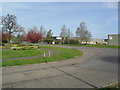
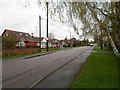
Area Overview for NN3 5AT
Photos of NN3 5AT
Area Information
NN3 5AT is a small, densely populated residential area in England, covering just 1.2 hectares and home to 1,738 residents. Its compact size means it is a tight-knit community, with a high population density of 150,866 people per square kilometre. The area is dominated by houses, reflecting a predominantly owner-occupied demographic, with 62% of residents owning their homes. The median age of 47 suggests a mature population, with the majority aged between 30 and 64. Living here offers proximity to essential services, including retail outlets like Aldi Overstone and Co-op Northampton, as well as transport hubs such as Northampton Railway Station. Digital connectivity is a strong point, with a broadband score of 100, ensuring seamless internet access for remote work or leisure. While the area lacks natural conservation designations, its practical amenities and straightforward infrastructure make it a viable choice for those prioritising convenience over rural landscapes.
- Area Type
- Postcode
- Area Size
- 1.2 hectares
- Population
- 1738
- Population Density
- 3575 people/km²
The property market in NN3 5AT is characterised by a high rate of home ownership (62%) and a focus on houses rather than flats or apartments. This suggests a market skewed towards owner-occupiers seeking long-term investment rather than rental properties. The small area size means housing stock is limited, with no indication of recent development or expansion. Buyers should consider the proximity to key amenities like Northampton Railway Station and nearby retail outlets, which may influence property values. The dominance of houses implies a preference for family-friendly or spacious living, though the high population density suggests properties are likely to be smaller or closely spaced. For those seeking a quiet, established area with minimal new construction, NN3 5AT offers a compact but functional housing landscape.
House Prices in NN3 5AT
Showing 28 properties
| Address | Type | Beds | Baths | Last Sale Price | Last Sale Date | |
|---|---|---|---|---|---|---|
| 11 Foxwell Square, Northampton, NN3 5AT | Terraced | 3 | 1 | £200,000 | Sep 2024 | |
| 10 Foxwell Square, Northampton, NN3 5AT | Terraced | 4 | 1 | £175,000 | Jan 2022 | |
| 6 Foxwell Square, Northampton, NN3 5AT | Terraced | 3 | 1 | £170,000 | Dec 2018 | |
| 18 Foxwell Square, Northampton, NN3 5AT | Terraced | 3 | 1 | £140,000 | Oct 2018 | |
| 5 Foxwell Square, Northampton, NN3 5AT | Terraced | 3 | 1 | £124,000 | Apr 2017 | |
| 1 Foxwell Square, Northampton, NN3 5AT | Terraced | 6 | 1 | £130,000 | Nov 2015 | |
| 17 Foxwell Square, Northampton, NN3 5AT | Terraced | 3 | 2 | £107,000 | Jul 2015 | |
| 8 Foxwell Square, Northampton, NN3 5AT | house | 3 | - | £94,500 | May 2011 | |
| 12 Foxwell Square, Northampton, NN3 5AT | Terraced | 3 | - | £105,000 | May 2008 | |
| 27 Foxwell Square, Northampton, NN3 5AT | Flat | - | - | £79,000 | Jan 2008 |
Energy Efficiency in NN3 5AT
Daily life in NN3 5AT is shaped by its proximity to essential amenities. Retail options include Aldi Overstone and Co-op outlets in Northampton and Moulton, offering groceries and everyday essentials. The area’s transport links, such as the University Bus Interchange and Northampton Railway Station, provide convenient access to broader networks, enabling easy travel to nearby towns or cities. While the area itself is small, its immediate surroundings offer a mix of retail, transport, and potential leisure options. The compact nature of NN3 5AT means residents can reach these services on foot or by short journeys, contributing to a practical, low-maintenance lifestyle. The absence of major parks or leisure facilities within the postcode suggests that residents may need to venture slightly further for recreational activities, though the area’s connectivity mitigates this limitation.
Amenities
Schools
| Rank | School | Type | Entry gender | Ages |
|---|
Explore more schools in this area
Go to Schools tabDemographics
The community in NN3 5AT is predominantly composed of adults aged 30 to 64, with a median age of 47. This suggests a stable population with established careers and family structures. Home ownership is high at 62%, indicating a preference for long-term residency over rental properties. The area is largely composed of houses, which aligns with the demographic profile of older, settled residents. The predominant ethnic group is White, with no specific data provided on other groups. The population density of 150,866 people per square kilometre is exceptionally high, implying limited private space per household. This density may influence local dynamics, such as shared community spaces or reliance on nearby amenities. For prospective buyers, this profile suggests a mature, low-turnover area with a focus on stability and established living.
Household Size
Accommodation Type
Tenure
Ethnic Group
Religion
Household Composition
Age
Household Deprivation
NS-SEC
Explore more demographic insights in this area
Go to Demographics tabPlanning
Planning Constraints
- Flood RiskPremium
- Ramsar Wetland SitesPremium
- Area of Outstanding Natural BeautyPremium
- Protected Nature ReservePremium
- Protected WoodlandPremium