Area Overview for NN3 3QE
Photos of NN3 3QE
Area Information
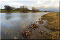
Living in NN3 3QE means inhabiting a tightly knit residential cluster in England, where 1351 people reside across just 4.5 hectares. This density creates a compact, community-focused environment, with homes predominantly in private ownership and a median age of 47 suggesting a mature, stable population. The area’s proximity to Northampton Bus Interchange and Northampton Railway Station ensures easy access to regional transport networks, while nearby shops like Tesco Northampton and Aldi Headlands cater to daily needs. Despite its small size, NN3 3QE balances practicality with convenience, offering a mix of retail, public transport, and low crime rates. However, the critical flood risk score of 59.83 means residents must consider water management and insurance. For those prioritising safety and proximity to amenities, this area provides a focused, manageable living space, though its limited size may restrict expansion or development.
- Area Type
- Postcode
- Area Size
- 4.5 hectares
- Population
- 1351
- Population Density
- 2824 people/km²
The property market in NN3 3QE is dominated by owner-occupied homes, with 88% of residents living in privately owned houses. This contrasts with areas where rental markets dominate, suggesting a focus on long-term residency and family homes. The compact nature of the area, covering just 4.5 hectares, means housing stock is limited, potentially increasing competition for available properties. Buyers should consider the proximity to amenities like Tesco Northampton and Northampton Railway Station, which enhance the area’s appeal. However, the critical flood risk score may affect property values and insurance costs. For those seeking a small, established residential cluster with a mix of retail and transport links, NN3 3QE offers a focused option, though its size may limit future development or expansion opportunities.
House Prices in NN3 3QE
Showing 28 properties
| Address | Type | Beds | Baths | Last Sale Price | Last Sale Date | |
|---|---|---|---|---|---|---|
| 3 Honeysuckle Way, Northampton, NN3 3QE | Detached | 3 | 2 | £365,000 | Sep 2025 | |
| 27 Honeysuckle Way, Northampton, NN3 3QE | Detached | 5 | 4 | £677,500 | Mar 2022 | |
| 22 Honeysuckle Way, Northampton, NN3 3QE | Detached | 5 | 2 | £535,500 | Mar 2019 | |
| 26 Honeysuckle Way, Northampton, NN3 3QE | Detached | 5 | - | £518,000 | Mar 2018 | |
| 16 Honeysuckle Way, Northampton, NN3 3QE | house | - | - | £340,000 | Sep 2017 | |
| 23 Honeysuckle Way, Northampton, NN3 3QE | Detached | 5 | - | £440,000 | Jun 2017 | |
| 17 Honeysuckle Way, Northampton, NN3 3QE | Detached | 4 | 2 | £275,000 | Jan 2015 | |
| 28 Honeysuckle Way, Northampton, NN3 3QE | Detached | 5 | 3 | £410,000 | May 2011 | |
| 20 Honeysuckle Way, Northampton, NN3 3QE | house | - | - | £215,000 | May 2011 | |
| 30 Honeysuckle Way, Northampton, NN3 3QE | house | - | - | £350,000 | Nov 2009 |
Energy Efficiency in NN3 3QE
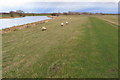
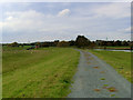
Life in NN3 3QE revolves around its compact retail and transport hubs. Residents have easy access to supermarkets like Tesco Northampton, Aldi Headlands, and Co-op Barry, ensuring daily shopping needs are met within walking or short driving distance. The area’s proximity to Northampton Bus Interchange and University Bus Interchange connects it to broader networks, while Northampton Railway Station offers regional travel options. Although the data does not mention parks or leisure facilities, the presence of multiple retail and transport points suggests a practical, convenience-driven lifestyle. The community’s focus on retail and mobility makes it ideal for those prioritising accessibility over expansive green spaces. However, the area’s small size means residents must balance proximity to amenities with the limitations of a tightly packed environment.
Amenities
Schools
| Rank | School | Type | Entry gender | Ages |
|---|
Explore more schools in this area
Go to Schools tabDemographics
NN3 3QE’s population of 1351 is predominantly composed of adults aged 30–64, with a median age of 47. This suggests a community of established professionals and families, reflected in the 88% home ownership rate, where most residents live in owner-occupied houses. The area’s demographic profile is largely homogenous, with the White ethnic group forming the majority. The high population density of 30,139 people per square kilometre indicates a tightly packed residential cluster, which may influence social dynamics and local services. While the data does not specify deprivation levels, the high home ownership and low crime score (85/100) imply a relatively stable, middle-income environment. However, the absence of protected natural areas or cultural diversity metrics means the community’s character is defined primarily by its residential and commercial infrastructure.
Household Size
Accommodation Type
Tenure
Ethnic Group
Religion
Household Composition
Age
Household Deprivation
NS-SEC
Explore more demographic insights in this area
Go to Demographics tabPlanning
Planning Constraints
- Flood RiskPremium
- Ramsar Wetland SitesPremium
- Area of Outstanding Natural BeautyPremium
- Protected Nature ReservePremium
- Protected WoodlandPremium