Area Overview for NN3 3LZ
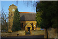
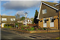
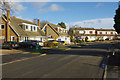
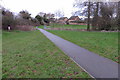
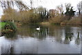
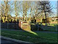
Photos of NN3 3LZ

Area Information
NN3 3LZ is a small, tightly packed residential area in England, covering just 3,000 square metres and home to 1,535 residents. Its high population density — 511,734 people per square kilometre — suggests a compact, community-focused layout. This postcode cluster is characterised by its predominantly owner-occupied housing, with 89% of homes owned by residents. The area’s residents are largely adults aged 30–64, with a median age of 47, indicating a stable, established population. Daily life here is likely shaped by proximity to local amenities and transport links, though the area’s size means it is not sprawling. The presence of nearby retail stores, bus routes, and a railway station suggests a balance between convenience and a sense of place. While the area lacks natural constraints like protected woodlands or wetlands, its safety profile is strong, with a crime risk score of 75. For those seeking a compact, well-connected home with minimal environmental risk, NN3 3LZ offers a focused, practical living environment.
- Area Type
- Postcode
- Area Size
- 3000 m²
- Population
- 1535
- Population Density
- 1690 people/km²
The property market in NN3 3LZ is dominated by owner-occupied homes, with 89% of properties owned by residents. This high rate of home ownership suggests a stable, long-term community rather than a rental-heavy area. The accommodation type is predominantly houses, which is unusual for a small postcode cluster but may reflect a focus on family homes or detached properties. Given the area’s compact size and high population density, the housing stock is likely limited, with limited scope for expansion. For buyers, this means a niche market with few properties available, but the high ownership rate may indicate strong demand. The small area’s immediate surroundings may offer limited alternatives, making NN3 3LZ a specific choice for those prioritising ownership in a tightly knit community.
House Prices in NN3 3LZ
Showing 6 properties
| Address | Type | Beds | Baths | Last Sale Price | Last Sale Date | |
|---|---|---|---|---|---|---|
| 3 Filleigh Way, Northampton, NN3 3LZ | Detached | 4 | 1 | £405,000 | May 2025 | |
| 7 Filleigh Way, Northampton, NN3 3LZ | Detached | 5 | 2 | £415,000 | Aug 2022 | |
| 9 Filleigh Way, Northampton, NN3 3LZ | Detached | 5 | 2 | £435,000 | Mar 2021 | |
| 1 Filleigh Way, Northampton, NN3 3LZ | Detached | 3 | - | £325,000 | Jun 2019 | |
| 11 Filleigh Way, Northampton, NN3 3LZ | Detached | 3 | - | £329,995 | Oct 2018 | |
| 5 Filleigh Way, Northampton, NN3 3LZ | Detached | 4 | - | £265,000 | Dec 2014 |
Energy Efficiency in NN3 3LZ
Living in NN3 3LZ offers access to a range of nearby amenities within practical reach. Retail options include Aldi Headlands, Tesco Northampton, and Co-op Birchfield, providing essential shopping needs. The area’s transport links, including two bus routes and a railway station, connect residents to Northampton and the University Bus Interchange, facilitating access to employment, education, and leisure. While specific parks or leisure facilities are not mentioned, the proximity to major retail hubs and transport networks suggests a lifestyle focused on convenience. The compact nature of the area may mean that residents rely heavily on these nearby services, creating a self-contained but connected community.
Amenities
Schools
| Rank | School | Type | Entry gender | Ages |
|---|
Explore more schools in this area
Go to Schools tabDemographics
The community in NN3 3LZ is predominantly composed of adults aged 30–64, making up the most common age range. The median age of 47 reflects a mature population, suggesting a mix of long-term residents and families. Home ownership is exceptionally high at 89%, indicating a stable, settled demographic. The accommodation type is primarily houses, which aligns with the area’s compact size and residential character. The predominant ethnic group is White, though specific data on diversity or deprivation is not provided. The high home ownership rate and adult population suggest a community focused on long-term living rather than transient rental markets. With no data on deprivation levels, it is unclear how this affects quality of life, but the overall profile points to a cohesive, established neighbourhood.
Household Size
Accommodation Type
Tenure
Ethnic Group
Religion
Household Composition
Age
Household Deprivation
NS-SEC
Explore more demographic insights in this area
Go to Demographics tabPlanning
Planning Constraints
- Flood RiskPremium
- Ramsar Wetland SitesPremium
- Area of Outstanding Natural BeautyPremium
- Protected Nature ReservePremium
- Protected WoodlandPremium