Area Overview for NN3 3AD
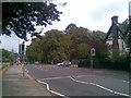
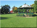
Photos of NN3 3AD


Area Information
NN3 3AD is a compact residential area in England, covering just 4.8 hectares and home to 1535 people. Its high population density of 32,267 people per square kilometre reflects a tightly knit community, where homes are closely spaced and services are within easy reach. The area’s small size means it is ideal for those seeking a quiet, established neighbourhood without the sprawl of larger towns. Daily life here is shaped by its proximity to Northampton’s transport hubs, including the Northampton Bus Interchange and Northampton Railway Station, which provide direct links to the city and beyond. The area’s demographics suggest a mature population, with a median age of 47 and a majority of residents aged 30–64. This makes it a place where stability and long-term residency are common. While the area lacks natural landscapes or protected sites, its practicality and connectivity to urban amenities make it a viable choice for those prioritising convenience and accessibility over rural scenery.
- Area Type
- Postcode
- Area Size
- 4.8 hectares
- Population
- 1535
- Population Density
- 1690 people/km²
The property market in NN3 3AD is characterised by high home ownership, with 89% of residents owning their homes. This suggests a stable market where properties are likely to be long-term investments rather than short-term rental assets. The accommodation type is predominantly houses, which is unusual for areas with high population density. This indicates that the housing stock may consist of smaller, family-friendly homes or terraced properties, rather than larger detached houses. Given the area’s small size, the number of available properties is limited, which could make it competitive for buyers. The high proportion of owner-occupied homes also implies that the area is not a major rental market, reducing the likelihood of short-term lettings or student housing. For buyers, this means the focus is on purchasing a home for long-term use, with potential value retention due to the area’s established nature. However, the limited size of NN3 3AD means that any property search would need to extend to nearby postcode areas for more options.
House Prices in NN3 3AD
Showing 73 properties
| Address | Type | Beds | Baths | Last Sale Price | Last Sale Date | |
|---|---|---|---|---|---|---|
| 30A Abington Park Crescent, Northampton, NN3 3AD | Bungalow | 4 | 2 | £540,000 | Mar 2025 | |
| 25 Abington Park Crescent, Northampton, NN3 3AD | Semi-detached | 6 | 4 | £665,000 | Jul 2024 | |
| 26 Abington Park Crescent, Northampton, NN3 3AD | Semi-detached | 4 | 4 | £580,000 | Dec 2023 | |
| 45 Abington Park Crescent, Northampton, NN3 3AD | Detached | 3 | 2 | £565,000 | Dec 2022 | |
| 11 Abington Park Crescent, Northampton, NN3 3AD | Semi-detached | 4 | 2 | £770,000 | Mar 2022 | |
| Lakehouse, 31 Abington Park Crescent, Northampton, NN3 3AD | house | - | - | £850,000 | Jun 2021 | |
| Abington Rectory, 5 Abington Park Crescent, Northampton, NN3 3AD | Detached | 4 | 1 | £612,012 | Nov 2019 | |
| Treetops, 21 Abington Park Crescent, Northampton, NN3 3AD | Detached | 5 | - | £1,001,252 | Mar 2019 | |
| Simpson House, 18 Abington Park Crescent, Northampton, NN3 3AD | Semi-detached | 6 | 2 | £625,000 | Aug 2018 | |
| 6 Abington Park Crescent, Northampton, NN3 3AD | house | - | - | £650,000 | Aug 2018 |
Energy Efficiency in NN3 3AD
Living in NN3 3AD offers access to a range of practical amenities within close proximity. The area is served by five retail outlets, including Tesco Northampton, Co-op Barry, and Co-op Birchfield, providing essential shopping and grocery needs. These stores are likely to be within walking distance or a short drive, making daily errands efficient. The presence of two bus interchanges and a railway station ensures that residents can easily travel to Northampton’s city centre, nearby towns, or the university campus. While the area lacks dedicated parks or leisure facilities, its proximity to transport hubs and retail centres means that entertainment and recreational options are readily available in the surrounding regions. The compact nature of NN3 3AD means that amenities are concentrated, reducing the need for long commutes. This makes it a practical choice for those who value convenience and accessibility over expansive green spaces.
Amenities
Schools
| Rank | School | Type | Entry gender | Ages |
|---|
Explore more schools in this area
Go to Schools tabDemographics
The community in NN3 3AD is predominantly composed of adults aged 30–64, with a median age of 47. This suggests a population that is largely settled, with fewer young families or elderly residents compared to other areas. Home ownership is exceptionally high at 89%, indicating that most residents own their properties rather than rent. The accommodation type is primarily houses, reflecting a preference for detached or semi-detached homes over flats or apartments. The predominant ethnic group is White, with no specific data provided on other ethnicities. The area’s population density of 32,267 people per square kilometre is among the highest in the country, which means services and amenities are concentrated within a small radius. This density can create a sense of community but may also limit private space. For residents, this translates to easy access to shops, transport, and other facilities, though it also means the area is highly developed with little undeveloped land.
Household Size
Accommodation Type
Tenure
Ethnic Group
Religion
Household Composition
Age
Household Deprivation
NS-SEC
Explore more demographic insights in this area
Go to Demographics tabPlanning
Planning Constraints
- Flood RiskPremium
- Ramsar Wetland SitesPremium
- Area of Outstanding Natural BeautyPremium
- Protected Nature ReservePremium
- Protected WoodlandPremium