Area Overview for NN3 3LH
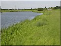
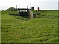
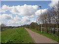
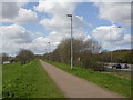
Photos of NN3 3LH
Area Information
Living in NN3 3LH offers a compact, tightly knit residential experience in a small cluster of homes. The area covers just 5,291 square metres, housing 1,330 residents in a densely populated setting. This makes it a highly localised community, where daily life is shaped by proximity to essential services and a strong sense of neighbourliness. The population density of 251,358 people per square kilometre reflects a mature demographic, with a median age of 47 and a majority of residents aged 30–64. This suggests a community of long-term residents, many of whom are likely to be homeowners. The area’s small size means that amenities and services are within easy reach, though its limited footprint also means that the housing stock is focused on individual properties rather than larger developments. For buyers, this presents a mix of stability and intimacy, with homes that cater to a settled, family-oriented population.
- Area Type
- Postcode
- Area Size
- 5291 m²
- Population
- 1330
- Population Density
- 1394 people/km²
The property market in NN3 3LH is characterised by high home ownership (88%) and a focus on individual houses rather than flats or apartments. This suggests a community of long-term residents, many of whom may have lived in the area for decades. The absence of rental properties indicates that the market is not driven by transient populations or student demand. Given the area’s small size, the housing stock is limited, with no indication of new developments or speculative investment. Buyers should expect a mix of traditional homes, likely tailored to family needs. The compact nature of the area means that properties are closely spaced, and the market is likely to be competitive for those seeking a stable, established residence.
House Prices in NN3 3LH
Showing 5 properties
| Address | Type | Beds | Baths | Last Sale Price | Last Sale Date | |
|---|---|---|---|---|---|---|
| 266 Billing Road East, Northampton, NN3 3LH | house | 4 | - | £475,000 | Feb 2023 | |
| 250 Billing Road East, Northampton, NN3 3LH | house | - | - | £280,000 | Oct 2012 | |
| 248 Billing Road East, Northampton, NN3 3LH | Detached | - | - | £245,000 | Oct 2006 | |
| The Chantry, 262 Billing Road East, Northampton, NN3 3LH | Detached | 4 | - | - | - | |
| The Chalet, 264 Billing Road East, Northampton, NN3 3LH | Detached | - | - | - | - |
Energy Efficiency in NN3 3LH
Residents of NN3 3LH enjoy access to a range of amenities within walking or short driving distance. Retail options include major supermarkets such as Tesco Northampton, Co-op Barry, and Sainsburys Wellingborough, ensuring everyday shopping needs are met. The area’s transport links, including the Northampton Bus Interchange and University Bus Interchange, provide convenient access to public transport. While the data does not mention parks or leisure facilities, the proximity to Northampton Railway Station suggests a connection to larger urban amenities. The compact nature of the area means that daily life is centred around these nearby hubs, offering convenience without the need for long commutes. This balance of retail, transport, and connectivity contributes to a practical, self-contained lifestyle.
Amenities
Schools
Residents of NN3 3LH have access to a range of educational institutions, including state and independent schools. Abington Vale Primary School, rated ‘good’ by Ofsted, serves the local primary needs, as does Northampton School for Boys, which has both a primary and academy branch rated ‘good’ and ‘outstanding’ respectively. St Andrew’s College, an independent school, also operates in the area with a ‘good’ Ofsted rating. This mix of school types provides families with options, from state-funded education to private institutions. The presence of an outstanding academy suggests high academic standards in some sectors, though the data does not indicate performance outcomes. For parents, the variety of options may be a key consideration when choosing to live in NN3 3LH.
| Rank | School | Type | Entry gender | Ages |
|---|
Explore more schools in this area
Go to Schools tabDemographics
The community in NN3 3LH is predominantly composed of adults aged 30–64, with a median age of 47. This indicates a mature, established population, likely with strong ties to the area. Home ownership is exceptionally high at 88%, suggesting that most residents are long-term homeowners rather than renters. The accommodation type is exclusively houses, which aligns with the demographic profile of older, family-oriented households. The predominant ethnic group is White, reflecting a homogenous community. While the data does not specify deprivation levels, the high home ownership and stable age profile suggest a relatively stable socioeconomic environment. However, the absence of detailed diversity metrics means the area’s cultural makeup remains largely unexplored in the provided data.
Household Size
Accommodation Type
Tenure
Ethnic Group
Religion
Household Composition
Age
Household Deprivation
NS-SEC
Explore more demographic insights in this area
Go to Demographics tabPlanning
Planning Constraints
- Flood RiskPremium
- Ramsar Wetland SitesPremium
- Area of Outstanding Natural BeautyPremium
- Protected Nature ReservePremium
- Protected WoodlandPremium