Area Overview for NN3 2JF
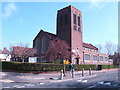
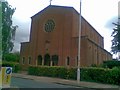
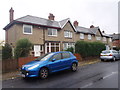
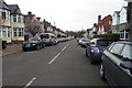
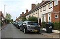
Photos of NN3 2JF
Area Information
NN3 2JF is a small, densely populated residential area in England, spanning just 1.9 hectares and home to 1,595 people. Its compact size means it is a tightly knit community, with a population density of 85,788 people per square kilometre. The area is characterised by a predominance of houses, reflecting its residential focus. With a median age of 47 and a majority of residents aged 30–64, this is a mature community with a strong emphasis on home ownership, where 75% of properties are owner-occupied. Daily life here is shaped by proximity to essential services and transport links, while the area’s small footprint ensures a sense of familiarity among residents. The absence of major environmental constraints or planning restrictions allows for straightforward living, though the high density may mean limited space for expansion. For those seeking a quiet, established neighbourhood with easy access to amenities, NN3 2JF offers a blend of practicality and convenience.
- Area Type
- Postcode
- Area Size
- 1.9 hectares
- Population
- 1595
- Population Density
- 6430 people/km²
The property market in NN3 2JF is dominated by owner-occupied homes, with 75% of properties held by their owners. This suggests a stable, long-term resident base rather than a transient rental market. The area’s accommodation type is primarily houses, which may appeal to families or those seeking more space than flats. Given the small area size and high population density, the housing stock is limited, meaning buyers must consider the immediate surroundings for additional options. The compact nature of NN3 2JF means properties are likely to be in close proximity to each other, with little scope for new development. For those prioritising home ownership in a residential setting, this area offers a straightforward, if limited, selection of houses.
House Prices in NN3 2JF
Showing 49 properties
| Address | Type | Beds | Baths | Last Sale Price | Last Sale Date | |
|---|---|---|---|---|---|---|
| 122 Cedar Road East, Northampton, NN3 2JF | Terraced | 3 | 2 | £304,500 | Aug 2025 | |
| 188 Cedar Road East, Northampton, NN3 2JF | Terraced | 3 | 2 | £295,000 | Nov 2024 | |
| 160 Cedar Road East, Northampton, NN3 2JF | house | - | - | £325,000 | Jan 2022 | |
| 136 Cedar Road East, Northampton, NN3 2JF | house | - | - | £265,000 | Dec 2021 | |
| 140 Cedar Road East, Northampton, NN3 2JF | house | - | - | £250,000 | Sep 2021 | |
| 156 Cedar Road East, Northampton, NN3 2JF | Terraced | 3 | 1 | £275,000 | Mar 2021 | |
| 110 Cedar Road East, Northampton, NN3 2JF | Terraced | 3 | 1 | £272,000 | Feb 2021 | |
| 176 Cedar Road East, Northampton, NN3 2JF | Terraced | 3 | 1 | £220,000 | Dec 2020 | |
| 126 Cedar Road East, Northampton, NN3 2JF | Terraced | 3 | - | £250,000 | Dec 2020 | |
| 113 Cedar Road East, Northampton, NN3 2JF | Terraced | 3 | - | £275,000 | Jun 2020 |
Energy Efficiency in NN3 2JF
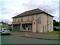
The lifestyle in NN3 2JF is shaped by its proximity to retail, transport, and community hubs. Within practical reach are five retail venues, including Co-op Birchfield, M&S Abington Ave Northampton BP, and Tesco Kingsley, offering everyday shopping needs. The area’s transport links, such as the University Bus Interchange and Northampton Railway Station, provide access to broader networks, enhancing connectivity. While the data does not specify parks or leisure facilities, the presence of multiple retail and transport options suggests a functional, convenience-driven lifestyle. The compact nature of the area means residents can access essentials without long commutes, though the lack of green spaces or recreational amenities may be a consideration for those prioritising outdoor activities.
Amenities
Schools
Residents of NN3 2JF have access to a mix of primary and independent schools. Cedar Road Primary School, rated ‘good’ by Ofsted, provides a state-funded option for younger children, while Weston Favell Preparatory School offers an independent alternative. The presence of both school types gives families flexibility, whether they seek a state education or the resources of an independent institution. The proximity of these schools to the area ensures ease of access for parents and students. With a primary school rated ‘good’ within the immediate vicinity, families can be confident in the quality of local education. However, the absence of secondary schools in the data suggests that older children may need to travel further for secondary education.
| Rank | School | Type | Entry gender | Ages |
|---|
Explore more schools in this area
Go to Schools tabDemographics
The population of NN3 2JF is predominantly adults aged 30–64, with a median age of 47. This suggests a community of middle-aged residents, many of whom may be settled in long-term homes. Home ownership is high at 75%, indicating a stable, owner-occupied demographic. The accommodation type is primarily houses, which aligns with the area’s residential character. The predominant ethnic group is White, reflecting a homogenous population profile. The high population density—85,788 people per square kilometre—suggests a compact, closely packed community where proximity to neighbours is inevitable. While no specific deprivation data is provided, the high home ownership rate and age profile imply a relatively stable economic environment, though the density may contribute to a lack of open space or green areas.
Household Size
Accommodation Type
Tenure
Ethnic Group
Religion
Household Composition
Age
Household Deprivation
NS-SEC
Explore more demographic insights in this area
Go to Demographics tabPlanning
Planning Constraints
- Flood RiskPremium
- Ramsar Wetland SitesPremium
- Area of Outstanding Natural BeautyPremium
- Protected Nature ReservePremium
- Protected WoodlandPremium