Area Overview for NN3 2BZ
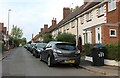
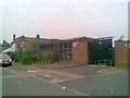
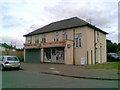
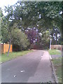
Photos of NN3 2BZ
Area Information
NN3 2BZ is a compact residential postcode area in England, spanning just 1.1 hectares and home to 1,595 residents. Its high population density of 145,221 people per square kilometre reflects a tightly knit community, with most properties clustered closely together. The area’s demographic profile suggests a mature population, with a median age of 47 and the majority of residents aged between 30 and 64. This makes it a stable, family-oriented neighbourhood where many have lived for years. Daily life here is shaped by proximity to essential services and transport links, though the small size means the area is best suited for those prioritising convenience over expansive living space. The mix of homes, predominantly owner-occupied, hints at a community of long-term residents rather than transient renters. While the area lacks natural or protected landscapes, its practical layout and accessibility to nearby amenities make it a viable choice for those seeking a settled, low-maintenance lifestyle.
- Area Type
- Postcode
- Area Size
- 1.1 hectares
- Population
- 1595
- Population Density
- 6430 people/km²
The property market in NN3 2BZ is characterised by a high rate of home ownership, with 75% of properties owner-occupied. This suggests a community of long-term residents rather than a rental-heavy market. The area’s accommodation is predominantly houses, which may appeal to families or individuals seeking private, spacious living. Given the small size of the postcode area, the housing stock is limited, meaning buyers should consider the immediate surrounding areas for more options. The concentration of owner-occupied homes implies that properties here are likely to be well-maintained and stable in value. However, the compact nature of the area means that proximity to amenities and transport is a key selling point. For buyers, the challenge lies in balancing the limited local housing supply with the need for nearby services and connectivity.
House Prices in NN3 2BZ
Showing 40 properties
| Address | Type | Beds | Baths | Last Sale Price | Last Sale Date | |
|---|---|---|---|---|---|---|
| 173 Birchfield Road East, Northampton, NN3 2BZ | house | - | - | £375,000 | Mar 2025 | |
| 215 Birchfield Road East, Northampton, NN3 2BZ | Terraced | 3 | 2 | £297,000 | Mar 2025 | |
| 193 Birchfield Road East, Northampton, NN3 2BZ | Terraced | 4 | 3 | £315,000 | Apr 2024 | |
| 165A Birchfield Road East, Northampton, NN3 2BZ | Detached | 4 | 3 | £445,000 | Aug 2022 | |
| 209 Birchfield Road East, Northampton, NN3 2BZ | house | - | - | £288,000 | Aug 2021 | |
| 205 Birchfield Road East, Northampton, NN3 2BZ | Terraced | 4 | - | £295,000 | Aug 2021 | |
| 203 Birchfield Road East, Northampton, NN3 2BZ | house | - | - | £223,000 | Feb 2021 | |
| 187 Birchfield Road East, Northampton, NN3 2BZ | Terraced | 3 | 1 | £235,000 | Nov 2019 | |
| 163 Birchfield Road East, Northampton, NN3 2BZ | Semi-detached | 5 | 2 | £400,000 | Mar 2019 | |
| 165 Birchfield Road East, Northampton, NN3 2BZ | Semi-detached | 4 | - | £340,000 | Jan 2017 |
Energy Efficiency in NN3 2BZ
Residents of NN3 2BZ have access to a range of nearby amenities within practical reach. Retail options include Co-op Birchfield, M&S Abington Ave Northampton BP, and Tesco Kingsley, offering everyday shopping needs. The area’s bus interchanges and Northampton Railway Station provide convenient transport links, making it easy to reach further destinations. While the data does not mention parks or leisure facilities, the proximity to Northampton—a city with cultural and recreational offerings—suggests that residents can enjoy a broader lifestyle beyond the immediate area. The mix of retail, transport, and connectivity contributes to a practical, convenient lifestyle, though the small postcode area means that larger amenities may require a short journey.
Amenities
Schools
Residents of NN3 2BZ have access to a mix of primary and independent schools. Cedar Road Primary School is listed twice in the data, both times as a primary school, with one entry noting an Ofsted rating of ‘good’. This suggests a reliable local state education option for younger children. Nearby, Weston Favell Preparatory School offers an independent education, catering to families seeking private schooling. The presence of both school types provides flexibility for parents, whether they prioritise affordability and accessibility or seek a more specialised curriculum. For families, the availability of a ‘good’-rated primary school is a significant advantage, as it reduces the need for long commutes to education. However, the lack of secondary school options in the immediate area may require residents to look further afield for comprehensive schooling.
| Rank | School | Type | Entry gender | Ages |
|---|
Explore more schools in this area
Go to Schools tabDemographics
The population of NN3 2BZ is predominantly adults aged 30–64, with a median age of 47. This suggests a community of established professionals and families, many of whom may be in their peak earning years. Home ownership is high at 75%, indicating a strong presence of long-term residents rather than transient renters. The area’s accommodation is largely composed of houses, reflecting a preference for single-family living. The predominant ethnic group is White, though specific data on diversity is not provided. The high population density of 145,221 people per square kilometre means residents live in close proximity, which can foster a sense of community but may also contribute to a feeling of overcrowding. For those considering the area, the demographic profile suggests a mature, stable environment where local amenities and services are likely to cater to the needs of older and middle-aged residents.
Household Size
Accommodation Type
Tenure
Ethnic Group
Religion
Household Composition
Age
Household Deprivation
NS-SEC
Explore more demographic insights in this area
Go to Demographics tabPlanning
Planning Constraints
- Flood RiskPremium
- Ramsar Wetland SitesPremium
- Area of Outstanding Natural BeautyPremium
- Protected Nature ReservePremium
- Protected WoodlandPremium