Area Overview for NN29 7TE
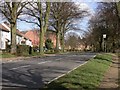
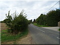
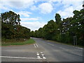
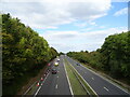
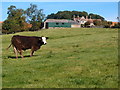
Photos of NN29 7TE


Area Information
Living in NN29 7TE offers a compact, residential experience within a small cluster of homes. The area spans 17.1 hectares and is home to 1,792 residents, creating a close-knit community with a population density of 166 people per square kilometre. The demographic profile suggests a mature population, with a median age of 47 and the majority of residents falling within the 30–64 age range. This indicates a stable, family-oriented environment where homeownership is prevalent, with 84% of properties owned by residents. The area is characterised by houses rather than flats, reflecting a traditional, low-density housing stock. While the postcode is small, it provides access to essential services, including nearby schools and retail outlets, making it a practical choice for those seeking a balanced lifestyle without the pressures of larger urban centres.
- Area Type
- Postcode
- Area Size
- 17.1 hectares
- Population
- 1792
- Population Density
- 166 people/km²
The property market in NN29 7TE is dominated by owner-occupied homes, with 84% of properties owned by their residents. This high rate of homeownership suggests a mature market with limited rental activity, making it more attractive to buyers seeking long-term investment rather than short-term tenancy. The accommodation type is primarily houses, which are typically larger and suited to families or individuals prioritising space and privacy. Given the small size of the postcode area, the housing stock is likely limited, meaning properties may be in high demand. Buyers should consider the area’s proximity to nearby amenities, such as retail and transport links, when evaluating its appeal. The combination of low population density and house-based housing stock creates a market where properties are likely to retain value, though the small size of the area may limit options for those seeking a wider selection of homes.
House Prices in NN29 7TE
Showing 87 properties
| Address | Type | Beds | Baths | Last Sale Price | Last Sale Date | |
|---|---|---|---|---|---|---|
| 102 Glenfield Drive, Great Doddington, NN29 7TE | Detached | 3 | 2 | £438,000 | Feb 2025 | |
| 58 Glenfield Drive, Great Doddington, NN29 7TE | house | 4 | 3 | £835,000 | Aug 2024 | |
| 7 Glenfield Drive, Great Doddington, NN29 7TE | Detached | 4 | 2 | £540,000 | Jul 2024 | |
| 56 Glenfield Drive, Great Doddington, NN29 7TE | house | - | - | £485,000 | Nov 2023 | |
| 22 Glenfield Drive, Great Doddington, NN29 7TE | Retail | 3 | 1 | £440,000 | May 2022 | |
| 59 Glenfield Drive, Great Doddington, NN29 7TE | house | - | - | £500,000 | Aug 2021 | |
| 46 Glenfield Drive, Great Doddington, NN29 7TE | house | - | - | £550,000 | Jun 2021 | |
| 96 Glenfield Drive, Great Doddington, NN29 7TE | Detached | 4 | - | £565,000 | May 2021 | |
| 43 Glenfield Drive, Great Doddington, NN29 7TE | Bungalow | 3 | 1 | £435,000 | May 2021 | |
| 1 Glenfield Drive, Great Doddington, NN29 7TE | house | - | - | £425,500 | Mar 2021 |
Energy Efficiency in NN29 7TE
Residents of NN29 7TE benefit from nearby retail amenities, including Co-op Earls, Budgens Berrymoor, and Sainsburys Wellingborough, which provide access to essential shopping and grocery services. The presence of these stores within practical reach enhances daily convenience, reducing the need for lengthy trips to larger centres. The area is also connected to Wellingborough Railway Station, offering rail access to broader regional networks. While the postcode itself is small, the surrounding area likely includes additional leisure and recreational spaces, though specific details are not provided. The combination of retail options and transport links creates a functional lifestyle, supporting both everyday needs and occasional travel. The compact nature of the area encourages a slower pace of life, with a focus on local amenities and community engagement.
Amenities
Schools
Residents of NN29 7TE have access to two primary schools within practical reach: Great Doddington Primary and Wilby Church of England Primary School. Both institutions hold a satisfactory Ofsted rating, indicating they meet basic standards but lack outstanding performance. The presence of two primary schools provides families with options, though the absence of secondary schools in the immediate area may require commuting to nearby towns. The mix of school types suggests a focus on early education, which is typical for smaller, residential communities. For parents prioritising local schooling, the availability of two primary schools is a practical advantage, though further research into secondary education options would be necessary for families with older children.
| Rank | School | Type | Entry gender | Ages |
|---|
Explore more schools in this area
Go to Schools tabDemographics
The community in NN29 7TE is predominantly composed of adults aged 30–64, with a median age of 47. This suggests a population skewed towards middle-aged individuals, likely including families and long-term residents. Homeownership is high, with 84% of properties owned by their occupants, indicating a stable and settled community. The area is largely composed of houses, which aligns with the demographic profile of older, established households. The predominant ethnic group is White, though specific data on diversity or deprivation is not provided. The population density of 166 people per square kilometre suggests a low-pressure environment, where residents have access to space without the congestion of denser urban areas. This combination of age profile, homeownership, and housing type points to a community that values stability and long-term residency.
Household Size
Accommodation Type
Tenure
Ethnic Group
Religion
Household Composition
Age
Household Deprivation
NS-SEC
Explore more demographic insights in this area
Go to Demographics tabPlanning
Planning Constraints
- Flood RiskPremium
- Ramsar Wetland SitesPremium
- Area of Outstanding Natural BeautyPremium
- Protected Nature ReservePremium
- Protected WoodlandPremium