Area Overview for NN29 7RN
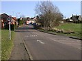
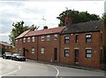
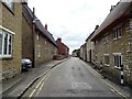
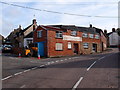
Photos of NN29 7RN


Area Information
NN29 7RN is a compact residential postcode in England, covering 5,817 square metres and home to 1,641 residents. With a population density of 609 people per square kilometre, it’s a tightly knit area where community ties are likely strong. The area is predominantly occupied by adults aged 30–64, reflecting a mature demographic with a median age of 47. This suggests a stable, established community, with 86% of residents owning their homes. The housing stock is largely composed of houses, not flats, which may appeal to those seeking traditional family homes. Daily life here is likely characterised by proximity to local amenities, with nearby shops, schools, and transport links. The area’s small size means it’s easy to navigate, and its low crime risk and absence of environmental constraints make it a practical choice for buyers seeking a balance between convenience and safety. Living in NN29 7RN offers a quiet, residential environment with straightforward access to essentials, making it suitable for families or professionals looking for a settled lifestyle.
- Area Type
- Postcode
- Area Size
- 5817 m²
- Population
- 1641
- Population Density
- 609 people/km²
The property market in NN29 7RN is heavily skewed towards owner-occupation, with 86% of homes owned by their residents. This suggests a stable, long-term market with limited rental activity, which may indicate lower demand for short-term lets. The accommodation type is predominantly houses, not flats, which aligns with the area’s character as a residential cluster rather than a high-density development. For buyers, this means the housing stock is likely traditional, with larger properties suited to families or individuals seeking more space. The small size of the area—just 5,817 square metres—means the immediate surroundings may offer limited property choices, but the high home ownership rate suggests a consistent supply of homes for sale. Buyers should consider the area’s compact nature, which may limit expansion but ensures proximity to amenities like schools and shops.
House Prices in NN29 7RN
Showing 7 properties
| Address | Type | Beds | Baths | Last Sale Price | Last Sale Date | |
|---|---|---|---|---|---|---|
| 4-6 Bell End, Wollaston, NN29 7RN | Cottage | 3 | 1 | £245,000 | Aug 2020 | |
| 15 Bell End, Wollaston, NN29 7RN | Detached | 2 | 1 | £233,000 | Apr 2020 | |
| 2 Bell End, Wollaston, NN29 7RN | Cottage | 2 | 1 | £176,500 | Feb 2016 | |
| 10 Bell End, Wollaston, NN29 7RN | Cottage | 4 | 1 | £180,000 | Apr 2014 | |
| 8 Bell End, Wollaston, NN29 7RN | Detached | - | - | £150,000 | Aug 2002 | |
| 12-14 Bell End, Wollaston, NN29 7RN | Cottage | 4 | 3 | £37,000 | Jan 1996 | |
| 16 Bell End, Wollaston, NN29 7RN | Detached | - | - | - | - |
Energy Efficiency in NN29 7RN
The lifestyle in NN29 7RN is supported by a range of nearby amenities, including five retail outlets such as Co-op Wollaston, Co-op Irchester, and Tesco Wellingborough. These shops provide essential services, from grocery shopping to local services, enhancing daily convenience. The Wellingborough Railway Station adds accessibility, allowing residents to travel to larger towns for additional leisure or work opportunities. While the area lacks detailed data on parks or leisure facilities, the presence of multiple retail options and rail links suggests a practical, community-focused environment. The compact nature of the postcode means most amenities are within a short distance, reducing the need for long commutes. This combination of local shops and transport links fosters a self-sufficient lifestyle, ideal for those valuing convenience and accessibility.
Amenities
Schools
Residents of NN29 7RN have access to Wollaston School, which operates as both a primary school and an academy with a ‘good’ Ofsted rating. This dual presence offers families a range of educational options, from early years schooling to secondary-level provision. The academy’s ‘good’ rating suggests a reliable standard of education, though specific details on curriculum or performance are not provided. The proximity of these schools within the area makes it an attractive choice for families prioritising convenience. The absence of other schools in the data means the local education landscape is focused on these two institutions, which may be sufficient for primary and secondary needs. Parents should consider whether the school’s offerings align with their children’s requirements, particularly given the area’s mature demographic.
| Rank | School | Type | Entry gender | Ages |
|---|
Explore more schools in this area
Go to Schools tabDemographics
The community in NN29 7RN is defined by its adult population, with 86% of residents owning their homes. The median age of 47 and the dominant age range of 30–64 years suggest a mature, stable demographic, likely with established careers and families. The area is predominantly White, with no specific data on other ethnic groups provided. Home ownership is exceptionally high, indicating a long-term presence of residents rather than a transient population. The absence of data on deprivation means the area’s socioeconomic profile remains largely unexplored, but the high home ownership rate and age distribution imply a relatively affluent, settled community. This demographic structure may influence local services and amenities, tailored to the needs of older adults and families. The lack of diversity data should not be interpreted as a lack of diversity itself, but as a gap in the available information.
Household Size
Accommodation Type
Tenure
Ethnic Group
Religion
Household Composition
Age
Household Deprivation
NS-SEC
Explore more demographic insights in this area
Go to Demographics tabPlanning
Planning Constraints
- Flood RiskPremium
- Ramsar Wetland SitesPremium
- Area of Outstanding Natural BeautyPremium
- Protected Nature ReservePremium
- Protected WoodlandPremium