Area Overview for NN29 7RD
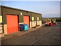
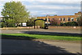
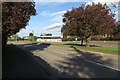
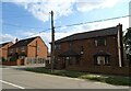
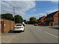
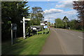
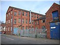
Photos of NN29 7RD
Area Information
NN29 7RD is a small, residential postcode area in England, covering 7,597 square metres and home to 2,474 residents. Its low population density of 124 people per square kilometre suggests a quiet, spread-out community, likely with larger properties and open spaces. This area is distinct for its mix of older and newer housing stock, catering to a predominantly adult population. Daily life here is shaped by proximity to local amenities, including shops and a railway station, while the surrounding landscape appears to offer a balance of residential comfort and practical connectivity. The area’s character is defined by its modest scale, with no major urban hubs nearby, making it suitable for those seeking a peaceful yet accessible environment. With a median age of 47 and a strong presence of households in the 30-64 age range, the community is likely stable and family-oriented. The absence of environmental constraints such as protected woodlands or AONB designations means development and living here is straightforward, though the area’s small size means residents may need to travel further for specialist services.
- Area Type
- Postcode
- Area Size
- 7597 m²
- Population
- 2474
- Population Density
- 124 people/km²
The property market in NN29 7RD is characterised by a high rate of home ownership (63%) and a predominance of houses over flats or apartments. This suggests a community of owner-occupiers rather than a rental-heavy market, which may appeal to those seeking long-term stability. The area’s small size means the housing stock is limited, likely comprising a mix of older and newer properties. Given the high proportion of houses, buyers should expect larger plots and potentially more private outdoor space compared to high-density areas. However, the small scale of the postcode means the immediate surroundings may offer limited variety in property types. For buyers, this could present both opportunities and challenges: the area is likely to have a cohesive architectural style, but the lack of a large inventory may require a broader search beyond NN29 7RD itself.
House Prices in NN29 7RD
Showing 15 properties
| Address | Type | Beds | Baths | Last Sale Price | Last Sale Date | |
|---|---|---|---|---|---|---|
| 3 Stone Close, Wollaston, NN29 7RD | Terraced | 3 | 1 | £250,000 | Oct 2023 | |
| 10 Stone Close, Wollaston, NN29 7RD | Semi-detached | 3 | 1 | £236,000 | Nov 2018 | |
| 16 Stone Close, Wollaston, NN29 7RD | Semi-detached | 2 | 1 | £155,600 | Dec 2015 | |
| 2A Stone Close, Wollaston, NN29 7RD | Detached | 3 | 2 | £165,000 | Jun 2015 | |
| 6 Stone Close, Wollaston, NN29 7RD | Semi-detached | - | - | £123,500 | Mar 2005 | |
| 8 Stone Close, Wollaston, NN29 7RD | Semi-detached | - | - | £89,000 | Mar 2002 | |
| 7 Stone Close, Wollaston, NN29 7RD | house | - | - | - | - | |
| 14 Stone Close, Wollaston, NN29 7RD | house | - | - | - | - | |
| 12 Stone Close, Wollaston, NN29 7RD | house | - | - | - | - | |
| 2 Stone Close, Wollaston, NN29 7RD | Semi-detached | 3 | 1 | - | - |
Energy Efficiency in NN29 7RD
Daily life in NN29 7RD is shaped by its proximity to retail and transport hubs. The area has five retail outlets within reach, including Co-op Wollaston, Co-op Irchester, and Tesco Wellingborough, providing access to groceries and everyday essentials. The Wellingborough Railway Station offers connections to broader transport networks, facilitating travel to nearby towns. While the data does not mention parks or leisure facilities, the absence of environmental constraints like protected woodlands suggests open spaces may be available locally. The combination of shops and rail access creates a convenient lifestyle, though residents may need to travel further for specialist services or entertainment. The area’s modest scale means it is likely to have a close-knit feel, with local amenities serving the community directly.
Amenities
Schools
Residents of NN29 7RD have access to three primary schools within practical reach. Wollaston Community Primary School and Wollaston Primary School both offer primary education, while Grendon Church of England Primary School is also nearby and holds an Ofsted rating of ‘good’. The presence of multiple primary schools provides families with options, though no secondary schools are listed in the data. This suggests that parents may need to consider commuting for secondary education, which could be a factor for families with older children. The ‘good’ rating at Grendon Church of England Primary School indicates a reliable standard of education, though the absence of detailed performance metrics or catchment area information means prospective residents should verify school admissions policies separately.
| Rank | School | Type | Entry gender | Ages |
|---|
Explore more schools in this area
Go to Schools tabDemographics
The population of NN29 7RD is 2,474, with a median age of 47. This indicates a mature demographic, with the majority of residents falling within the 30-64 age range. Home ownership is high at 63%, suggesting a community of long-term residents rather than transient renters. The accommodation type is predominantly houses, which aligns with the area’s low population density and likely suburban or semi-rural setting. The predominant ethnic group is White, though no specific data on diversity or deprivation is provided. The age profile implies a population with established careers and family commitments, which may influence local services and amenities. With no mention of deprivation levels, it is reasonable to assume the area supports a baseline quality of life, though further data would be needed to confirm this. The demographic stability also suggests a consistent demand for housing, with limited turnover in property ownership.
Household Size
Accommodation Type
Tenure
Ethnic Group
Religion
Household Composition
Age
Household Deprivation
NS-SEC
Explore more demographic insights in this area
Go to Demographics tabPlanning
Planning Constraints
- Flood RiskPremium
- Ramsar Wetland SitesPremium
- Area of Outstanding Natural BeautyPremium
- Protected Nature ReservePremium
- Protected WoodlandPremium