Area Overview for NN29 7RB
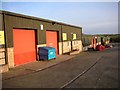
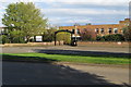
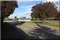
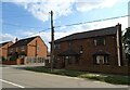
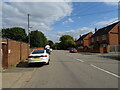
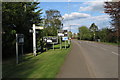
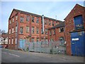
Photos of NN29 7RB
Area Information
Living in NN29 7RB offers a quiet, compact residential experience in a small cluster of homes. With a population of 2,474 spread over 1.6 hectares, the area maintains a low density of 124 people per square kilometre, fostering a close-knit community feel. This postcode is ideal for those seeking a peaceful environment without sacrificing proximity to essential services. Residents benefit from nearby schools, a railway station, and local shops, ensuring daily needs are met within easy reach. The area’s low crime risk and absence of environmental constraints like protected woodlands or AONB designations make it a practical choice for families and professionals. While the housing stock is limited to a small number of properties, the area’s charm lies in its simplicity—fewer traffic concerns, a slower pace of life, and a focus on local amenities. For buyers prioritising safety, convenience, and a manageable community size, NN29 7RB presents a straightforward option. Its small footprint means it is best suited for those content with a modest, self-contained living environment rather than sprawling developments.
- Area Type
- Postcode
- Area Size
- 1.6 hectares
- Population
- 2474
- Population Density
- 124 people/km²
The property market in NN29 7RB is characterised by a high rate of home ownership (63%) and a focus on detached or semi-detached houses. Given the area’s small size—just 1.6 hectares—there is limited housing stock, which means the market is unlikely to be highly competitive. The absence of flats or apartments suggests a preference for traditional family homes, which may appeal to buyers seeking space and privacy. However, the small footprint of the area means that property options are confined to the immediate postcode, with little scope for expansion into surrounding zones. For buyers, this implies that availability is likely to be limited, and those interested may need to consider nearby areas for more choices. The high home ownership rate also indicates a stable market with fewer rental properties, which could be advantageous for long-term investment but less so for those seeking short-term lettings.
House Prices in NN29 7RB
No properties found in this postcode.
Energy Efficiency in NN29 7RB
The lifestyle in NN29 7RB is shaped by its proximity to local retail and transport hubs. Residents can access Co-op Wollaston, Co-op Irchester, and Tesco Wellingborough, providing a range of grocery and everyday shopping options. The Wellingborough Railway Station offers direct connections to nearby towns, making it easier to access larger urban centres for work or leisure. While the area lacks dedicated parks or leisure facilities, the low population density suggests open spaces may be available within the surrounding countryside. The presence of three primary schools and a low crime risk adds to the area’s appeal for families, though the limited housing stock means amenities are tailored to a small, localised community. This combination of practical retail, transport links, and safety creates a lifestyle that prioritises convenience over expansive leisure opportunities.
Amenities
Schools
Residents of NN29 7RB have access to three primary schools within practical reach. Wollaston Community Primary School and Wollaston Primary School both serve the area, while Grendon Church of England Primary School holds an Ofsted rating of ‘good’. The presence of multiple primary schools ensures that families have options, though the absence of secondary schools means parents may need to look further afield for secondary education. The ‘good’ rating at Grendon Church of England Primary School suggests a reliable standard of teaching, which is a key consideration for families prioritising education. However, the lack of diversity in school types—only primary schools are listed—means the area does not cater to older children, which could be a limitation for growing families.
| Rank | School | Type | Entry gender | Ages |
|---|---|---|---|---|
| 1 | Wollaston Community Primary School | primary | N/A | N/A |
| 2 | Grendon Church of England Primary School | primary | N/A | N/A |
| 3 | Wollaston Primary School | primary | N/A | N/A |
Explore more schools in this area
Go to Schools tabDemographics
The population of NN29 7RB is predominantly adults aged 30–64, with a median age of 47. This suggests a mature, stable community where many residents are likely to be in their peak earning years or retired. Home ownership is high at 63%, indicating a strong presence of long-term residents rather than transient renters. The accommodation type is exclusively houses, reflecting a lack of flats or apartments, which aligns with the area’s low density. The predominant ethnic group is White, which shapes the cultural and social dynamics of the neighbourhood. With no data on deprivation levels, it is reasonable to infer that the area’s safety profile—low crime risk—and access to basic amenities contribute to a quality of life that supports this demographic. The absence of younger families or students may mean fewer childcare facilities, but the presence of three primary schools suggests the area is family-friendly for those with children.
Household Size
Accommodation Type
Tenure
Ethnic Group
Religion
Household Composition
Age
Household Deprivation
NS-SEC
Explore more demographic insights in this area
Go to Demographics tabPlanning
Planning Constraints
- Flood RiskPremium
- Ramsar Wetland SitesPremium
- Area of Outstanding Natural BeautyPremium
- Protected Nature ReservePremium
- Protected WoodlandPremium
- Crime RiskPremium