Area Overview for NN29 7QT
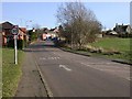
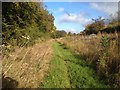
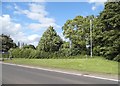
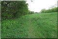
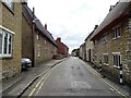
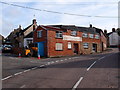
Photos of NN29 7QT


Area Information
NN29 7QT is a small, tightly knit residential area in England, covering 5,532 square metres and home to 2,474 residents. With a population density of 124 people per square kilometre, it strikes a balance between suburban tranquillity and accessible amenities. The area’s character is defined by its modest size and the presence of family-oriented infrastructure. Daily life here is shaped by its proximity to essential services, including three primary schools and a railway station in nearby Wellingborough. The community is predominantly composed of adults aged 30–64, reflecting a mature, stable demographic. While the area lacks large-scale commercial hubs, its compact nature ensures that residents can reach key services within a short distance. The low crime risk and absence of environmental constraints make it a practical choice for those seeking a secure, low-maintenance lifestyle. For buyers, NN29 7QT offers a blend of affordability and convenience, though its limited size means careful consideration of nearby areas may be necessary for expanded options.
- Area Type
- Postcode
- Area Size
- 5532 m²
- Population
- 2474
- Population Density
- 124 people/km²
NN29 7QT is primarily an owner-occupied area, with 63% of homes owned by residents rather than rented. The accommodation type is predominantly houses, which is typical for areas with a mature demographic and lower population density. This suggests a focus on family homes and long-term investment rather than high turnover or rental-focused developments. The small size of the area means the housing stock is limited, and buyers may need to consider nearby regions for more options. The presence of houses rather than flats or apartments indicates a preference for private, spacious living. For those seeking a property here, the market is likely to be stable, with fewer speculative pressures compared to larger urban areas. However, the compact nature of NN29 7QT means that proximity to amenities and transport links is a key consideration for potential buyers.
House Prices in NN29 7QT
Showing 22 properties
| Address | Type | Beds | Baths | Last Sale Price | Last Sale Date | |
|---|---|---|---|---|---|---|
| 4 Hinwick Road, Wollaston, NN29 7QT | Cottage | 3 | 1 | £315,000 | Aug 2024 | |
| 50 Hinwick Road, Wollaston, NN29 7QT | house | - | - | £210,000 | Jul 2022 | |
| 32 Hinwick Road, Wollaston, NN29 7QT | Terraced | 2 | 1 | £177,000 | May 2018 | |
| 6 Hinwick Road, Wollaston, NN29 7QT | Cottage | 3 | 3 | £320,000 | Jun 2017 | |
| 10 Hinwick Road, Wollaston, NN29 7QT | house | - | - | £145,000 | Feb 2017 | |
| 34 Hinwick Road, Wollaston, NN29 7QT | house | - | - | £90,000 | Mar 2015 | |
| 40 Hinwick Road, Wollaston, NN29 7QT | house | 2 | - | £142,000 | Dec 2014 | |
| 42 Hinwick Road, Wollaston, NN29 7QT | Terraced | 2 | - | £122,500 | Jul 2014 | |
| 60 Hinwick Road, Wollaston, NN29 7QT | Detached | 3 | - | £250,000 | Sep 2012 | |
| 52 Hinwick Road, Wollaston, NN29 7QT | house | - | - | £122,500 | Jul 2010 |
Energy Efficiency in NN29 7QT
The lifestyle in NN29 7QT is shaped by its proximity to essential amenities. Retail options include Co-op Wollaston, Co-op Irchester, and Tesco Wellingborough, providing access to groceries and everyday necessities. The Wellingborough Railway Station adds convenience for commuting or travel beyond the immediate area. While the data does not specify dining or leisure venues, the presence of multiple retail outlets and transport links suggests a functional, community-oriented environment. The area’s compact size means residents can access services without long journeys, fostering a self-contained lifestyle. The lack of detailed information on parks or leisure facilities implies a focus on practicality over large-scale recreation, though nearby towns may offer additional options. For those valuing convenience over expansive amenities, NN29 7QT delivers a straightforward, low-effort daily routine.
Amenities
Schools
Residents of NN29 7QT have access to three primary schools within practical reach. Wollaston Community Primary School and Wollaston Primary School both serve the area, though specific Ofsted ratings are not provided for the former. Grendon Church of England Primary School holds a ‘good’ Ofsted rating, indicating a reliable standard of education. The presence of multiple primary schools offers families choice and flexibility, particularly for those prioritising quality schooling. The concentration of primary schools suggests a community-focused approach to education, with local needs clearly addressed. While no secondary schools are listed, the proximity to Wellingborough may provide additional options for older students. The mix of school types ensures coverage for different educational preferences, though parents should verify specific details for admissions and curriculum.
| Rank | School | Type | Entry gender | Ages |
|---|
Explore more schools in this area
Go to Schools tabDemographics
The population of NN29 7QT is 2,474, with a median age of 47 and the majority of residents falling within the 30–64 age range. This suggests a community of established professionals and families, rather than a transient or student population. Home ownership is high at 63%, indicating a strong presence of owner-occupied properties. The area is predominantly composed of houses, which aligns with the demographic profile of older, settled residents. The predominant ethnic group is White, reflecting a homogenous community. While no specific data on deprivation is provided, the low crime risk and absence of environmental constraints suggest a relatively stable quality of life. The age profile and ownership figures imply a focus on long-term residency rather than rental turnover, creating a consistent, community-driven environment.
Household Size
Accommodation Type
Tenure
Ethnic Group
Religion
Household Composition
Age
Household Deprivation
NS-SEC
Explore more demographic insights in this area
Go to Demographics tabPlanning
Planning Constraints
- Flood RiskPremium
- Ramsar Wetland SitesPremium
- Area of Outstanding Natural BeautyPremium
- Protected Nature ReservePremium
- Protected WoodlandPremium