Area Overview for NN29 7QS
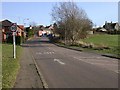
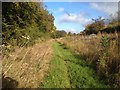
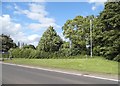
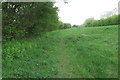
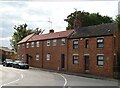
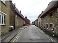
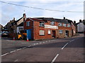
Photos of NN29 7QS

Area Information
NN29 7QS is a small, residential postcode area in England covering 24.8 hectares, home to 2474 people. Its compact size means it is a tightly knit community, with a population density of 124 people per square kilometre. The area is characterised by a mature demographic, with a median age of 47 and the majority of residents falling within the 30-64 age range. This suggests a stable, family-oriented environment where many residents are likely to be established professionals or long-term locals. The area’s housing stock is predominantly composed of houses, with 63% of properties owner-occupied, indicating a strong sense of community and long-term residency. Living here offers proximity to essential services, including primary schools, retail outlets, and a railway station, making it practical for daily life. The area’s small footprint means it is well-suited for those seeking a quiet, manageable space without the sprawl of larger towns, though its limited size may restrict expansion. For buyers, NN29 7QS presents a blend of stability, practicality, and accessibility, ideal for those prioritising a balanced lifestyle.
- Area Type
- Postcode
- Area Size
- 24.8 hectares
- Population
- 2474
- Population Density
- 124 people/km²
The property market in NN29 7QS is defined by a high rate of home ownership (63%) and a focus on houses rather than flats or apartments. This suggests a community where long-term residency is common, with properties likely to be family homes or larger residences. The small area size means the housing stock is limited, which could make the market competitive for buyers seeking properties in this specific postcode. The predominance of houses may appeal to those prioritising space and privacy, though the limited number of properties could restrict options for buyers. Proximity to amenities such as schools, retail, and a railway station adds to the area’s practicality, making it attractive for families or professionals requiring easy access to services. However, the small scale of the area means that buyers should consider the broader surrounding regions for additional choices.
House Prices in NN29 7QS
Showing 50 properties
| Address | Type | Beds | Baths | Last Sale Price | Last Sale Date | |
|---|---|---|---|---|---|---|
| 181 London Road, Wollaston, NN29 7QS | Detached | 4 | 2 | £365,000 | Sep 2025 | |
| 169 London Road, Wollaston, NN29 7QS | Terraced | 3 | 2 | £299,995 | Aug 2025 | |
| 80 London Road, Wollaston, NN29 7QS | Semi-detached | 3 | 2 | £215,000 | Apr 2025 | |
| 177 London Road, Wollaston, NN29 7QS | house | 3 | 2 | £321,000 | Feb 2025 | |
| 86 London Road, Wollaston, NN29 7QS | house | - | - | £595,000 | Jan 2025 | |
| 102 London Road, Wollaston, NN29 7QS | Cottage | 4 | 2 | £500,000 | Sep 2024 | |
| 92 London Road, Wollaston, NN29 7QS | house | - | - | £925,000 | Oct 2023 | |
| 82 London Road, Wollaston, NN29 7QS | Semi-detached | 3 | 2 | £217,500 | Aug 2023 | |
| 180 London Road, Wollaston, NN29 7QS | Detached | 3 | 1 | £545,000 | May 2023 | |
| 167 London Road, Wollaston, NN29 7QS | Terraced | 3 | 2 | £317,500 | Aug 2022 |
Energy Efficiency in NN29 7QS
The lifestyle in NN29 7QS is shaped by its proximity to essential amenities. Retail options include Co-op Wollaston, Co-op Irchester, and Tesco Wellingborough, offering everyday shopping needs within easy reach. The Wellingborough Railway Station provides access to broader transport networks, facilitating travel to nearby towns. While the area lacks detailed information on dining or leisure venues, the presence of multiple retail outlets and a railway station suggests a practical, service-oriented environment. The compact size of the area means that residents can access these amenities without long commutes, contributing to a convenient daily life. However, the absence of named parks or recreational spaces indicates that outdoor leisure may require venturing slightly beyond the immediate postcode.
Amenities
Schools
Residents of NN29 7QS have access to three primary schools within practical reach. Wollaston Community Primary School and Wollaston Primary School both serve the area, though no Ofsted ratings are specified for either. Grendon Church of England Primary School is rated 'good' by Ofsted, offering a benchmark of quality for local education. The presence of multiple primary schools provides families with options, though the lack of secondary schools or further education institutions in the immediate vicinity may require commuting. The mix of school types, including a Church of England school, reflects a range of educational approaches. For parents, the availability of at least one well-rated primary school is a significant advantage, though broader schooling needs would need to be addressed through nearby towns.
| Rank | School | Type | Entry gender | Ages |
|---|
Explore more schools in this area
Go to Schools tabDemographics
The community in NN29 7QS is predominantly composed of adults aged 30-64, with a median age of 47. This suggests a mature population, likely with established careers and family commitments. Home ownership is high at 63%, reflecting a mix of long-term residents and those who have purchased properties in the area. The accommodation type is primarily houses, which aligns with the demographic profile of older, settled households. The predominant ethnic group is White, though no specific data on diversity or deprivation is provided. The age range and home ownership figures indicate a stable, low-turnover community, where residents are likely to have formed lasting social ties. The absence of significant rental properties suggests a focus on owner-occupation, which may contribute to a cohesive, familiar neighbourhood environment.
Household Size
Accommodation Type
Tenure
Ethnic Group
Religion
Household Composition
Age
Household Deprivation
NS-SEC
Explore more demographic insights in this area
Go to Demographics tabPlanning
Planning Constraints
- Flood RiskPremium
- Ramsar Wetland SitesPremium
- Area of Outstanding Natural BeautyPremium
- Protected Nature ReservePremium
- Protected WoodlandPremium