Area Overview for NN29 7LN
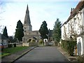
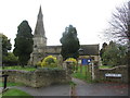
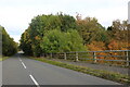
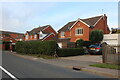
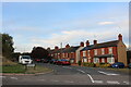
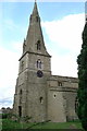
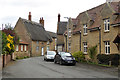
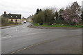
Photos of NN29 7LN

Area Information
NN29 7LN is a small, tightly knit residential area in England, covering just 2271 square metres and home to 2166 residents. With a population density of 122 people per square kilometre, it’s a quiet, low-rise neighbourhood where most properties are houses rather than flats. The area skews older, with a median age of 47 and a majority of residents aged between 30 and 64. This suggests a stable, family-oriented community, with many households likely to have children or be in their prime working years. The presence of Bozeat Community Primary School, rated good by Ofsted, adds to the appeal for families. Daily life here is characterised by proximity to local shops, a railway station, and a low crime rate. The area’s compact size means most amenities are within walking distance, while the broadband score of 97 ensures reliable internet for remote work or entertainment. It’s a place where convenience and safety are prioritised, with minimal environmental constraints.
- Area Type
- Postcode
- Area Size
- 2271 m²
- Population
- 2166
- Population Density
- 122 people/km²
NN29 7LN is a predominantly owner-occupied area, with 77% of properties owned by residents rather than rented. The housing stock is largely composed of houses, which is unusual for a small postcode area but may indicate a mix of detached and semi-detached homes. This suggests a market where properties are likely to be family homes, with limited turnover. The compact size of the area means the housing stock is finite, which could make it a competitive market for buyers. However, the high home ownership rate implies a stable demand, with fewer rental properties available. For buyers, this means a focus on purchasing rather than renting, and the need to consider the specific character of each home. The absence of flats or apartments may appeal to those seeking traditional housing, though it limits options for those preferring urban living.
House Prices in NN29 7LN
Showing 7 properties
| Address | Type | Beds | Baths | Last Sale Price | Last Sale Date | |
|---|---|---|---|---|---|---|
| 1 Puddingbag Lane, Bozeat, NN29 7LN | Semi-detached | 3 | 2 | £420,000 | Jul 2023 | |
| 7 Puddingbag Lane, Bozeat, NN29 7LN | house | - | - | £180,000 | Feb 2023 | |
| 8 Puddingbag Lane, Bozeat, NN29 7LN | Terraced | 2 | - | £175,095 | Feb 2020 | |
| 6 Puddingbag Lane, Bozeat, NN29 7LN | Terraced | 1 | - | £130,000 | Mar 2016 | |
| 4 Puddingbag Lane, Bozeat, NN29 7LN | Detached | 4 | 1 | £102,000 | Jun 1998 | |
| 5 Puddingbag Lane, Bozeat, NN29 7LN | Terraced | - | - | - | - | |
| 9 Puddingbag Lane, Bozeat, NN29 7LN | Terraced | - | - | - | - |
Energy Efficiency in NN29 7LN
The lifestyle in NN29 7LN is shaped by its proximity to essential amenities. Within practical reach are five retail outlets, including Co-op Wollaston, Co-op Harrold, and Aldi 1 Worcester Way, providing everyday shopping convenience. These stores offer a range of goods, from groceries to household items, reducing the need for long journeys. The Wellingborough Railway Station adds to the area’s accessibility, allowing residents to commute to larger towns or cities for work or leisure. While the data does not mention parks or leisure facilities, the low population density and absence of planning constraints suggest space for outdoor activities. The combination of local shops and transport links creates a self-contained yet connected lifestyle, ideal for those valuing convenience without sacrificing access to broader opportunities.
Amenities
Schools
The nearest school to NN29 7LN is Bozeat Community Primary School, which serves the local area and is rated good by Ofsted. This primary school is the only educational institution listed in the data, suggesting that secondary education options may be located further afield. The presence of a good-rated primary school is a significant draw for families, as it provides a reliable foundation for early education. The school’s proximity to the area means parents can easily access it for drop-offs and pickups, reducing commuting time. While the data does not mention secondary schools, the primary school’s quality may indicate a broader commitment to education in the region. For families, this is a key factor in deciding whether NN29 7LN is a suitable place to live.
| Rank | School | Type | Entry gender | Ages |
|---|
Explore more schools in this area
Go to Schools tabDemographics
The population of NN29 7LN is 2166, with a median age of 47, indicating a mature demographic. The majority of residents are adults aged 30 to 64, suggesting a community of long-term residents and families. Home ownership is high at 77%, with houses being the predominant type of accommodation. This reflects a settled population with a strong sense of place. The area’s ethnic composition is predominantly White, though specific diversity statistics are not provided. The low population density of 122 people per square kilometre means the area feels spacious despite its small size. This demographic profile implies a community focused on stability, with fewer transient residents. The age range also suggests a balance between active professionals and retirees, contributing to a diverse but cohesive social fabric.
Household Size
Accommodation Type
Tenure
Ethnic Group
Religion
Household Composition
Age
Household Deprivation
NS-SEC
Explore more demographic insights in this area
Go to Demographics tabPlanning
Planning Constraints
- Flood RiskPremium
- Ramsar Wetland SitesPremium
- Area of Outstanding Natural BeautyPremium
- Protected Nature ReservePremium
- Protected WoodlandPremium