Area Overview for NN29 7LL
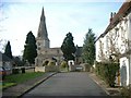
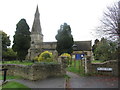
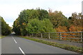
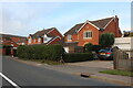
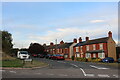
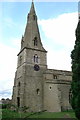
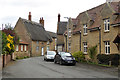
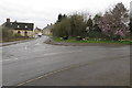
Photos of NN29 7LL
Area Information
Living in NN29 7LL offers a quiet, low-density lifestyle in a small residential cluster spanning 1024 square metres. With a population of 2166 and a population density of 122 people per square kilometre, the area feels uncluttered, ideal for those seeking space without isolation. The community is predominantly composed of adults aged 30–64, with a median age of 47, suggesting a stable, family-oriented demographic. Most residents own their homes, with 77% of properties in private ownership, and the area is characterised by houses rather than flats. Daily life here is shaped by proximity to local amenities and a relatively low crime risk. While the area lacks major urban hubs, its small size fosters a close-knit environment. Residents benefit from excellent broadband connectivity and a nearby railway station, making it practical for commuters or remote workers. NN29 7LL is not a place for those seeking high-density living; it’s suited to those prioritising tranquillity, home ownership, and a manageable pace of life.
- Area Type
- Postcode
- Area Size
- 1024 m²
- Population
- 2166
- Population Density
- 122 people/km²
The property market in NN29 7LL is characterised by a strong emphasis on owner-occupied homes, with 77% of properties in private hands. This suggests a community focused on long-term residency rather than rental turnover. The accommodation type is predominantly houses, which is unusual for areas with higher population densities. This housing stock implies larger properties, likely appealing to families or individuals prioritising space. However, the small area size of 1024 square metres means the housing stock is limited, and the market is unlikely to be competitive or rapidly expanding. For buyers, this means a niche opportunity to purchase in a low-density, stable environment, though the small size of the area may limit immediate options. The absence of flats or apartments also means it is not a hotspot for renters, making it more suited to those seeking a private, settled lifestyle.
House Prices in NN29 7LL
Showing 4 properties
| Address | Type | Beds | Baths | Last Sale Price | Last Sale Date | |
|---|---|---|---|---|---|---|
| 7-8, Burton Terrace, Church Lane, Bozeat, NN29 7LL | house | 2 | - | £275,000 | Aug 2017 | |
| 5, Burton Terrace, Church Lane, Bozeat, NN29 7LL | Semi-detached | - | - | £47,500 | Jan 1995 | |
| 1, Burton Terrace, Church Lane, Bozeat, NN29 7LL | house | - | - | - | - | |
| 6, Burton Terrace, Church Lane, Bozeat, NN29 7LL | house | - | - | - | - |
Energy Efficiency in NN29 7LL
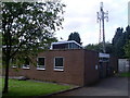
The lifestyle in NN29 7LL is shaped by its proximity to a handful of retail and leisure amenities. Within practical reach are five retail outlets, including Co-op Wollaston, Co-op Harrold, and Aldi on Worcester Way. These shops provide access to everyday essentials, though the selection is limited compared to larger towns. The area’s small size means residents must travel further for more extensive shopping or dining options. The presence of Wellingborough Railway Station adds to the area’s practicality, offering a link to broader services. While there is no mention of parks or leisure facilities in the data, the low population density and lack of planning constraints suggest open spaces may be available nearby. The lifestyle here is defined by convenience for basic needs and the ability to commute, with a focus on simplicity over urban vibrancy.
Amenities
Schools
The nearest school to NN29 7LL is Bozeat Community Primary School, which serves the local area with a primary education offering. The school holds an Ofsted rating of ‘good’, indicating a satisfactory standard of teaching and facilities. While the data does not list secondary schools, the presence of a primary school suggests the area is suitable for families with young children, though parents may need to consider commuting for secondary education. The school’s rating reflects a moderate level of performance, which may be sufficient for many families but could prompt further investigation into additional educational options. For those prioritising proximity to schools, Bozeat Community Primary School provides a foundational resource, though the lack of secondary institutions nearby is a practical consideration for long-term family planning.
| Rank | School | Type | Entry gender | Ages |
|---|
Explore more schools in this area
Go to Schools tabDemographics
The demographic profile of NN29 7LL is defined by its mature population, with a median age of 47 and the majority of residents falling within the 30–64 age range. This suggests a community of established professionals and families, rather than a younger, transient population. Home ownership is high, with 77% of residents living in owner-occupied properties, reinforcing a sense of stability. The area is predominantly composed of houses, which aligns with the demographic’s preference for private, spacious living. The predominant ethnic group is White, reflecting the broader regional composition. While no specific deprivation data is provided, the high home ownership rate and low population density indicate a relatively affluent, settled community. This profile may appeal to buyers seeking a long-term, low-maintenance lifestyle, though it also means the area is less likely to cater to younger renters or students.
Household Size
Accommodation Type
Tenure
Ethnic Group
Religion
Household Composition
Age
Household Deprivation
NS-SEC
Explore more demographic insights in this area
Go to Demographics tabPlanning
Planning Constraints
- Flood RiskPremium
- Ramsar Wetland SitesPremium
- Area of Outstanding Natural BeautyPremium
- Protected Nature ReservePremium
- Protected WoodlandPremium