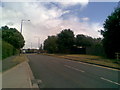
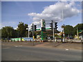
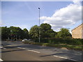
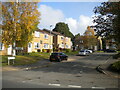
Area Overview for NN2 8DW
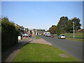
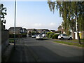
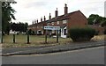
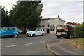
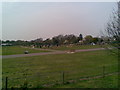
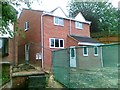
Photos of NN2 8DW


Area Information
NN2 8DW is a compact residential postcode in England, covering just 1.8 hectares and home to 2,078 people. Its high population density of 113,988 people per square kilometre reflects a tightly packed, urbanised cluster. This area is characterised by its proximity to essential services and transport links, making it practical for those prioritising convenience. The presence of Northampton Railway Station, within practical reach, connects residents to broader regional networks, while nearby bus interchanges offer flexibility for commuting. Daily life here is shaped by its small-scale nature, with a focus on accessible amenities and a community profile skewed towards adults aged 30–64. The area’s compactness means residents are likely within walking or short-vehicle distance of shops, schools, and public transport, though the limited size may restrict expansion. For buyers, this postcode offers a snapshot of a mature, established neighbourhood with a clear emphasis on connectivity and proximity to services.
- Area Type
- Postcode
- Area Size
- 1.8 hectares
- Population
- 2078
- Population Density
- 5067 people/km²
The property market in NN2 8DW is defined by its 56% home ownership rate and a focus on houses rather than flats or apartments. This suggests a community where many residents are long-term owners, potentially contributing to a sense of stability. The predominance of houses may appeal to those seeking more space or privacy, though the area’s small size means the housing stock is limited. Buyers should consider that the market is likely to be competitive, with properties in high demand due to the area’s connectivity to transport links like Northampton Railway Station. The compact nature of NN2 8DW also means that property values could be influenced by proximity to amenities such as retail hubs and public transport. For those seeking rental options, the data does not specify availability, but the lower home ownership rate implies a segment of the market may be open to tenants.
House Prices in NN2 8DW
Showing 46 properties
| Address | Type | Beds | Baths | Last Sale Price | Last Sale Date | |
|---|---|---|---|---|---|---|
| 239 Harborough Road, Northampton, NN2 8DW | Terraced | 3 | 1 | £157,000 | Mar 2023 | |
| 223 Harborough Road, Northampton, NN2 8DW | Terraced | 4 | 1 | £220,000 | Feb 2023 | |
| 247 Harborough Road, Northampton, NN2 8DW | Detached | 3 | 1 | £467,500 | Jan 2023 | |
| 261 Harborough Road, Northampton, NN2 8DW | Terraced | 3 | 1 | £240,000 | Jun 2022 | |
| 213 Harborough Road, Northampton, NN2 8DW | Terraced | 3 | 1 | £213,500 | Jan 2022 | |
| 215 Harborough Road, Northampton, NN2 8DW | house | 3 | - | £145,000 | Jan 2022 | |
| 201 Harborough Road, Northampton, NN2 8DW | house | - | - | £242,500 | Nov 2021 | |
| 227 Harborough Road, Northampton, NN2 8DW | Terraced | 2 | 1 | £151,000 | Sep 2021 | |
| 231 Harborough Road, Northampton, NN2 8DW | Semi-detached | 3 | 1 | £188,000 | Jul 2021 | |
| 229A Harborough Road, Northampton, NN2 8DW | Detached | 3 | 2 | £257,000 | May 2019 |
Energy Efficiency in NN2 8DW
Living in NN2 8DW offers access to a range of nearby amenities, including retail options such as M&S Harborough BP, Heron Kingsthorpe, and Waitrose Kingsthorpe. These shops provide convenience for daily errands, though the area’s compact size means these locations are likely within a short drive or walk. The presence of two bus interchanges—University Bus Interchange and Northampton Bus Interchange—enhances mobility, while Northampton Railway Station offers rail connections to broader destinations. Though the data does not mention parks or leisure facilities, the proximity to transport hubs suggests that residents can easily access larger recreational areas in nearby towns. The area’s lifestyle is defined by accessibility, with a balance between local services and the ability to travel further for additional amenities. This makes it suitable for those who value convenience without sacrificing the ability to explore beyond the immediate vicinity.
Amenities
Schools
| Rank | School | Type | Entry gender | Ages |
|---|
Explore more schools in this area
Go to Schools tabDemographics
The population of NN2 8DW is predominantly adults aged 30–64, with a median age of 47. This suggests a community of settled individuals, possibly including families and professionals in mid-career. Home ownership stands at 56%, indicating a mix of owner-occupied and rental properties, though the exact proportion of rentals is not specified. The accommodation type is primarily houses, which contrasts with areas dominated by flats or apartments. The predominant ethnic group is White, though no data on diversity beyond this is provided. The high population density—over 113,000 people per square kilometre—raises questions about living space per household, though specific deprivation metrics are absent. The age profile implies a stable, possibly family-oriented environment, with fewer young children or retirees compared to other areas. This demographic structure may influence local services, such as schools and healthcare, though the data does not confirm this.
Household Size
Accommodation Type
Tenure
Ethnic Group
Religion
Household Composition
Age
Household Deprivation
NS-SEC
Explore more demographic insights in this area
Go to Demographics tabPlanning
Planning Constraints
- Flood RiskPremium
- Ramsar Wetland SitesPremium
- Area of Outstanding Natural BeautyPremium
- Protected Nature ReservePremium
- Protected WoodlandPremium