Area Overview for NN2 8DL
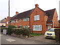
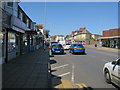
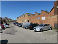
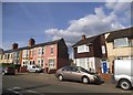
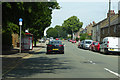
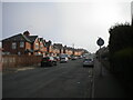
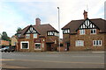
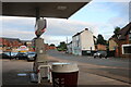
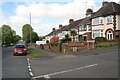
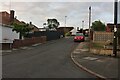
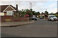
Photos of NN2 8DL

Area Information
NN2 8DL is a compact residential postcode in England, covering just 8,994 square metres and home to 2,078 residents. Its high population density—231,033 people per square kilometre—means the area is tightly packed, with a strong sense of community. Daily life here is shaped by its small-scale nature, where proximity to amenities and transport hubs plays a key role. The area’s character is defined by its mix of local shops, transport links, and the presence of nearby educational and commercial centres. Residents benefit from being within practical reach of Northampton’s infrastructure, including the Northampton Railway Station and multiple bus interchanges. While the area lacks large-scale natural features, its density and connectivity make it a practical choice for those prioritising convenience. The demographic profile—predominantly adults aged 30–64, with a median age of 47—suggests a mature, stable population, many of whom own their homes. This creates a settled environment, though the high density may influence the pace of life. For buyers, NN2 8DL offers a focused, compact living experience, ideal for those seeking proximity to services without the sprawl of larger towns.
- Area Type
- Postcode
- Area Size
- 8994 m²
- Population
- 2078
- Population Density
- 5067 people/km²
The property market in NN2 8DL is characterised by a high proportion of owner-occupied homes, with 56% of residents owning their properties. This suggests a market where long-term residency is common, rather than a transient rental-driven environment. The accommodation type is predominantly houses, which contrasts with areas where flats or apartments dominate. This housing stock may appeal to families or individuals seeking more space, though the area’s small size means the overall inventory of homes is limited. Buyers should consider that the compact nature of NN2 8DL means properties are likely to be in close proximity to one another, with little scope for expansion. The high home ownership rate also indicates that the area may be less influenced by rental demand, which could affect property prices and availability. For those considering purchase, the focus on houses suggests a market that prioritises traditional family homes over modern or high-density developments. However, the limited size of the area means buyers may need to look beyond NN2 8DL itself for more options.
House Prices in NN2 8DL
Showing 44 properties
| Address | Type | Beds | Baths | Last Sale Price | Last Sale Date | |
|---|---|---|---|---|---|---|
| 155 Harborough Road, Northampton, NN2 8DL | Detached | 4 | 2 | £510,000 | Sep 2025 | |
| 151 Harborough Road, Northampton, NN2 8DL | Semi-detached | 2 | 2 | £305,000 | Feb 2025 | |
| 115-117 Harborough Road, Northampton, NN2 8DL | Terraced | 3 | 1 | £195,000 | Nov 2023 | |
| 169 Harborough Road, Northampton, NN2 8DL | house | - | - | £170,000 | Jun 2021 | |
| 167 Harborough Road, Northampton, NN2 8DL | Terraced | 2 | 1 | £168,000 | Mar 2021 | |
| 165 Harborough Road, Northampton, NN2 8DL | Detached | 2 | 1 | £158,000 | Jul 2020 | |
| 101 Harborough Road, Northampton, NN2 8DL | house | - | - | £350,000 | Aug 2019 | |
| 157 Harborough Road, Northampton, NN2 8DL | Flat | 3 | 2 | £119,000 | Sep 2016 | |
| 175 Harborough Road, Northampton, NN2 8DL | Terraced | 2 | 1 | £140,000 | Sep 2015 | |
| 163 Harborough Road, Northampton, NN2 8DL | house | - | - | £130,000 | Nov 2012 |
Energy Efficiency in NN2 8DL
Living in NN2 8DL offers access to a range of amenities within practical reach. Retail options include notable stores such as Heron Kingsthorpe, Waitrose Kingsthorpe, and M&S Harborough BP, providing a mix of everyday shopping and specialist services. These venues cater to both routine needs and occasional indulgence, contributing to a convenient lifestyle. The area’s proximity to transport hubs like the University Bus Interchange and Northampton Bus Interchange ensures easy access to broader regional networks, enhancing mobility for work, leisure, or travel. While the data does not specify parks or leisure facilities, the presence of retail and transport infrastructure suggests a focus on practicality over expansive recreational spaces. The compact nature of the area means that residents can reach essential services quickly, reducing the need for long commutes. This blend of retail, transport, and connectivity creates a functional environment, ideal for those who value efficiency and accessibility in their daily lives.
Amenities
Schools
| Rank | School | Type | Entry gender | Ages |
|---|
Explore more schools in this area
Go to Schools tabDemographics
The community in NN2 8DL is predominantly composed of adults aged 30–64, with a median age of 47. This suggests a mature population, likely with established careers and family structures. Home ownership is strong, with 56% of residents owning their homes, indicating a stable and long-term demographic. The area is largely composed of houses, which aligns with the higher proportion of owner-occupied properties compared to rentals. The predominant ethnic group is White, which reflects broader regional trends but does not provide detailed insight into cultural diversity. The high population density—231,033 people per square kilometre—means living spaces are closely packed, which can influence the character of the area. While no specific deprivation data is provided, the high home ownership rate and age profile suggest a relatively stable quality of life, though the density may impact personal space and privacy. This demographic profile indicates a community that values stability and proximity to services, with a focus on practical living over expansive housing.
Household Size
Accommodation Type
Tenure
Ethnic Group
Religion
Household Composition
Age
Household Deprivation
NS-SEC
Explore more demographic insights in this area
Go to Demographics tabPlanning
Planning Constraints
- Flood RiskPremium
- Ramsar Wetland SitesPremium
- Area of Outstanding Natural BeautyPremium
- Protected Nature ReservePremium
- Protected WoodlandPremium