Area Overview for NN2 8AQ
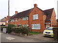
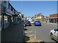
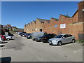
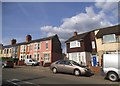
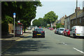
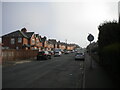
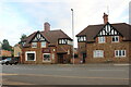
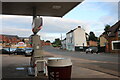
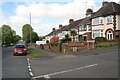
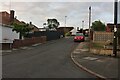
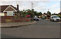
Photos of NN2 8AQ

Area Information
NN2 8AQ is a small, tightly packed residential area in England, covering just 2234 square metres and home to 1587 residents. Its high population density—710,294 people per square kilometre—suggests a compact, closely knit community. The area is characterised by its focus on houses, with 70% of residents owning their homes. This suggests a stable, long-term population, with many families and individuals settled in the area. Proximity to Northampton Railway Station and key bus interchanges, such as the University Bus Interchange, ensures easy access to the city and beyond. Nearby, St John the Baptist CofE Lower School and Kingsthorpe Village Primary School offer primary education, while retail options like Waitrose Kingsthorpe and Heron Kingsthorpe cater to daily needs. Living here means balancing a tight-knit community with practical connectivity, though the area’s small size may limit expansion. Its appeal lies in accessibility and the presence of essential services, though buyers should consider its constrained footprint.
- Area Type
- Postcode
- Area Size
- 2234 m²
- Population
- 1587
- Population Density
- 2081 people/km²
The property market in NN2 8AQ is dominated by owner-occupied homes, with 70% of residents living in houses. This suggests a focus on family-friendly, single-family dwellings rather than rental properties or flats. The small area size and high population density mean the housing stock is limited, with little scope for new development. Buyers should consider the immediate surroundings, as the area’s compact nature may require looking beyond NN2 8AQ for additional options. The prevalence of houses implies larger properties, which could be appealing for families but may also mean fewer affordable options. The market’s stability, driven by long-term residents, could offer security for buyers, though competition for properties may be fierce due to the area’s constrained footprint.
House Prices in NN2 8AQ
Showing 12 properties
| Address | Type | Beds | Baths | Last Sale Price | Last Sale Date | |
|---|---|---|---|---|---|---|
| 39 Welford Road, Northampton, NN2 8AQ | Detached | 2 | 1 | £160,000 | Jun 2025 | |
| 37 Welford Road, Northampton, NN2 8AQ | Semi-detached | 2 | 1 | £192,000 | Feb 2025 | |
| 33A Welford Road, Northampton, NN2 8AQ | Flat | - | - | £98,750 | Jun 1999 | |
| 23 Welford Road, Northampton, NN2 8AQ | Office | - | - | - | - | |
| 27 Welford Road, Northampton, NN2 8AQ | Flat | 1 | - | - | - | |
| 29 Welford Road, Northampton, NN2 8AQ | house | - | - | - | - | |
| 25A Welford Road, Northampton, NN2 8AQ | Flat | - | - | - | - | |
| Flat At, 31 Welford Road, Northampton, NN2 8AQ | Flat | - | - | - | - | |
| Braydown Properties Ltd, Room 1, 21 Welford Road, Northampton, NN2 8AQ | Office | - | - | - | - | |
| First Floor Office, 21 Welford Road, Northampton, NN2 8AQ | Office | - | - | - | - |
Energy Efficiency in NN2 8AQ
Residents of NN2 8AQ enjoy a range of nearby amenities, including five retail outlets such as Heron Kingsthorpe and Waitrose Kingsthorpe, offering shopping and dining options. The area’s proximity to Northampton Bus Interchange and the University Bus Interchange ensures easy access to public transport, linking to the city’s cultural and commercial hubs. While there are no named parks or leisure facilities in the data, the presence of multiple retail and transport points suggests a focus on convenience over expansive recreational spaces. The compact nature of the area means daily needs are met locally, though those seeking larger green spaces may need to venture beyond NN2 8AQ. The combination of retail, transport, and schools creates a self-contained lifestyle, ideal for those prioritising accessibility and practicality.
Amenities
Schools
Residents of NN2 8AQ have access to two primary schools: St John the Baptist CofE Lower School and Kingsthorpe Village Primary School, which holds a ‘good’ Ofsted rating. These institutions provide early education for children in the area, with the latter offering a benchmark of quality for parents. The presence of two primary schools within practical reach suggests a focus on local education, reducing the need for long commutes. However, the absence of secondary schools in the immediate area may require families to consider nearby towns for further education. The ‘good’ rating at Kingsthorpe Village Primary School indicates a reliable standard of teaching, which is a key consideration for families prioritising education.
| Rank | School | Type | Entry gender | Ages |
|---|
Explore more schools in this area
Go to Schools tabDemographics
The population of NN2 8AQ is predominantly adults aged 30–64, with a median age of 47. This indicates a mature community, likely with established families and professionals. Home ownership is high at 70%, suggesting a stable demographic with long-term residency. The area’s accommodation is primarily houses, reflecting a preference for single-family living. The predominant ethnic group is White, with no data provided on other groups. The high proportion of older adults and homeowners may imply a lower turnover of properties, which could be advantageous for buyers seeking stability. However, the absence of detailed diversity data means the full range of community experiences here remains less defined. The area’s age profile also suggests a need for services tailored to older residents, such as healthcare and leisure facilities.
Household Size
Accommodation Type
Tenure
Ethnic Group
Religion
Household Composition
Age
Household Deprivation
NS-SEC
Explore more demographic insights in this area
Go to Demographics tabPlanning
Planning Constraints
- Flood RiskPremium
- Ramsar Wetland SitesPremium
- Area of Outstanding Natural BeautyPremium
- Protected Nature ReservePremium
- Protected WoodlandPremium