Area Overview for NN2 6QT
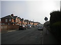
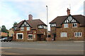
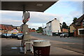
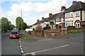
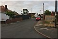
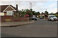
Photos of NN2 6QT


Area Information
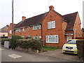
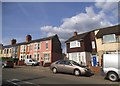
Living in NN2 6QT means inhabiting a tightly knit residential cluster in England, where 1,587 people reside across 2,602 square metres. This compact area, though small, offers a high population density of 609,894 people per square kilometre, reflecting a focused, community-oriented environment. The median age of 47 suggests a mature demographic, with most residents falling within the 30-64 age range. Daily life here is shaped by proximity to essential services, including two primary schools and nearby transport hubs. The area’s small size fosters a sense of familiarity, though it demands consideration of limited space. For those seeking a quiet, established neighbourhood with easy access to amenities, NN2 6QT balances residential comfort with practical connectivity. Its location near Northampton’s infrastructure, including railway stations and bus interchanges, ensures residents are well-positioned for commuting or leisure. While the area lacks sprawling green spaces, its compact design prioritises accessibility, making it a viable option for those valuing convenience over expansive landscapes.
- Area Type
- Postcode
- Area Size
- 2602 m²
- Population
- 1587
- Population Density
- 2081 people/km²
The property market in NN2 6QT is characterised by a high rate of home ownership (70%) and a focus on houses rather than flats or apartments. This suggests a market skewed towards owner-occupied properties, with limited rental availability. The area’s small size means the housing stock is finite, which could make it a competitive market for buyers seeking established homes. The predominance of houses implies a preference for private, low-density living, which may appeal to families or individuals desiring space and privacy. However, the compact nature of the area means buyers must consider proximity to amenities and transport links as critical factors. Given the high home ownership rate, properties here are likely to hold value over time, though the limited size of NN2 6QT means buyers should evaluate the immediate surroundings carefully.
House Prices in NN2 6QT
Showing 4 properties
| Address | Type | Beds | Baths | Last Sale Price | Last Sale Date | |
|---|---|---|---|---|---|---|
| 4 Stable Court, Northampton, NN2 6QT | Semi-detached | 4 | 3 | £335,000 | May 2018 | |
| 3 Stable Court, Northampton, NN2 6QT | Terraced | 4 | - | £324,500 | Aug 2016 | |
| 1 Stable Court, Northampton, NN2 6QT | Semi-detached | 4 | 2 | £275,000 | Apr 2015 | |
| 2 Stable Court, Northampton, NN2 6QT | house | 4 | - | £197,500 | Jan 2011 |
Energy Efficiency in NN2 6QT
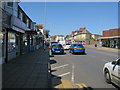
The lifestyle in NN2 6QT is shaped by its proximity to retail, dining, and transport hubs. Local shops include Heron Kingsthorpe, Waitrose Kingsthorpe, and Cook Kingsthorpe, offering a range of shopping and dining options. These venues contribute to a convenient, everyday experience, reducing the need for long trips to larger centres. The area’s transport links, such as the University Bus Interchange and Northampton Bus Interchange, provide access to broader networks, while the Northampton Railway Station connects to regional rail services. Though the area lacks expansive parks or leisure facilities, its compact design ensures amenities are within practical reach. This balance of retail, transport, and accessibility creates a functional lifestyle, ideal for those prioritising convenience over sprawling recreational spaces.
Amenities
Schools
Residents of NN2 6QT have access to two primary schools: St John the Baptist CofE Lower School and Kingsthorpe Village Primary School, which holds an Ofsted rating of ‘good’. Both institutions cater to younger children, providing families with options for early education. The presence of two primary schools within practical reach reduces the need for long commutes, though secondary education may require travel to nearby towns. The ‘good’ rating at Kingsthorpe Village Primary School indicates a satisfactory standard of teaching and facilities, which is reassuring for parents. However, the absence of secondary schools in the immediate area means families should investigate nearby options in Northampton or surrounding districts. The mix of schools suggests a focus on foundational education, but those requiring secondary schooling may need to plan accordingly.
| Rank | School | Type | Entry gender | Ages |
|---|
Explore more schools in this area
Go to Schools tabDemographics
The community in NN2 6QT is predominantly composed of adults aged 30-64, with a median age of 47. This suggests a stable, mature population, likely with established careers and families. Home ownership is high at 70%, indicating a strong preference for long-term residency over rental properties. The accommodation type is primarily houses, which aligns with the area’s residential character and contributes to a quieter, more private living environment. The predominant ethnic group is White, reflecting a homogenous demographic profile. The high population density—over 600,000 people per square kilometre—means the area is densely populated despite its small size, which could influence the pace of life and availability of space. While no specific deprivation data is provided, the high home ownership rate and age profile suggest a relatively stable quality of life, with residents likely prioritising security and familiarity over rapid change.
Household Size
Accommodation Type
Tenure
Ethnic Group
Religion
Household Composition
Age
Household Deprivation
NS-SEC
Explore more demographic insights in this area
Go to Demographics tabPlanning
Planning Constraints
- Flood RiskPremium
- Ramsar Wetland SitesPremium
- Area of Outstanding Natural BeautyPremium
- Protected Nature ReservePremium
- Protected WoodlandPremium