Area Overview for NN2 7EF
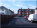
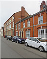
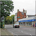
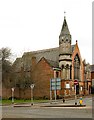
Photos of NN2 7EF


Area Information
NN2 7EF is a small, tightly packed residential area in England, covering just 2869 square metres and home to 1946 residents. Its high population density of 678,367 people per square kilometre reflects a compact, closely knit community. The area is characterised by a mature demographic, with a median age of 47 and most residents falling within the 30-64 age range. This suggests a stable, established population, likely with strong family ties and long-term residency. Living here means navigating a small, walkable cluster of homes, where proximity to local amenities and services is key. The area’s limited size means it is not suited to sprawling development, but its density supports a sense of community. Residents benefit from nearby schools, retail options, and transport links, though the compact nature of NN2 7EF means every choice in living here is deliberate. It is a place where convenience and familiarity outweigh space, appealing to those who prioritise accessibility over expansive surroundings.
- Area Type
- Postcode
- Area Size
- 2869 m²
- Population
- 1946
- Population Density
- 4411 people/km²
The property market in NN2 7EF is defined by a 60% home ownership rate, indicating a strong presence of owner-occupied homes. The accommodation type is predominantly houses, which suggests a limited stock of flats or apartments. This makes the area more suited to families or individuals seeking private, standalone properties rather than rental-focused or mixed-use developments. Given the small size of the area—just 2869 square metres—housing stock is constrained, meaning properties are likely to be in high demand. Buyers considering NN2 7EF should be aware that the market is not expansive, and opportunities may be limited to immediate surroundings. The focus on houses also implies that the area may lack modern, high-density housing options, which could be a consideration for those prioritising space or investment potential. For those seeking a stable, owner-occupied home in a compact, established community, NN2 7EF offers a niche but specific appeal.
House Prices in NN2 7EF
Showing 6 properties
| Address | Type | Beds | Baths | Last Sale Price | Last Sale Date | |
|---|---|---|---|---|---|---|
| 3 Wallace Gardens, Northampton, NN2 7EF | Semi-detached | 3 | 2 | £240,000 | Jun 2022 | |
| 6 Wallace Gardens, Northampton, NN2 7EF | house | 3 | 1 | £127,000 | Mar 2010 | |
| 5 Wallace Gardens, Northampton, NN2 7EF | Semi-detached | - | - | £79,950 | Jul 2002 | |
| 1 Wallace Gardens, Northampton, NN2 7EF | Semi-detached | - | - | - | - | |
| 4 Wallace Gardens, Northampton, NN2 7EF | house | - | - | - | - | |
| 2 Wallace Gardens, Northampton, NN2 7EF | Semi-detached | - | - | - | - |
Energy Efficiency in NN2 7EF
The lifestyle in NN2 7EF is shaped by its proximity to essential amenities, including retail, transport, and community hubs. The area’s retail offerings include notable venues such as Tesco Kingsley, Morrisons Kingsley, and M&S Abington Ave Northampton BP, providing a range of shopping options for daily needs. These stores cater to both practical purchases and occasional retail therapy, ensuring residents have access to essential goods without long trips. The presence of two bus interchanges and a railway station enhances mobility, connecting residents to Northampton and beyond. While the area lacks extensive parks or leisure facilities, the compact layout ensures that shops, transport, and services are within practical reach. This convenience fosters a lifestyle where daily errands and social interactions are seamlessly integrated into the local environment. The mix of retail and transport options contributes to a functional, if modest, quality of life in NN2 7EF.
Amenities
Schools
Residents of NN2 7EF have access to a range of educational institutions, including Wallace Road Nursery School and Kingsley Primary School. The latter is notable for its Ofsted rating of ‘good’, reflecting a standard of education that meets or exceeds expectations. The presence of both nursery and primary schools within proximity suggests a family-friendly environment, where young children can be educated locally without long commutes. For parents, this combination of early-years and primary education provides continuity and convenience. However, the absence of secondary schools in the immediate area means families may need to consider commuting to nearby towns for further education. The quality of the primary school, as rated by Ofsted, is a positive indicator for families prioritising academic standards, though the broader educational landscape beyond primary level remains unexplored in the data.
| Rank | School | Type | Entry gender | Ages |
|---|
Explore more schools in this area
Go to Schools tabDemographics
The population of NN2 7EF is predominantly composed of adults aged 30-64, with a median age of 47. This age group makes up the majority, indicating a community that is largely in middle age or beyond, with a focus on stability and long-term residence. Home ownership in the area is robust, with 60% of properties owned by residents rather than rented. The accommodation type is predominantly houses, suggesting a mix of family homes and single-unit dwellings. The predominant ethnic group is White, reflecting a homogenous demographic profile. While no specific data on deprivation is provided, the high home ownership rate and mature age profile imply a community with established financial security and fewer transient residents. This demographic structure likely influences the area’s character, with a focus on local traditions, community events, and long-standing social networks. The absence of detailed diversity metrics means the population’s full composition remains partially unexplored.
Household Size
Accommodation Type
Tenure
Ethnic Group
Religion
Household Composition
Age
Household Deprivation
NS-SEC
Explore more demographic insights in this area
Go to Demographics tabPlanning
Planning Constraints
- Flood RiskPremium
- Ramsar Wetland SitesPremium
- Area of Outstanding Natural BeautyPremium
- Protected Nature ReservePremium
- Protected WoodlandPremium