Area Overview for NN2 7DU
Photos of NN2 7DU


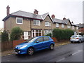
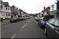
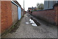
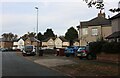
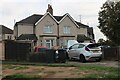
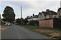
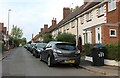
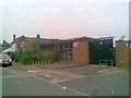
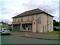
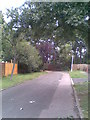
75 photos from this area
Area Information
Key information about the NN2 7DU including its size, population, and administrative classification.
- Area Type
- Postcode
- Area Size
- 2.9 hectares
- Population
- 1946
- Population Density
- 4411 people/km²
House Prices in NN2 7DU
34
Properties
£157,179
Average Sold Price
£39,000
Lowest Price
£225,000
Highest Price
Showing 34 properties
| Address | Type | Beds | Baths | Last Sale Price | Last Sale Date | |
|---|---|---|---|---|---|---|
| 271 Kettering Road, Northampton, NN2 7DU | Semi-detached | 3 | 1 | £205,000 | Mar 2019 | |
| 223 Kettering Road, Northampton, NN2 7DU | Terraced | 3 | 1 | £220,000 | Feb 2019 | |
| 213 Kettering Road, Northampton, NN2 7DU | Semi-detached | 3 | - | £210,000 | Jan 2019 | |
| 255 Kettering Road, Northampton, NN2 7DU | Semi-detached | 3 | 1 | £225,000 | Dec 2018 | |
| 231 Kettering Road, Northampton, NN2 7DU | Terraced | 3 | - | £210,000 | Aug 2018 | |
| 209 Kettering Road, Northampton, NN2 7DU | Semi-detached | 3 | - | £210,000 | Sep 2016 | |
| 217 Kettering Road, Northampton, NN2 7DU | Semi-detached | 3 | 1 | £189,000 | May 2015 | |
| 243 Kettering Road, Northampton, NN2 7DU | house | 3 | - | £135,000 | Jan 2015 | |
| 215 Kettering Road, Northampton, NN2 7DU | Semi-detached | - | - | £140,000 | Apr 2009 | |
| 249 Kettering Road, Northampton, NN2 7DU | Terraced | 3 | 1 | £185,000 | Jul 2008 |
Page 1 of 4
Energy Efficiency in NN2 7DU
Amenities
Schools
| Rank | School | Type | Entry gender | Ages |
|---|
Explore more schools in this area
Go to Schools tabDemographics
Household Size
Family (3-5 people)
most common
Accommodation Type
Houses
most common
Tenure
60
majority
Ethnic Group
White
most common
Religion
N/A
most common
Household Composition
N/A
most common
Age
47
median
Adults (30-64 years)
most common
Household Deprivation
N/A
with no deprivation
NS-SEC
21
in Lower managerial occupations
Explore more demographic insights in this area
Go to Demographics tabPlanning
Planning Constraints
- Flood RiskPremium
- Ramsar Wetland SitesPremium
- Area of Outstanding Natural BeautyPremium
- Protected Nature ReservePremium
- Protected WoodlandPremium