Area Overview for NN2 7DY
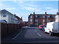
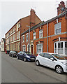
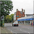
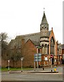
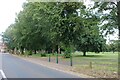
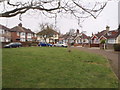
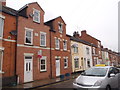
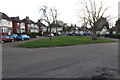
Photos of NN2 7DY


Area Information
NN2 7DY is a compact residential postcode in England, covering just 4,112 square metres and home to 1,946 residents. Its high population density—473,238 people per square kilometre—reflects a tightly knit community, where proximity to amenities and services is a defining feature. The area’s small size means residents are likely to know their neighbours, fostering a sense of familiarity. With a median age of 47 and a majority of adults aged 30–64, it is a mature, stable community. The prevalence of house ownership (60%) and the predominance of homes over flats suggest a focus on family living. While the area lacks expansive green spaces or natural features, its strategic location near Northampton’s transport hubs and retail centres offers practical convenience. Daily life here balances quiet residential living with access to essential services, making it appealing to those prioritising proximity to schools, shops, and public transport. However, the high density may mean limited private space, a trade-off for the area’s connectivity and community-centric vibe.
- Area Type
- Postcode
- Area Size
- 4112 m²
- Population
- 1946
- Population Density
- 4411 people/km²
The property market in NN2 7DY is characterised by a strong emphasis on home ownership, with 60% of residents owning their homes. This suggests a stable, long-term demographic rather than a transient rental market. The predominance of houses over flats indicates a focus on family-oriented living, with properties likely offering more space than typical urban developments. Given the area’s small size, the housing stock is limited, meaning buyers should consider nearby areas for more options. The high population density may also mean properties are closely spaced, with little room for expansion. For those seeking owner-occupied homes, NN2 7DY offers a compact, community-focused environment, though the lack of larger housing developments may make it challenging for growing families. The proximity to Northampton’s transport links and amenities could offset the area’s constraints, making it appealing to those prioritising convenience over space.
House Prices in NN2 7DY
Showing 13 properties
| Address | Type | Beds | Baths | Last Sale Price | Last Sale Date | |
|---|---|---|---|---|---|---|
| 19 Kenmuir Avenue, Northampton, NN2 7DY | house | - | - | £220,000 | Aug 2022 | |
| 13 Kenmuir Avenue, Northampton, NN2 7DY | house | - | - | £175,000 | Jul 2021 | |
| 21 Kenmuir Avenue, Northampton, NN2 7DY | Terraced | 2 | - | £176,000 | Jul 2021 | |
| 23 Kenmuir Avenue, Northampton, NN2 7DY | Terraced | 3 | 1 | £220,000 | Nov 2020 | |
| 25 Kenmuir Avenue, Northampton, NN2 7DY | Terraced | 3 | - | £170,000 | May 2020 | |
| 5 Kenmuir Avenue, Northampton, NN2 7DY | house | - | - | £198,000 | Jul 2019 | |
| 3 Kenmuir Avenue, Northampton, NN2 7DY | Semi-detached | 4 | - | £192,000 | Jan 2017 | |
| 7 Kenmuir Avenue, Northampton, NN2 7DY | Terraced | 2 | - | £126,995 | Nov 2014 | |
| 17 Kenmuir Avenue, Northampton, NN2 7DY | house | - | - | - | - | |
| 15 Kenmuir Avenue, Northampton, NN2 7DY | house | - | - | - | - |
Energy Efficiency in NN2 7DY
The lifestyle in NN2 7DY is shaped by its proximity to retail, transport, and essential services. Nearby shops include Morrisons Kingsley, Tesco Kingsley, and Co-op Birchfield, offering a range of grocery and household needs within walking or short driving distance. The area’s transport links—Northampton Railway Station and two bus interchanges—provide easy access to Northampton’s broader urban offerings, from dining to entertainment. While the data does not mention parks or leisure facilities, the high population density suggests a focus on compact, functional living rather than expansive recreational spaces. Residents benefit from the convenience of having essential amenities nearby, though the area’s small size may mean limited options for larger-scale leisure activities. The mix of retail and transport infrastructure supports a practical, community-oriented lifestyle, ideal for those prioritising accessibility over sprawling green spaces.
Amenities
Schools
Residents of NN2 7DY have access to a range of educational institutions, including Wallace Road Nursery School and Kingsley Primary School. The primary school, which has an Ofsted rating of ‘good’, provides a solid foundation for young learners. The presence of both nursery and primary schools within the area suggests a family-friendly environment, where parents can access early education and primary schooling without long commutes. This mix of school types supports families with children at different stages of their education, reducing the need for additional travel. However, the data does not mention secondary schools or higher education institutions, so families requiring these may need to look beyond the immediate area. The quality of the primary school, combined with the area’s connectivity, positions NN2 7DY as a viable option for those prioritising accessible education.
| Rank | School | Type | Entry gender | Ages |
|---|
Explore more schools in this area
Go to Schools tabDemographics
The population of NN2 7DY skews towards adults aged 30–64, with a median age of 47. This suggests a community of established professionals and families, rather than a mix of younger or older demographics. Home ownership is strong, with 60% of residents owning their homes, while the remaining 40% likely rent. The area is predominantly composed of houses, reflecting a preference for single-family dwellings over flats. The predominant ethnic group is White, though no specific diversity statistics are provided. The high population density—over 470,000 people per square kilometre—implies a compact, possibly multi-generational living environment. While this density can foster community interaction, it may also limit personal space. The absence of explicit deprivation data means quality of life factors like access to services and infrastructure must be inferred from the availability of amenities and transport links.
Household Size
Accommodation Type
Tenure
Ethnic Group
Religion
Household Composition
Age
Household Deprivation
NS-SEC
Explore more demographic insights in this area
Go to Demographics tabPlanning
Planning Constraints
- Flood RiskPremium
- Ramsar Wetland SitesPremium
- Area of Outstanding Natural BeautyPremium
- Protected Nature ReservePremium
- Protected WoodlandPremium