Area Overview for NN2 7AX
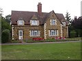
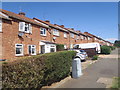
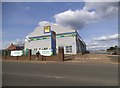
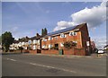
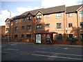
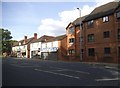
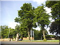
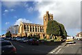
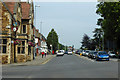
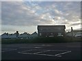
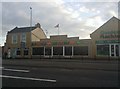
Photos of NN2 7AX

Area Information
NN2 7AX is a compact residential postcode in England, covering just 2,748 square metres and home to 2,122 people. Its high population density of 772,229 people per square kilometre reflects a tightly knit, established community. The area is characterised by its small-scale nature, with homes clustered closely together. Daily life here is shaped by proximity to key services and a mix of local amenities. Residents benefit from nearby schools, retail outlets, and transport links, making it practical for families and commuters. The median age of 47 suggests a mature population, with many residents in their 30s to 60s. While the area lacks large-scale infrastructure, its size ensures a sense of familiarity and accessibility. For those seeking a quiet, connected neighbourhood with minimal travel time to essential services, NN2 7AX offers a blend of convenience and community.
- Area Type
- Postcode
- Area Size
- 2748 m²
- Population
- 2122
- Population Density
- 3817 people/km²
NN2 7AX is a small, residential area where 49% of homes are owner-occupied, with the remaining properties likely rented out. The accommodation type is predominantly houses, indicating a lack of high-density housing such as flats or apartments. This suggests a market skewed towards single-family homes, which may appeal to families or individuals seeking private, spacious living. Given the area’s limited size, the housing stock is unlikely to be extensive, meaning buyers should consider proximity to the postcode’s boundaries for more options. The 49% ownership rate also implies a significant rental market, which could affect property values and availability. For those prioritising a house in a compact, established area, NN2 7AX may be suitable, though its small footprint could limit choices for those seeking larger properties or investment opportunities.
House Prices in NN2 7AX
Showing 4 properties
| Address | Type | Beds | Baths | Last Sale Price | Last Sale Date | |
|---|---|---|---|---|---|---|
| 21A Harborough Road, Northampton, NN2 7AX | Flat | - | - | - | - | |
| The White Horse Public House, 25A Harborough Road, Northampton, NN2 7AX | restaurant_cafe | - | - | - | - | |
| First Floor Flat, 23 Harborough Road, Northampton, NN2 7AX | Maisonette | - | - | - | - | |
| Flat, 21 Harborough Road, Northampton, NN2 7AX | Flat | - | - | - | - |
Energy Efficiency in NN2 7AX
NN2 7AX offers a range of nearby amenities, including five retail outlets such as Cook Kingsthorpe, Aldi Kingsthorpe, and Waitrose Kingsthorpe. These shops provide everyday essentials, from groceries to household items, ensuring convenience for residents. The area also benefits from two major bus interchanges—University Bus Interchange and Northampton Bus Interchange—alongside Northampton Railway Station, offering easy access to broader transport networks. While the area lacks large parks or leisure facilities, the proximity to retail and transport hubs supports a practical lifestyle. The compact nature of NN2 7AX means most services are within walking or short driving distance, fostering a self-contained community. For those prioritising accessibility and convenience over expansive recreational spaces, this area delivers a functional, connected environment.
Amenities
Schools
Residents of NN2 7AX have access to three special schools: Northgate School Arts College, Cambian Northampton School (rated ‘good’ by Ofsted), and Northgate School Academy Trust. All three institutions cater to specific educational needs, though none are mainstream primary or secondary schools. The presence of special schools may indicate a local demand for tailored education, but families requiring a broader range of school types may need to look beyond the immediate area. Cambian Northampton School’s ‘good’ Ofsted rating suggests a reliable standard of education, though it is important to note that the area lacks traditional state or independent schools. This mix of special schools could be a key consideration for parents seeking appropriate educational provision for their children.
| Rank | School | Type | Entry gender | Ages |
|---|
Explore more schools in this area
Go to Schools tabDemographics
The population of NN2 7AX is predominantly adults aged 30 to 64, with a median age of 47. This indicates a community of middle-aged residents, many of whom may be in their peak earning years or raising families. Home ownership stands at 49%, suggesting a mix of owner-occupied properties and rental homes. The accommodation type is primarily houses, reflecting a residential area with single-family dwellings rather than flats or apartments. The predominant ethnic group is White, though specific data on diversity or deprivation is not provided. The high population density, while not uncommon in urban areas, may influence the character of the neighbourhood, fostering a close-knit environment. For buyers, this demographic profile suggests a stable, established community with a focus on long-term residency.
Household Size
Accommodation Type
Tenure
Ethnic Group
Religion
Household Composition
Age
Household Deprivation
NS-SEC
Explore more demographic insights in this area
Go to Demographics tabPlanning
Planning Constraints
- Flood RiskPremium
- Ramsar Wetland SitesPremium
- Area of Outstanding Natural BeautyPremium
- Protected Nature ReservePremium
- Protected WoodlandPremium