Area Overview for NN2 6NS
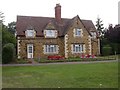
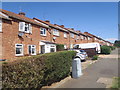
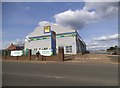
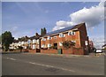
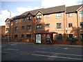
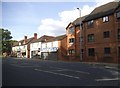
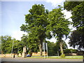
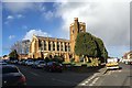
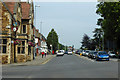
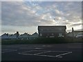
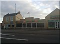
Photos of NN2 6NS

Area Information
NN2 6NS is a compact residential postcode in England, covering just 2.5 hectares and home to 1,746 people. Its high population density—70,623 people per square kilometre—reflects a tightly knit community, though the area’s small size means it is best suited for those seeking a quiet, localised living environment. The postcode is part of a broader cluster of homes, predominantly single-family residences, which suggests a stable, established demographic. Proximity to Northampton Railway Station and nearby bus interchanges ensures connectivity to the city and beyond, while local amenities like Waitrose Kingsthorpe and Heron Kingsthorpe provide everyday conveniences. The area’s schools, including Kingsthorpe Grove Primary School and St David’s Catholic Middle School, cater to families, though the mix of primary schools may limit options for older students. Living here means embracing a densely populated, family-oriented setting with access to essential services, though the small footprint means the community is best for those prioritising proximity to amenities over expansive space.
- Area Type
- Postcode
- Area Size
- 2.5 hectares
- Population
- 1746
- Population Density
- 6474 people/km²
NN2 6NS is a small, tightly packed area where 46% of residents own their homes, with the remaining properties likely occupied by renters. The accommodation type is predominantly houses, which may suggest a focus on family homes rather than apartments or flats. Given the area’s compact size and high population density, the housing stock is limited, making it a niche market for buyers seeking a specific location. The low proportion of owner-occupied properties could indicate a strong rental market, though the exact balance between buy-to-let and long-term rentals is unclear. For those considering a purchase, the area’s proximity to Northampton’s transport hubs and amenities may outweigh the constraints of its small footprint. However, buyers should be prepared for a competitive market, as the limited number of properties may drive up prices or reduce availability.
House Prices in NN2 6NS
Showing 21 properties
| Address | Type | Beds | Baths | Last Sale Price | Last Sale Date | |
|---|---|---|---|---|---|---|
| 17 Kingsthorpe Grove, Northampton, NN2 6NS | Terraced | 4 | 1 | £284,000 | Apr 2023 | |
| 19 Kingsthorpe Grove, Northampton, NN2 6NS | Terraced | 4 | 1 | £288,453 | Apr 2023 | |
| 5 Kingsthorpe Grove, Northampton, NN2 6NS | house | 1 | 2 | £252,000 | Nov 2022 | |
| 29 Kingsthorpe Grove, Northampton, NN2 6NS | Semi-detached | 3 | - | £210,500 | Dec 2020 | |
| 33 Kingsthorpe Grove, Northampton, NN2 6NS | Semi-detached | 3 | - | £165,500 | Sep 2014 | |
| 39 Kingsthorpe Grove, Northampton, NN2 6NS | house | - | - | £140,000 | Nov 2013 | |
| 7 Kingsthorpe Grove, Northampton, NN2 6NS | house | 4 | - | £222,000 | Jan 2008 | |
| 11 Kingsthorpe Grove, Northampton, NN2 6NS | Terraced | 7 | - | £176,000 | Oct 2006 | |
| 15 Kingsthorpe Grove, Northampton, NN2 6NS | Terraced | 4 | 3 | £167,500 | Mar 2004 | |
| 25 Kingsthorpe Grove, Northampton, NN2 6NS | Semi-detached | 1 | 2 | £122,000 | Oct 2003 |
Energy Efficiency in NN2 6NS
Residents of NN2 6NS have access to a range of nearby amenities, including retail outlets like Cook Kingsthorpe, Waitrose Kingsthorpe, and Heron Kingsthorpe, which cater to everyday shopping needs. The area’s proximity to Northampton’s transport hubs ensures easy access to the city’s broader leisure, dining, and cultural offerings. While the postcode itself is small, the density of services means most essentials are within walking distance or a short trip by bus. The presence of multiple primary schools and the convenience of nearby retail and transport options contribute to a lifestyle that balances local convenience with connectivity to larger urban amenities. For those who value proximity to services without sacrificing a quiet, residential environment, NN2 6NS offers a compact but functional living experience.
Amenities
Schools
The area is served by four primary schools, including Kingsthorpe Grove Primary School and The Good Shepherd Catholic Primary School, both of which hold a ‘good’ Ofsted rating. St David’s Catholic Middle School also operates in the vicinity, though its Ofsted rating is not specified. The presence of multiple primary schools, including both state and Catholic institutions, provides families with options aligned with their educational preferences. However, the absence of secondary schools means students will need to travel to nearby Northampton for further education. The ‘good’ ratings suggest a generally high standard of primary education, which is a significant draw for families prioritising school quality. For those considering a move, the availability of multiple primary schools may reduce the pressure of school choice, though the need for secondary education elsewhere is a practical consideration.
| Rank | School | Type | Entry gender | Ages |
|---|
Explore more schools in this area
Go to Schools tabDemographics
The median age in NN2 6NS is 47, with the majority of residents aged between 30 and 64. This suggests a mature, settled population, likely with established careers and families. Home ownership stands at 46%, indicating that nearly half of residents rent, which may reflect the area’s limited housing stock or the appeal of rental flexibility. The predominant accommodation type is houses, aligning with the demographic profile of older, family-oriented households. The White ethnic group forms the largest proportion of the population, though specific diversity statistics are not provided. The high population density—over 70,000 people per square kilometre—means the area is intensely populated, which can influence local dynamics and the availability of private space. For those considering a move, the community appears to prioritise stability and proximity to services over rapid growth or change.
Household Size
Accommodation Type
Tenure
Ethnic Group
Religion
Household Composition
Age
Household Deprivation
NS-SEC
Explore more demographic insights in this area
Go to Demographics tabPlanning
Planning Constraints
- Flood RiskPremium
- Ramsar Wetland SitesPremium
- Area of Outstanding Natural BeautyPremium
- Protected Nature ReservePremium
- Protected WoodlandPremium