Area Overview for NN2 6JH
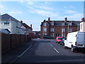
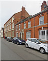
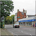
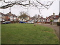
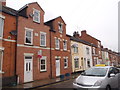
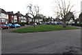
Photos of NN2 6JH


Area Information
Living in NN2 6JH means inhabiting a compact, residential postcode area in England, where 1,378 people reside across 9,332 square metres. This small cluster of homes is densely populated, with 147,661 people per square kilometre, reflecting a tightly knit community. The area’s proximity to retail hubs, transport links, and a primary school suggests a practical, family-oriented lifestyle. While the postcode lacks natural or protected landscapes, its strategic location near Northampton’s infrastructure ensures ease of access to urban amenities. Daily life here is shaped by proximity to shops like Tesco Kingsley and Asda Northampton, as well as the Northampton Bus Interchange and Railway Station. The demographic profile—predominantly adults aged 30–64—hints at a mature, stable population, with 50% owning their homes. For buyers, this area offers a blend of limited housing stock and established community networks, though its small size means choices are constrained.
- Area Type
- Postcode
- Area Size
- 9332 m²
- Population
- 1378
- Population Density
- 1870 people/km²
The property market in NN2 6JH is characterised by a 50% home ownership rate, with houses making up the majority of accommodation types. This suggests a relatively stable market, though the small area size—just 9,332 square metres—limits housing stock. The predominance of houses over flats or apartments may appeal to buyers seeking family-friendly or long-term properties. However, the compact nature of the postcode means the market is likely constrained, with limited scope for expansion or new developments. For buyers, this could translate to competitive pricing and a focus on existing properties. The 50% ownership rate also implies a significant rental sector, which may influence affordability and investment potential. Given the area’s proximity to transport and retail, properties here may cater to commuters or those prioritising convenience over space.
House Prices in NN2 6JH
Showing 26 properties
| Address | Type | Beds | Baths | Last Sale Price | Last Sale Date | |
|---|---|---|---|---|---|---|
| 3, Methodist Homestead, Homestead Way, Northampton, NN2 6JH | Bungalow | - | - | - | - | |
| 18, Methodist Homestead, Homestead Way, Northampton, NN2 6JH | Bungalow | - | - | - | - | |
| 7, Methodist Homestead, Homestead Way, Northampton, NN2 6JH | Bungalow | - | - | - | - | |
| 16, Methodist Homestead, Homestead Way, Northampton, NN2 6JH | Bungalow | - | - | - | - | |
| 17, Methodist Homestead, Homestead Way, Northampton, NN2 6JH | Bungalow | - | - | - | - | |
| 2, Methodist Homestead, Homestead Way, Northampton, NN2 6JH | Bungalow | - | - | - | - | |
| 6, Methodist Homestead, Homestead Way, Northampton, NN2 6JH | Bungalow | - | - | - | - | |
| 4, Methodist Homestead, Homestead Way, Northampton, NN2 6JH | Bungalow | - | - | - | - | |
| 20, Methodist Homestead, Homestead Way, Northampton, NN2 6JH | Bungalow | - | - | - | - | |
| 19, Methodist Homestead, Homestead Way, Northampton, NN2 6JH | Bungalow | - | - | - | - |
Energy Efficiency in NN2 6JH
Residents of NN2 6JH have access to a range of nearby amenities, including retail outlets such as Tesco Kingsley, Asda Northampton, and M&S Abington Ave Northampton BP. These shops provide everyday convenience, from groceries to clothing. The area’s proximity to the Northampton Bus Interchange and University Bus Interchange ensures easy access to public transport, while the Northampton Railway Station connects to broader regional networks. Though the data does not mention parks or leisure facilities, the practical reach of these amenities suggests a lifestyle focused on convenience and accessibility. The presence of a primary school and retail options indicates the area is designed for daily living, though the absence of recreational spaces may require residents to travel for leisure activities.
Amenities
Schools
The nearest school to NN2 6JH is Kingsley Park Middle School, a primary school serving the local community. While no Ofsted rating is provided, the presence of a primary school indicates the area is suitable for families with young children. The absence of secondary schools nearby may require residents to travel to Northampton or surrounding areas for higher education. The single primary school suggests a limited educational ecosystem, which could be a consideration for families planning long-term stays. The school’s location within practical reach of homes in NN2 6JH highlights its role as a key amenity, though the lack of additional schools or educational facilities may impact the area’s appeal for larger families.
| Rank | School | Type | Entry gender | Ages |
|---|
Explore more schools in this area
Go to Schools tabDemographics
The community in NN2 6JH is defined by a median age of 47, with the majority of residents falling within the 30–64 age range. This suggests a population skewed toward working-age adults and older homeowners, rather than younger families or retirees. Home ownership stands at 50%, with houses being the predominant accommodation type. The White ethnic group constitutes the majority, though no specific data on diversity or deprivation is provided. The high population density—147,661 people per square kilometre—indicates a compact, possibly urbanised settlement where space is at a premium. For quality of life, this density may mean limited private outdoor space but proximity to services. The lack of specific data on income or deprivation means assumptions about affluence or hardship remain unverified, though the 50% home ownership rate suggests a mix of owner-occupied and rental properties.
Household Size
Accommodation Type
Tenure
Ethnic Group
Religion
Household Composition
Age
Household Deprivation
NS-SEC
Explore more demographic insights in this area
Go to Demographics tabPlanning
Planning Constraints
- Flood RiskPremium
- Ramsar Wetland SitesPremium
- Area of Outstanding Natural BeautyPremium
- Protected Nature ReservePremium
- Protected WoodlandPremium