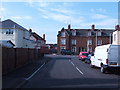
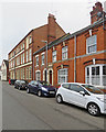
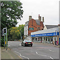
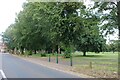
Area Overview for NN2 6JG
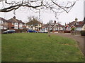
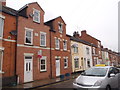
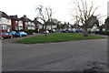
Photos of NN2 6JG


Area Information
NN2 6JG is a compact residential postcode in England, covering just 2.3 hectares and home to 1,378 residents. Its high population density—60,303 people per square kilometre—suggests a tightly woven community, likely centred around local amenities and transport links. The area’s small footprint means residents live in close proximity to shops, schools, and public transport, fostering a sense of accessibility. While the postcode lacks large-scale infrastructure, its proximity to Northampton’s retail hubs and transport networks offers practical convenience. Daily life here is likely shaped by the needs of a mature population, with the median age at 47 and a majority of residents aged 30–64. This demographic may prioritise stability and established services, reflected in the area’s mix of homes and the presence of a primary school. The absence of significant environmental constraints, such as protected woodlands or AONB designations, suggests development has focused on residential and commercial needs rather than conservation. For buyers, NN2 6JG presents a mix of opportunity and challenge: a compact, well-served area with clear limitations in space and potential safety concerns.
- Area Type
- Postcode
- Area Size
- 2.3 hectares
- Population
- 1378
- Population Density
- 1870 people/km²
NN2 6JG’s property market is characterised by a 50% home ownership rate, with houses forming the majority of accommodation types. This suggests a mix of owner-occupied and rental properties, though the exact split between the two is not specified. Given the area’s small size—just 2.3 hectares—housing stock is likely limited, potentially increasing competition among buyers. The dominance of houses over flats or apartments may appeal to families or those seeking more space, but the compact nature of the postcode could restrict availability. For buyers, this means a small, possibly saturated market where properties may be in high demand. Proximity to Northampton’s transport networks and retail hubs adds value, though the high population density might lead to pressure on local services. Buyers should consider the area’s constraints, including its size and potential safety risks, when evaluating long-term viability.
House Prices in NN2 6JG
Showing 73 properties
| Address | Type | Beds | Baths | Last Sale Price | Last Sale Date | |
|---|---|---|---|---|---|---|
| 44 Homestead Way, Northampton, NN2 6JG | Detached | - | - | £250,000 | Apr 2024 | |
| 26 Homestead Way, Northampton, NN2 6JG | Detached | 3 | 1 | £280,000 | Mar 2024 | |
| 3 Homestead Way, Northampton, NN2 6JG | Bungalow | - | - | £325,000 | Dec 2023 | |
| 28 Homestead Way, Northampton, NN2 6JG | house | 4 | 2 | £360,000 | Aug 2022 | |
| 46 Homestead Way, Northampton, NN2 6JG | Retail | 4 | 2 | £370,000 | Jul 2022 | |
| 29 Homestead Way, Northampton, NN2 6JG | Terraced | 3 | - | £290,000 | May 2022 | |
| 16 Homestead Way, Northampton, NN2 6JG | house | - | - | £340,000 | Feb 2022 | |
| 5, Homestead Mews, Homestead Way, Northampton, NN2 6JG | Flat | - | - | £196,000 | Oct 2021 | |
| 12 Homestead Way, Northampton, NN2 6JG | house | - | - | £259,995 | Jul 2021 | |
| 52 Homestead Way, Northampton, NN2 6JG | Detached | 4 | - | £360,000 | Feb 2021 |
Energy Efficiency in NN2 6JG
Living in NN2 6JG offers access to a range of practical amenities within close reach. Retail options include Tesco Kingsley, M&S Abington Ave Northampton BP, and Asda Northampton, providing everyday shopping needs. The area’s transport links—Northampton Bus Interchange, University Bus Interchange, and Northampton Railway Station—facilitate commuting and travel beyond the immediate postcode. While the data does not mention parks or leisure facilities, the proximity to Northampton’s urban centres likely means residents can access green spaces, cafes, and cultural venues nearby. The compact nature of the area means daily life is centred around these key points, with convenience prioritised over expansive recreational options. The mix of retail and transport hubs supports a functional lifestyle, though the lack of specific details on leisure facilities leaves room for further exploration of local offerings.
Amenities
Schools
The nearest school to NN2 6JG is Kingsley Park Middle School, a primary school. No Ofsted rating is provided, so its educational quality remains unspecified. The presence of a single primary school suggests the area may cater to younger families, though the lack of secondary schools nearby could require commuting for older students. This mix of school types—only primary in this case—may limit options for families needing both primary and secondary education within the immediate vicinity. Parents should consider the need for additional transport or relocation to access higher education levels. The school’s location within practical reach of residents highlights its role as a key community anchor, though its performance and facilities are not detailed in the data.
| Rank | School | Type | Entry gender | Ages |
|---|
Explore more schools in this area
Go to Schools tabDemographics
The population of NN2 6JG is 1,378, with a median age of 47 and the largest age group spanning 30–64 years. This suggests a community dominated by adults in their prime working and family-raising years. Home ownership sits at 50%, with houses being the predominant accommodation type. This balance between owner-occupied and rental properties may indicate a mix of long-term residents and those seeking temporary housing. The predominant ethnic group is White, though no specific data on diversity or deprivation is provided. The high population density—60,303 people per square kilometre—implies a compact, possibly multi-generational living environment. For quality of life, this density could mean efficient access to services but may also strain local infrastructure. The lack of specific deprivation metrics means it’s unclear whether the area’s resources meet the needs of its residents, though the presence of a primary school and retail options suggests basic amenities are available.
Household Size
Accommodation Type
Tenure
Ethnic Group
Religion
Household Composition
Age
Household Deprivation
NS-SEC
Explore more demographic insights in this area
Go to Demographics tabPlanning
Planning Constraints
- Flood RiskPremium
- Ramsar Wetland SitesPremium
- Area of Outstanding Natural BeautyPremium
- Protected Nature ReservePremium
- Protected WoodlandPremium