Area Overview for NN18 9PE
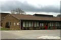
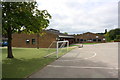
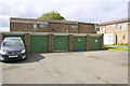
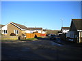
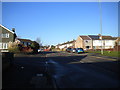
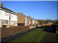
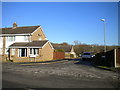
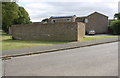
Photos of NN18 9PE

Area Information
Living in NN18 9PE means being part of a tightly knit residential cluster in Corby, Northamptonshire. This small area covers just 1.8 hectares, yet it is home to 2,292 people, making it one of the most densely populated places in England, with over 127,000 people per square kilometre. The postcode sits in a town designated a new town in 1950, historically shaped by its steel industry. Corby’s name derives from its Domesday Book entry as “Corbei,” and its raven symbol reflects its medieval roots. Daily life here is shaped by its compact size and proximity to essential services. The area’s character blends modern infrastructure with historical legacy, offering a snapshot of a town that grew rapidly in the 20th century. For buyers, NN18 9PE represents a chance to live in a place with strong community ties, though its density means space is limited. The area’s focus on housing, with 60% owner-occupied properties, suggests a stable, long-term resident base.
- Area Type
- Postcode
- Area Size
- 1.8 hectares
- Population
- 2292
- Population Density
- 2406 people/km²
The property market in NN18 9PE is characterised by a strong emphasis on owner-occupied homes, with 60% of properties owned by residents rather than rented. The accommodation type is predominantly houses, which is notable in a small area with limited space. This suggests a market skewed towards established, family-oriented housing rather than rental properties or flats. The compact size of the postcode—just 1.8 hectares—means the housing stock is finite, and buyers should consider the area’s immediate surroundings for more options. The high home ownership rate indicates a community with long-term residents, which may contribute to a stable property value trend. However, the limited land area could restrict development, making this a niche market for those seeking a specific type of housing in a historically industrial town.
House Prices in NN18 9PE
Showing 56 properties
| Address | Type | Beds | Baths | Last Sale Price | Last Sale Date | |
|---|---|---|---|---|---|---|
| 59 Bede Close, Corby, NN18 9PE | Semi-detached | 3 | 1 | £180,000 | Jun 2025 | |
| 79 Bede Close, Corby, NN18 9PE | Bungalow | 1 | 1 | £120,000 | Apr 2025 | |
| 57 Bede Close, Corby, NN18 9PE | Semi-detached | 3 | 1 | £240,000 | Mar 2025 | |
| 98 Bede Close, Corby, NN18 9PE | house | - | - | £246,000 | Jan 2023 | |
| 74 Bede Close, Corby, NN18 9PE | Retail | 3 | 1 | £185,000 | Feb 2022 | |
| 90 Bede Close, Corby, NN18 9PE | Flat | - | - | £123,000 | Apr 2021 | |
| 89 Bede Close, Corby, NN18 9PE | house | - | - | £179,950 | Mar 2021 | |
| 77 Bede Close, Corby, NN18 9PE | house | - | - | £170,000 | Sep 2020 | |
| 55 Bede Close, Corby, NN18 9PE | Semi-detached | 3 | 1 | £162,000 | Feb 2020 | |
| 87 Bede Close, Corby, NN18 9PE | Detached | 3 | 1 | £155,000 | Feb 2020 |
Energy Efficiency in NN18 9PE
Residents of NN18 9PE have access to a range of nearby amenities, including five retail outlets such as Morrisons Oakley, Aldi Oakley, and Morrisons Daily Corby Gateway. These shops provide convenience for daily errands, from groceries to household essentials. The area’s proximity to Corby Railway Station and Kettering Railway Station, along with a nearby bus interchange, ensures easy travel for work, leisure, or shopping trips. While the data does not mention parks or leisure facilities directly, the town’s industrial history suggests a focus on functional infrastructure over expansive green spaces. The compact size of the postcode means amenities are clustered closely, reducing travel time for residents. The presence of multiple retail options and transport links contributes to a practical, efficient lifestyle, ideal for those prioritising accessibility over sprawling natural landscapes.
Amenities
Schools
| Rank | School | Type | Entry gender | Ages |
|---|
Explore more schools in this area
Go to Schools tabDemographics
The community in NN18 9PE is predominantly middle-aged, with a median age of 47 and the most common age range being adults aged 30–64. This suggests a population largely in their prime working and family-raising years. Home ownership is high at 60%, with the majority of residents living in houses rather than flats. The predominant ethnic group is White, reflecting broader trends in the region. The population density of 127,536 people per square kilometre is exceptionally high, which may influence the pace of life and access to shared resources. While the data does not specify deprivation levels, such density could imply a mix of social dynamics, from established families to workers commuting to nearby industrial hubs. The age profile indicates a stable demographic, with fewer young children or elderly residents compared to other areas.
Household Size
Accommodation Type
Tenure
Ethnic Group
Religion
Household Composition
Age
Household Deprivation
NS-SEC
Explore more demographic insights in this area
Go to Demographics tabPlanning
Planning Constraints
- Flood RiskPremium
- Ramsar Wetland SitesPremium
- Area of Outstanding Natural BeautyPremium
- Protected Nature ReservePremium
- Protected WoodlandPremium