Area Overview for NN18 9PD
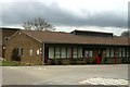
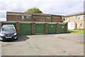
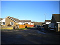
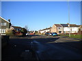
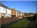
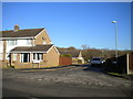
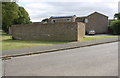
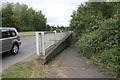
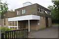
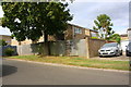
Photos of NN18 9PD


Area Information
NN18 9PD is a compact residential cluster in Northamptonshire, part of the town of Corby, which was designated a new town in 1950. This area, spanning 1.5 hectares, is densely populated, with 2292 residents squeezed into a space of 156,876 people per square kilometre. Corby itself has a long history, from its 1086 Domesday Book mention as “Corbei” to its transformation into a steelmaking hub in the 1930s. Today, NN18 9PD reflects a mature community, with a median age of 47 and a majority of residents aged 30–64. Daily life here is shaped by its proximity to industrial heritage and modern amenities, though the area’s small size means it is tightly knit. The absence of natural reserves or protected landscapes means development is focused on housing and retail. Living here offers a blend of historical context and practical living, though the high density may feel cramped for those seeking more space. The area’s character is defined by its role within Corby’s broader urban fabric, where the legacy of steelworks still influences the local economy and community dynamics.
- Area Type
- Postcode
- Area Size
- 1.5 hectares
- Population
- 2292
- Population Density
- 2406 people/km²
The property market in NN18 9PD is dominated by owner-occupied homes, with 60% of residents living in their own houses. This contrasts with areas where rental markets dominate, suggesting a community of long-term residents rather than transient tenants. The accommodation type is exclusively houses, not flats or apartments, which may appeal to those seeking larger living spaces or family-friendly layouts. Given the area’s small size—just 1.5 hectares—the housing stock is limited, which could make the market competitive for buyers. The high home ownership rate implies strong local demand, potentially driving up prices. However, the absence of data on property values or recent transactions means the market’s current health remains unclear. For buyers, the focus on houses and the compact nature of the area means proximity to amenities is key, though the limited land area may restrict future development.
House Prices in NN18 9PD
Showing 50 properties
| Address | Type | Beds | Baths | Last Sale Price | Last Sale Date | |
|---|---|---|---|---|---|---|
| 11 Bede Close, Corby, NN18 9PD | Maisonette | 1 | 1 | £127,500 | Jul 2025 | |
| 1 Bede Close, Corby, NN18 9PD | Bungalow | 3 | 1 | £184,000 | Mar 2024 | |
| 22 Bede Close, Corby, NN18 9PD | Flat | 1 | 1 | £117,000 | Nov 2023 | |
| 36 Bede Close, Corby, NN18 9PD | Semi-detached | 3 | 1 | £225,000 | May 2023 | |
| 14 Bede Close, Corby, NN18 9PD | Semi-detached | 4 | 2 | £270,800 | Mar 2023 | |
| 18 Bede Close, Corby, NN18 9PD | house | 4 | 1 | £210,000 | Jan 2023 | |
| 30 Bede Close, Corby, NN18 9PD | house | - | - | £172,000 | Jan 2022 | |
| 5 Bede Close, Corby, NN18 9PD | house | - | - | £155,000 | Jan 2022 | |
| 43 Bede Close, Corby, NN18 9PD | house | - | - | £190,000 | Jul 2021 | |
| 4 Bede Close, Corby, NN18 9PD | house | - | - | £185,000 | Jun 2021 |
Energy Efficiency in NN18 9PD
Daily life in NN18 9PD is shaped by its proximity to retail and transport hubs. The area’s shops, including Morrisons Oakley and Aldi Oakley, provide access to groceries and household goods, while Morrisons Daily Corby Gateway caters to convenience shopping. The nearest rail stations—Corby and Kettering—offer regular services to nearby towns, and the bus interchange ensures local mobility. Though the data does not mention parks or leisure facilities, Corby’s historical ties to industry suggest a focus on practical amenities over recreational spaces. The town’s annual Corby Pole Fair, held every 20 years, is a notable event rooted in the area’s 1568 charter, offering a glimpse into its heritage. For residents, the lifestyle balances proximity to essential services with the constraints of a densely packed environment. The absence of nearby natural spaces means outdoor activities may require travel, but the area’s retail and transport links make it functional for everyday needs.
Amenities
Schools
| Rank | School | Type | Entry gender | Ages |
|---|
Explore more schools in this area
Go to Schools tabDemographics
The population of NN18 9PD is predominantly adults aged 30–64, with a median age of 47. This suggests a community of established professionals and families, rather than students or retirees. Home ownership is high at 60%, indicating a stable, long-term resident base. The area is composed mainly of houses, not flats, which aligns with the demographic profile of older, settled households. The predominant ethnic group is White, reflecting Corby’s historical roots as a settlement shaped by industrial migration. The high population density—156,876 people per square kilometre—means living spaces are closely packed, which can influence local amenities and social interactions. While the data does not specify deprivation levels, the combination of high home ownership and a mature age profile suggests a relatively stable economic environment. However, the lack of diversity in ethnicity and the absence of specific data on income or deprivation means the area’s socioeconomic challenges remain unexplored in this context.
Household Size
Accommodation Type
Tenure
Ethnic Group
Religion
Household Composition
Age
Household Deprivation
NS-SEC
Explore more demographic insights in this area
Go to Demographics tabPlanning
Planning Constraints
- Flood RiskPremium
- Ramsar Wetland SitesPremium
- Area of Outstanding Natural BeautyPremium
- Protected Nature ReservePremium
- Protected WoodlandPremium