Area Overview for NN18 8RP
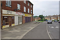
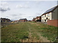
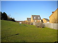
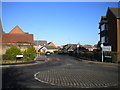
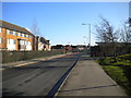
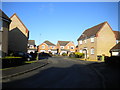
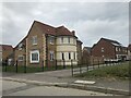
Photos of NN18 8RP


Area Information
NN18 8RP lies within the town of Corby in Northamptonshire, a historic industrial settlement designated a new town in 1950. This small postcode area covers just 1.7 hectares, yet it is home to 2,727 residents, making it one of the most densely populated regions in the UK, with 159,708 people per square kilometre. The area’s compact size reflects its role as a residential cluster within Corby, a town shaped by its 20th-century steelworks legacy. Daily life here is characterised by proximity to amenities and transport links, with a population skewed toward adults aged 30–64. The town’s historical roots, from its 10th-century origins to its transformation into a steelmaking hub, underpin a community that balances industrial heritage with modern living. With a high rate of home ownership (74%) and predominantly owner-occupied houses, NN18 8RP offers a stable, settled environment. Its location near rail and bus services, combined with excellent digital connectivity, ensures residents can navigate both local and regional needs efficiently.
- Area Type
- Postcode
- Area Size
- 1.7 hectares
- Population
- 2727
- Population Density
- 6790 people/km²
The property market in NN18 8RP is dominated by owner-occupied houses, with 74% of homes owned by residents rather than rented. This suggests a market prioritising long-term residency over investment or rental income. The area’s compact size (1.7 hectares) means housing stock is limited, likely creating a competitive environment for buyers. The prevalence of houses, rather than flats, indicates a focus on family-friendly or larger properties, which may appeal to those seeking space and stability. For buyers, this small area’s immediate surroundings may offer more options, but within NN18 8RP itself, availability is constrained. The high home ownership rate also implies a steady demand for properties, potentially driving prices upward. Prospective buyers should consider the area’s density and the dominance of owner-occupied housing when evaluating opportunities.
House Prices in NN18 8RP
Showing 44 properties
| Address | Type | Beds | Baths | Last Sale Price | Last Sale Date | |
|---|---|---|---|---|---|---|
| 53 Jay Road, Corby, NN18 8RP | Terraced | 3 | 2 | £250,000 | Sep 2023 | |
| 45 Jay Road, Corby, NN18 8RP | house | 3 | 2 | £250,000 | Aug 2023 | |
| 27 Jay Road, Corby, NN18 8RP | Semi-detached | 3 | 2 | £195,000 | Sep 2021 | |
| 16 Jay Road, Corby, NN18 8RP | Detached | 4 | 2 | £290,000 | Jan 2021 | |
| 21 Jay Road, Corby, NN18 8RP | Semi-detached | 3 | 2 | £195,000 | Jul 2020 | |
| 57 Jay Road, Corby, NN18 8RP | Detached | 3 | 1 | £218,950 | Jun 2020 | |
| 7 Jay Road, Corby, NN18 8RP | house | - | - | £175,000 | Jan 2020 | |
| 49 Jay Road, Corby, NN18 8RP | Detached | 4 | 3 | £238,000 | Apr 2018 | |
| 13 Jay Road, Corby, NN18 8RP | house | - | - | £167,500 | Mar 2018 | |
| 12 Jay Road, Corby, NN18 8RP | Detached | 4 | 1 | £235,000 | Feb 2018 |
Energy Efficiency in NN18 8RP
Residents of NN18 8RP have access to a range of nearby amenities, including five retail outlets such as Tesco Oakley, Lidl Central, and Morrisons Oakley, ensuring convenience for shopping and daily essentials. The area’s rail links to Corby and Kettering stations provide easy access to larger towns, while the bus interchange offers local transport options. Though the data does not specify parks or leisure facilities, the proximity to retail and transport suggests a practical, functional lifestyle. The presence of multiple supermarkets and transport hubs indicates a community prioritising accessibility and ease of movement. For those seeking a balance between local convenience and regional connectivity, NN18 8RP offers a compact yet well-served environment.
Amenities
Schools
| Rank | School | Type | Entry gender | Ages |
|---|
Explore more schools in this area
Go to Schools tabDemographics
The population of NN18 8RP is predominantly adults aged 30–64, with a median age of 47, reflecting a mature, established community. Home ownership is high at 74%, indicating a strong presence of long-term residents. The accommodation type is primarily houses, suggesting a mix of family homes and larger properties. The predominant ethnic group is White, though specific diversity figures are not provided. The area’s demographic profile implies a stable, low-turnover population, with fewer transient renters compared to other regions. The high home ownership rate and age distribution suggest a community focused on long-term residence rather than short-term rental stays. This stability may contribute to a cohesive local culture, though the absence of detailed diversity data limits a fuller picture of the area’s social composition.
Household Size
Accommodation Type
Tenure
Ethnic Group
Religion
Household Composition
Age
Household Deprivation
NS-SEC
Explore more demographic insights in this area
Go to Demographics tabPlanning
Planning Constraints
- Flood RiskPremium
- Ramsar Wetland SitesPremium
- Area of Outstanding Natural BeautyPremium
- Protected Nature ReservePremium
- Protected WoodlandPremium