Area Overview for NN18 8EN
Photos of NN18 8EN
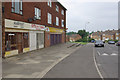

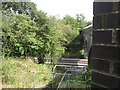
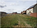
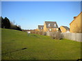
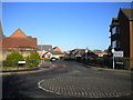
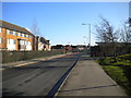
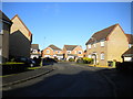
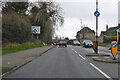
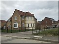
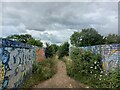
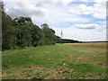
14 photos from this area
Area Information
Key information about the NN18 8EN including its size, population, and administrative classification.
- Area Type
- Postcode
- Area Size
- 1.4 hectares
- Population
- 2727
- Population Density
- 6790 people/km²
House Prices in NN18 8EN
40
Properties
£212,203
Average Sold Price
£134,995
Lowest Price
£375,000
Highest Price
Showing 40 properties
| Address | Type | Beds | Baths | Last Sale Price | Last Sale Date | |
|---|---|---|---|---|---|---|
| 141 Dunnock Road, Corby, NN18 8EN | Detached | 4 | 2 | £270,000 | Aug 2024 | |
| 23 Dunnock Road, Corby, NN18 8EN | house | - | - | £367,000 | Jan 2024 | |
| 17 Dunnock Road, Corby, NN18 8EN | house | 4 | 2 | £375,000 | Mar 2023 | |
| 3 Dunnock Road, Corby, NN18 8EN | Semi-detached | 3 | 2 | £240,000 | Jul 2022 | |
| 147 Dunnock Road, Corby, NN18 8EN | house | 3 | 1 | £195,000 | Oct 2021 | |
| 111 Dunnock Road, Corby, NN18 8EN | Semi-detached | 3 | 2 | £198,000 | Jun 2021 | |
| 139 Dunnock Road, Corby, NN18 8EN | Detached | 4 | 2 | £298,000 | Feb 2021 | |
| 1 Dunnock Road, Corby, NN18 8EN | Semi-detached | 3 | 2 | £180,000 | Jan 2021 | |
| 7 Dunnock Road, Corby, NN18 8EN | house | - | - | £169,000 | Apr 2020 | |
| 133 Dunnock Road, Corby, NN18 8EN | Semi-detached | 3 | - | £165,000 | Aug 2019 |
Page 1 of 4
Energy Efficiency in NN18 8EN
Amenities
Schools
| Rank | School | Type | Entry gender | Ages |
|---|
Explore more schools in this area
Go to Schools tabDemographics
Household Size
Family (3-5 people)
most common
Accommodation Type
Houses
most common
Tenure
74
majority
Ethnic Group
White
most common
Religion
N/A
most common
Household Composition
N/A
most common
Age
47
median
Adults (30-64 years)
most common
Household Deprivation
N/A
with no deprivation
NS-SEC
33
in Lower managerial occupations
Explore more demographic insights in this area
Go to Demographics tabPlanning
Planning Constraints
- Flood RiskPremium
- Ramsar Wetland SitesPremium
- Area of Outstanding Natural BeautyPremium
- Protected Nature ReservePremium
- Protected WoodlandPremium