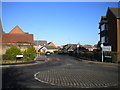
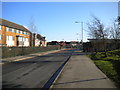
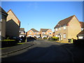
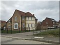
Area Overview for NN18 8BP
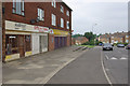
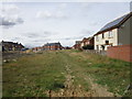
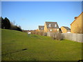
Photos of NN18 8BP


Area Information
NN18 8BP lies within the town of Corby in Northamptonshire, a historically industrialised area designated a new town in 1950. This small postcode area covers just 4 hectares, housing 1,355 residents in a densely populated cluster. The community reflects Corby’s legacy as a steelworks hub, with a median age of 47 and a population skewed toward adults aged 30–64. Daily life here is shaped by proximity to retail, rail, and transport infrastructure. Residents benefit from nearby supermarkets such as Lidl Central and Tesco Oakley, while rail links to Corby and Kettering stations provide swift access to regional centres. The area’s compact size means amenities are within practical reach, though its character remains rooted in Corby’s post-war industrial identity. With a population density of 33,518 per km², the neighbourhood offers a tightly knit environment, though its small footprint means housing options are limited to a handful of properties. For buyers seeking a quiet, established residential area with essential services nearby, NN18 8BP combines practicality with a sense of community.
- Area Type
- Postcode
- Area Size
- 4.0 hectares
- Population
- 1355
- Population Density
- 5341 people/km²
The property market in NN18 8BP is characterised by a 48% home ownership rate, with houses forming the predominant accommodation type. This suggests a small, tightly held housing stock, likely consisting of semi-detached or terraced properties typical of Corby’s post-war development. The low number of properties in such a compact area means competition for homes is likely, particularly for buyers seeking owner-occupied properties. With no data on rental availability, it is unclear whether the market leans more toward private ownership or lettings, but the lower home ownership rate implies a significant proportion of residents may be renting. For buyers, this small area offers limited scope for property choice, necessitating a focus on nearby suburbs or towns for broader options. The housing stock’s age and type reflect Corby’s industrial past, with potential for characterful, well-established homes.
House Prices in NN18 8BP
Showing 43 properties
| Address | Type | Beds | Baths | Last Sale Price | Last Sale Date | |
|---|---|---|---|---|---|---|
| 42 Lynton Grove, Corby, NN18 8BP | Terraced | 3 | 2 | £225,000 | Aug 2025 | |
| 34 Lynton Grove, Corby, NN18 8BP | Terraced | 3 | 1 | £119,000 | Jun 2023 | |
| 60 Lynton Grove, Corby, NN18 8BP | Terraced | 3 | 1 | £192,000 | Oct 2022 | |
| 46 Lynton Grove, Corby, NN18 8BP | Terraced | 3 | 1 | £170,000 | Jun 2021 | |
| 32 Lynton Grove, Corby, NN18 8BP | house | - | - | £135,000 | May 2019 | |
| 44 Lynton Grove, Corby, NN18 8BP | Terraced | 3 | - | £139,000 | Nov 2016 | |
| 54 Lynton Grove, Corby, NN18 8BP | house | - | - | £102,000 | Nov 2014 | |
| 4 Lynton Grove, Corby, NN18 8BP | Terraced | - | - | £79,000 | Nov 2005 | |
| 62 Lynton Grove, Corby, NN18 8BP | Terraced | - | - | £70,000 | Oct 2005 | |
| 16 Lynton Grove, Corby, NN18 8BP | house | - | - | £24,000 | Dec 1998 |
Energy Efficiency in NN18 8BP
Residents of NN18 8BP have access to essential retail and transport hubs within easy reach. Supermarkets such as Lidl Central, Tesco Oakley, and Iceland Corby provide daily shopping convenience, while the nearby rail stations at Corby and Kettering offer swift access to broader regional networks. A bus interchange adds flexibility for local travel. Though the area is small, its proximity to these amenities ensures a practical lifestyle, reducing the need for long commutes. The absence of detailed data on parks or leisure facilities means the area’s recreational options are less defined, but the presence of rail and retail suggests a focus on functional living. For those prioritising convenience and connectivity, NN18 8BP delivers a compact, service-rich environment, though its limited size may require residents to seek additional leisure opportunities beyond the immediate vicinity.
Amenities
Schools
| Rank | School | Type | Entry gender | Ages |
|---|
Explore more schools in this area
Go to Schools tabDemographics
The population of NN18 8BP is predominantly adults aged 30–64, reflecting a mature demographic with a median age of 47. Home ownership stands at 48%, suggesting a mix of owner-occupied and rental properties. The area is largely composed of houses, aligning with Corby’s historical development as a working-class town. The predominant ethnic group is White, with no specific data on other demographics. The high population density of 33,518 per km² indicates a compact, possibly multi-generational living pattern. While the data does not specify deprivation levels, the low crime risk score of 68 (on a 100-point scale) and absence of environmental constraints suggest a stable, low-risk environment. However, the high density may impact living space per person, potentially influencing quality of life for families or those requiring larger homes. The area’s demographic profile paints a picture of a settled, middle-aged community with established roots in the region.
Household Size
Accommodation Type
Tenure
Ethnic Group
Religion
Household Composition
Age
Household Deprivation
NS-SEC
Explore more demographic insights in this area
Go to Demographics tabPlanning
Planning Constraints
- Flood RiskPremium
- Ramsar Wetland SitesPremium
- Area of Outstanding Natural BeautyPremium
- Protected Nature ReservePremium
- Protected WoodlandPremium