Area Overview for NN18 8BD
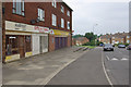
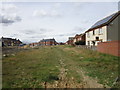
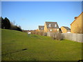
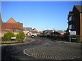
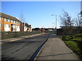
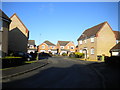
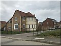
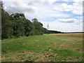
Photos of NN18 8BD


Area Information
NN18 8BD is a compact residential postcode in Corby, Northamptonshire, covering 4,647 square metres and home to 1,355 residents. The area’s high population density of 291,597 people per square kilometre reflects its small, closely knit character. Corby itself is an industrial town with a history rooted in steelmaking, designated a new town in 1950 to accommodate post-war growth. Today, NN18 8BD sits within this framework, offering a blend of historical legacy and modern infrastructure. The area’s proximity to railway stations and retail hubs like Lidl Central and Iceland Corby makes it practical for daily life. While the population is predominantly White and skewed toward adults aged 30–64, the community’s dynamics are shaped by its industrial past and evolving present. Living here means navigating a tight-knit environment where local amenities and transport links are within easy reach, though the high density may influence the pace of life. The area’s low flood risk and absence of environmental constraints suggest stability, though its compact size limits expansion. For buyers, NN18 8BD represents a focused, functional slice of Corby’s urban fabric.
- Area Type
- Postcode
- Area Size
- 4647 m²
- Population
- 1355
- Population Density
- 5341 people/km²
The property market in NN18 8BD is characterised by a 48% home ownership rate, with houses as the primary accommodation type. This suggests a mix of owner-occupied and rental properties, though the relatively low home ownership rate may indicate a reliance on private rentals or shared living arrangements. Given the area’s compact size and high population density, the housing stock is likely limited to terraced or semi-detached homes, typical of post-war industrial towns like Corby. The focus on houses rather than flats or apartments aligns with the area’s historical development, which prioritised family homes for a working-class population. For buyers, this small postcode offers a niche market with limited scope for expansion, but proximity to retail and transport hubs may enhance its appeal. However, the high density and industrial heritage could influence property values, with potential for investment in renovation or redevelopment. Buyers should consider the area’s constrained size and the practicality of its housing stock in relation to long-term needs.
House Prices in NN18 8BD
Showing 16 properties
| Address | Type | Beds | Baths | Last Sale Price | Last Sale Date | |
|---|---|---|---|---|---|---|
| 38 Cecil Drive, Corby, NN18 8BD | house | - | - | £185,000 | Feb 2023 | |
| 48 Cecil Drive, Corby, NN18 8BD | house | - | - | £170,000 | Apr 2022 | |
| 42 Cecil Drive, Corby, NN18 8BD | Semi-detached | 2 | 1 | £155,000 | May 2021 | |
| 46 Cecil Drive, Corby, NN18 8BD | Semi-detached | 2 | - | £105,000 | May 2021 | |
| 24 Cecil Drive, Corby, NN18 8BD | Semi-detached | 2 | 1 | £123,000 | Jun 2016 | |
| 44 Cecil Drive, Corby, NN18 8BD | house | - | - | £89,950 | Nov 2006 | |
| 30 Cecil Drive, Corby, NN18 8BD | Semi-detached | 2 | 1 | £68,500 | Jun 2004 | |
| 40 Cecil Drive, Corby, NN18 8BD | Semi-detached | - | - | - | - | |
| 34 Cecil Drive, Corby, NN18 8BD | house | - | - | - | - | |
| 7 Cecil Drive, Corby, NN18 8BD | Bungalow | - | - | - | - |
Energy Efficiency in NN18 8BD
Residents of NN18 8BD have access to essential amenities within practical reach, including retail options like Lidl Central, Iceland Corby, and Farmfoods Corby. These stores provide everyday shopping convenience, from groceries to household items. The area’s proximity to Corby Railway Station and Kettering Railway Station enhances mobility, while the nearby bus interchange offers additional transport flexibility. Though the data does not mention parks or leisure facilities, the absence of environmental constraints like protected woodlands or AONB designations suggests open spaces may be limited. The retail and transport infrastructure implies a practical, service-oriented lifestyle, catering to daily needs without requiring long commutes. However, the lack of detailed information on leisure options means the area’s recreational appeal remains unclear. For those prioritising convenience and connectivity, NN18 8BD offers a functional base, though its small size may limit opportunities for more expansive amenities.
Amenities
Schools
| Rank | School | Type | Entry gender | Ages |
|---|
Explore more schools in this area
Go to Schools tabDemographics
The population of NN18 8BD is predominantly adults aged 30–64, with a median age of 47. This suggests a community rooted in middle-age stability, likely comprising working professionals and families. Home ownership stands at 48%, slightly below the national average, indicating a mix of owner-occupied and rental properties. The accommodation type is primarily houses, which is notable given the area’s high density—houses in such a small footprint may be semi-detached or terraced. The predominant ethnic group is White, though specific diversity metrics are not provided. The age profile implies a workforce-oriented demographic, potentially linked to Corby’s historical industrial economy. However, the high population density—over 290,000 people per square kilometre—could impact living conditions, such as space per household or access to green areas. This data suggests a community that balances established residents with potential for new arrivals, though the limited data on deprivation means broader quality-of-life implications remain unexplored.
Household Size
Accommodation Type
Tenure
Ethnic Group
Religion
Household Composition
Age
Household Deprivation
NS-SEC
Explore more demographic insights in this area
Go to Demographics tabPlanning
Planning Constraints
- Flood RiskPremium
- Ramsar Wetland SitesPremium
- Area of Outstanding Natural BeautyPremium
- Protected Nature ReservePremium
- Protected WoodlandPremium