Area Overview for NN18 8AZ
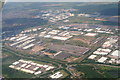
Photos of NN18 8AZ


Area Information
NN18 8AZ is a compact residential area in England, covering 6.6 hectares and home to 1898 residents. With a population density of 203 people per square kilometre, it is a small, tightly knit community. The area is characterised by a predominance of houses, reflecting its focus on family-oriented living. Most residents are adults aged 30–64, with a median age of 47, suggesting a stable, mature demographic. Daily life here is shaped by proximity to local amenities, including retail outlets and a rail link to Corby. The area’s low crime risk and minimal environmental constraints make it an attractive option for those prioritising safety and practicality. While it lacks large-scale infrastructure, its size ensures a quiet, manageable environment. For buyers seeking a residential area with a balance of accessibility and tranquillity, NN18 8AZ offers a straightforward, no-frills living experience.
- Area Type
- Postcode
- Area Size
- 6.6 hectares
- Population
- 1898
- Population Density
- 203 people/km²
The property market in NN18 8AZ is dominated by owner-occupied homes, with 87% of residents living in houses rather than rental properties. This suggests a market geared toward long-term residents rather than short-term tenants. The small area size of 6.6 hectares means the housing stock is limited, likely comprising a mix of older and newer properties. Buyers should consider the proximity to amenities such as retail outlets and the Corby Railway Station, which enhance the area’s practicality. However, the lack of larger infrastructure or development opportunities may limit property value growth. For those seeking a quiet, family-friendly environment with minimal competition, NN18 8AZ could be a viable option, though its small size may restrict choice.
House Prices in NN18 8AZ
Showing 5 properties
| Address | Type | Beds | Baths | Last Sale Price | Last Sale Date | |
|---|---|---|---|---|---|---|
| Flat Glass Merchants, Unit C, Tyson Courtyard, Weldon South Industrial Estate, Corby, NN18 8AZ | general_industrial | - | - | - | - | |
| In2connect Uk Ltd, Unit L, Tyson Courtyard, Weldon South Industrial Estate, Corby, NN18 8AZ | Industrial | - | - | - | - | |
| Global Technologies Europe Ltd, Unit L, Tyson Courtyard, Weldon South Industrial Estate, Corby, NN18 8AZ | Industrial | - | - | - | - | |
| Dantex Graphics Limited, Unit E And F, Tyson Courtyard, Weldon South Industrial Estate, Corby, NN18 8AZ | Industrial | - | - | - | - | |
| Mbs Components Ltd, Unit L, Tyson Courtyard, Weldon South Industrial Estate, Corby, NN18 8AZ | Industrial | - | - | - | - |
Energy Efficiency in NN18 8AZ
The lifestyle in NN18 8AZ is shaped by its proximity to local retail and transport hubs. Within practical reach are five retail outlets, including Asda Corby, M&S Corby, and Iceland Corby, offering everyday shopping needs. The Corby Railway Station provides access to broader regional networks, facilitating commuting or travel. While the area lacks detailed information on parks or leisure facilities, the availability of retail and rail services contributes to a convenient, practical lifestyle. The small size of the area means amenities are closely clustered, reducing the need for long commutes. For residents prioritising accessibility and simplicity, NN18 8AZ provides a functional base with essential services nearby.
Amenities
Schools
The nearest school to NN18 8AZ is Stanion Church of England (Aided) Primary School, which serves the local community with a primary education offering. It holds an Ofsted rating of ‘good’, indicating a reliable standard of teaching and facilities. Families in the area benefit from this single primary school, though no secondary schools are listed in the data. The presence of a primary school with a positive rating supports the area’s appeal for families with young children, ensuring access to education within a short distance. However, those requiring secondary schooling may need to look further afield, which is a practical consideration for prospective buyers.
| Rank | School | Type | Entry gender | Ages |
|---|
Explore more schools in this area
Go to Schools tabDemographics
The community in NN18 8AZ is predominantly composed of adults aged 30–64, with a median age of 47. This age group constitutes the most common demographic, indicating a population focused on established careers and family life. Home ownership is high, with 87% of residents owning their homes, suggesting a stable, long-term presence. The area is largely composed of houses, reflecting a preference for single-family dwellings over flats. The predominant ethnic group is White, and while no specific deprivation data is provided, the high home ownership rate and low crime risk imply a relatively secure and self-sufficient community. The population density of 203 people per square kilometre ensures a balance between privacy and access to local services.
Household Size
Accommodation Type
Tenure
Ethnic Group
Religion
Household Composition
Age
Household Deprivation
NS-SEC
Explore more demographic insights in this area
Go to Demographics tabPlanning
Planning Constraints
- Flood RiskPremium
- Ramsar Wetland SitesPremium
- Area of Outstanding Natural BeautyPremium
- Protected Nature ReservePremium
- Protected WoodlandPremium