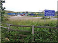
Area Overview for NN18 8AG
Photos of NN18 8AG


Area Information
NN18 8AG is a small residential cluster in England, spanning 41.7 hectares and home to 1,898 people. With a population density of 203 people per square kilometre, it is a tightly knit community where daily life is shaped by proximity to local amenities and a quiet, suburban rhythm. The area’s compact size means residents have easy access to essential services, while its low population density suggests a balance between private space and community interaction. The median age of 47, with the majority of residents aged 30–64, indicates a stable, mature demographic. This is an area where homeownership is prevalent, with 87% of properties owned by residents, reflecting a long-term presence of families and individuals seeking a settled lifestyle. The predominantly white population and focus on house-based living further define its character, offering a blend of traditional housing and a sense of continuity. For those considering living here, NN18 8AG presents a mix of practicality and community, with its small footprint ensuring a manageable, low-pressure environment for daily living.
- Area Type
- Postcode
- Area Size
- 41.7 hectares
- Population
- 1898
- Population Density
- 203 people/km²
The property market in NN18 8AG is characterised by high home ownership, with 87% of properties owned by residents rather than rented. This suggests a market skewed towards owner-occupied homes, which are predominantly houses. The focus on houses indicates a preference for larger, more permanent living spaces, likely catering to families or individuals seeking stability. Given the area’s small size and limited housing stock, the market is likely to be competitive, with limited scope for new developments. Buyers should consider the proximity to local amenities and transport links, as these are key factors in the area’s appeal. The compact nature of NN18 8AG means that properties are likely to be in close proximity to each other, offering convenience but also potentially limiting options for those seeking more space. For those prioritising a settled, family-friendly environment, the existing housing stock provides a reliable foundation, though the small size of the area may require buyers to look further afield for additional choices.
House Prices in NN18 8AG
Showing 11 properties
| Address | Type | Beds | Baths | Last Sale Price | Last Sale Date | |
|---|---|---|---|---|---|---|
| Raskelf Limited, 8 Cronin Courtyard, Corby, NN18 8AG | storage_distribution | - | - | - | - | |
| Twynham Components Ltd, 2-3 Cronin Courtyard, Corby, NN18 8AG | storage_distribution | - | - | - | - | |
| Mail Solutions Print Ltd, 12-16 Cronin Courtyard, Corby, NN18 8AG | Industrial | - | - | - | - | |
| Argos Limited Clearance Bargains, Cronin Road, Weldon South Industrial Estate, Corby, NN18 8AG | office_workshop | - | - | - | - | |
| Smurfit Kappa, 10 Cronin Courtyard, Corby, NN18 8AG | storage_distribution | - | - | - | - | |
| Warehouse And Premises, 11-16 Cronin Courtyard, Corby, NN18 8AG | warehouse | - | - | - | - | |
| Tradesource Ltd, 13 Cronin Courtyard, Corby, NN18 8AG | general_industrial | - | - | - | - | |
| 14 Cronin Courtyard, Corby, NN18 8AG | general_industrial | - | - | - | - | |
| 5 Cronin Courtyard, Corby, NN18 8AG | general_industrial | - | - | - | - | |
| 7 Cronin Courtyard, Corby, NN18 8AG | storage_distribution | - | - | - | - |
Energy Efficiency in NN18 8AG
The lifestyle in NN18 8AG is shaped by its proximity to a range of practical amenities. Within easy reach are five retail outlets, including Asda Corby, Iceland Corby, and M&S Corby, offering shopping convenience for everyday needs. The presence of these stores suggests a well-supplied local economy, reducing the need for long journeys to larger centres. The area is also connected to Corby Railway Station, which provides access to broader transport networks, enabling residents to travel further afield for work, leisure, or socialising. While the data does not mention parks or leisure facilities directly, the small residential cluster implies a community-oriented environment where local amenities play a central role. The mix of retail and transport options contributes to a self-contained lifestyle, where residents can manage daily errands and connectivity without relying heavily on distant services. This balance of convenience and accessibility enhances the area’s appeal for those seeking a practical, low-maintenance living environment.
Amenities
Schools
The nearest school to NN18 8AG is Stanion Church of England (Aided) Primary School, which serves the local community with a good Ofsted rating. This primary school is a key asset for families in the area, providing a reliable foundation for early education. While no secondary schools are listed in the data, the presence of a well-rated primary school suggests that the area is well-served for younger children’s education. The school’s rating indicates a commitment to quality teaching and facilities, which is crucial for parents prioritising educational standards. However, families requiring secondary schooling may need to look beyond NN18 8AG, as the data does not include information on nearby secondary institutions. The availability of a single primary school underscores the importance of local education infrastructure in shaping the area’s appeal to families.
| Rank | School | Type | Entry gender | Ages |
|---|
Explore more schools in this area
Go to Schools tabDemographics
The community in NN18 8AG is defined by its mature age profile, with a median age of 47 and the largest group of residents falling within the 30–64 age range. This suggests a population largely composed of established families and individuals in their prime working years. Homeownership is exceptionally high, at 87%, indicating a strong preference for long-term residency over rental properties. The accommodation type is predominantly houses, which aligns with the area’s focus on private, family-oriented living. The predominant ethnic group is white, and while no specific data on diversity is provided, this reflects a homogenous demographic. The high home ownership rate and age distribution point to a stable, low-turnover community where residents are likely to have built long-term connections. This stability may contribute to a sense of security and familiarity, though it also means the area’s character is unlikely to shift rapidly. The absence of detailed deprivation data means its quality of life remains unquantified, but the demographic profile suggests a generally secure and consistent living environment.
Household Size
Accommodation Type
Tenure
Ethnic Group
Religion
Household Composition
Age
Household Deprivation
NS-SEC
Explore more demographic insights in this area
Go to Demographics tabPlanning
Planning Constraints
- Flood RiskPremium
- Ramsar Wetland SitesPremium
- Area of Outstanding Natural BeautyPremium
- Protected Nature ReservePremium
- Protected WoodlandPremium